Point Sur Lighthouse
 Point Sur Light in 2013 | |
 California | |
| Location |
Point Sur State Historic Park California United States |
|---|---|
| Coordinates | 36°18′22.79″N 121°54′05.36″W / 36.3063306°N 121.9014889°WCoordinates: 36°18′22.79″N 121°54′05.36″W / 36.3063306°N 121.9014889°W |
| Year first constructed | 1889 |
| Automated | 1972 |
| Construction | sandstone tower |
| Tower shape | square tower with balcony and lantern attached to fog signal building |
| Markings / pattern |
unpainted tower, black lantern |
| Height | 48 ft (15 m) |
| Focal height | 270 ft (82 m) |
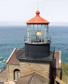
| Original lens | First order Fresnel lens |
| Current lens | DCB-224 |
| Characteristic | Fl W 15s. |
| Fog signal | 2 blasts every 60 |
| Admiralty number | G3988 |
| USCG number | 6-0280 |
| Managing agent | |
|
Point Sur Light Station | |
| Nearest city | Big Sur, California |
| Area | 37 acres (15 ha) |
| Architectural style | Renaissance, Romanesque, Lighthouse |
| MPS | Light Stations of California MPS |
| NRHP reference # | 91001097[4] |
| CHISL # | 951[3] |
| Added to NRHP | September 3, 1991 |
| Heritage |
place listed on the National Register of Historic Places |
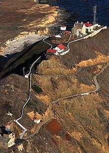
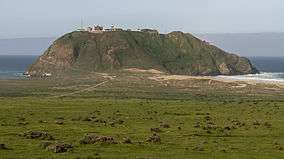
Point Sur Lightstation is a lighthouse at Point Sur, California, 135 miles (217 km) south of San Francisco, on the 361-foot (110 m)-tall rock at the head of the point. It was established in 1889 and is part of Point Sur State Historic Park. The light house is 40 feet (12 m) tall and 270 feet (82 m) above sea level. As of 2016, and for the foreseeable future the light is still in operation as an essential aid to navigation. The lightstation is part of Point Sur State Historic Park. Point Sur is the only complete turn-of-the-20th-century lightstation open to the public in California.[5] Three-hour walking tours guided by volunteers are available on Wednesdays and weekends throughout the year.
Construction
Light sources
The lighthouse has had four different light sources during its history. First, it had an oil wick lamp, and then an oil vapor lamp. Three different fuels were used: whale oil, lard oil, and kerosene. Later, two different kinds of electric lights were used.
Since Point Sur was a major point used for navigation, it was equipped with first-order Fresnel lens, the largest made at the time. The lens was more than 6 feet (2 m) in diameter and 9 feet (3 m) tall. It weighed 4,330 pounds and included 16 panels of prisms, each with a bulls-eye in the center surrounded by concentric rings of prismatic glass. Its light beam could be seen to the horizon, which for the Point Sur light, at 270 feet (82 m) feet high, is 23 miles (37 km).[6][7]
The entire structure, including the pedestal and clockworks was 18 feet (5 m) tall and weighed 9,570 pounds (4,341 kg). Each ring projects the light beyond the previous one.[7]
Foghorns
In dense fog, the light beam might not be visible, so the lighthouse had a foghorn to alert ships. A coal-powered foghorn was installed when the light was used, but this labor-intensive system was replaced as soon as better technology was available. A steam-driven fog signal was installed by the turn of the century. It was fired by wood harvested from the redwoods of Big Sur. The steam boiler used about 100 cords of wood per year.[6]
Diaphone horns were placed on top of the fog-signal room from 1935 to 1960. The two horns produced a two-tone "bee-oh" sound.[6] In 1972, the "Super Tyfon Double Fog Signal," named after the giant Typhon from Greek mythology, was put into use. This system consisted of two compressed air horns sounding simultaneously, and could be heard up to 3 nautical miles (6 km) away. The modern electric tone fog signal was a 12 volt high frequency fog signal with a sound range of half a nautical mile. The high frequency was very effective in fog.
Structures
The staff of the station consisted of a head keeper and three assistant keepers. The families of the keepers lived with them at the station. The Station had a residence for the head keeper and his family, and another for the assistant keepers.
The lighthouse keepers and their families lived in isolation at Point Sur. The station included all facilities needed for them to be self-sustaining. There was a cistern which held 53,000 US gallons (200,627 l) of water (later replaced by a water tower), and a pump house which brought up water from a well in the sand flats at the base of the rocks.
There was a barn where horses and cattle were kept. The carpenter and blacksmith shop held supplies for the keepers to do their own construction, since Monterey was a full day's trip away until the Cabrillo-San Simeon Highway was completed in 1937. The lamp tower, oil room, and fog signal room were all combined into one building because of limited space.
Etymology
The land formation later known as Point Sur is visible at sea for 10 miles (16 km) and was first mentioned in the logs of Juan Rodríguez Cabrillo in 1552. Sebastian Viscaino visited the area in the early 1600s, and his 1603 map names the promontory "Punta que Parece Isla." In 1769, explorer Miguel Costansó, a member of the Portolá expedition, named the point "Morro de la Trompa" because it looked like a rock in the shape of a trumpet.[8]
The name "El Sur" (meaning "The South") was first applied to a land grant named Rancho El Sur given by Governor José Figueroa to Juan Bautista Alvarado on July 30, 1834. The U.S. Coast Survey named the rock Point Sur in 1851.[8]
History
In 1793, British explorer George Vancouver described the "small, high, rocky lump of land nearly half a mile from the shore."[6] Point Sur has been a hazard to ships since California was first settled, and increased shipping traffic during the California Gold Rush caused many wrecks. The United States Lighthouse Service (USLS) board stated in 1874, "Point Sur is the most important point and should be the site of a lighthouse. In considering the various points on the California coast where lighthouses are still required, Point Sur claims the place of greatest importance." The board repeated this recommendation, and California citizens submitted petitions in support. In 1885, the board stated again that "this dangerous point, which is still unlighted, is made subject of much complaint."
In 1886, Congress finally appropriated $50,000 (equivalent to $1.36 million in 2017) for construction of a lighthouse at Point Sur. Funding ran out and construction was stopped for several months until Congress appropriated another $50,000 in 1887.[9]
Twenty-five men were employed in the construction of the lighthouse and adjacent buildings. They built a road from the mainland to the rock, blasted a trail to the top of the rock, quarried stone, and built a tramway from the shore to the peak. By the end of the first year, all the rock had been quarried and construction of many buildings was well underway. The Lighthouse Board hoped the construction would be completed by the end of 1888, but an additional $10,000 was needed. in 1887-88, Congress paid $69,100.69 to three individuals for their expenses in building the station.[10]:112
The light station was completed and the lantern lit on August 1, 1889. (Point Sur is technically a light station, as opposed to a lighthouse, because it consists of multiple buildings.)
Life on Point Sur was very isolated. The only road, which led to Monterey, was long and often dangerous. The keepers received goods and bulk supplies by boat roughly every four months. A "lighthouse tender" brought the supplies, but to get them ashore, the supplies were transferred to skiffs and floated to land in barrels.
Highway 1 was completed in 1937, connecting Big Sur with Monterey to the north and San Luis Obispo to the south.[11] Prior to the construction of Highway 1, the California coast south of Carmel and north of San Simeon was one of the most remote regions in the state, rivaling nearly any other region in the United States for its difficult access.[12] Life on the Point Sur became less isolated.
The site is now registered as California Historical Landmark #951.[3] In 1991, the old lighthouse and a 37-acre (15 ha) area was listed on the U.S. National Register of Historic Places as Point Sur Light Station.[4] In 2004, the Coast Guard transferred the building and land to California Department of Parks and Recreation.

The original Fresnel lens was moved in 1978 to the Allen Knight Maritime Museum of Monterey, where it was an exhibit. The Maritime Museum ceased operation and was renamed the Museum of Monterey. The museum no longer wanted to retain the Fresnel lens as part of its collection. Interested individuals and groups began efforts to return the lens to the Point Sur Light Station. The lens is still owned by the United States Coast Guard who had to approve returning the lens. The nonprofit Central Coast Light Keepers collected more than $100,000 in donations to pay to return the lens. The project was approved in late 2017. The lens was disassembled, restored,and placed in storage until it can be moved to the lighthouse and reassembled in the lighthouse tower.[7]
Shipwrecks
Notable shipwrecks occurring near Point Sur:
- April 20, 1875 – Ventura
- April 22, 1894 – SS Los Angeles (formerly USRC Wayanda)
- December 5, 1909 – Majestic
- October 3, 1915 – Cantania
- July 21, 1916 – Shna-Yak
- September 23, 1921 – G. C. Lindquer
- September 16, 1922 – Thomas Wand
- March 4, 1923, Babinda
- April 4, 1930, Panama
- March 30, 1930, Rhine Maru
- November 25, 1933 – Lupine
- February 13, 1935 – USS Macon (ZRS-5)
- May 24, 1946 – Frank Lawrence
- October 24, 1947 – Sparrows Point
- May 14, 1956 – Howard Olsen
On February 12, 1935, two Point Sur lighthouse keepers witnessed the end of an era when the rigid airship USS Macon crashed offshore and sank in 1,450 feet of water.
Head lightkeepers
- James Nightwine (1889 – 1890)
- John F. Ingersoll (1890 – 1901)
- Ora O. Newhall (1901 – 1908)
- John W. Astrom (1908 – 1927)
- William Mollering (1927 – 1931)
- Thomas Henderson (1932 – 1938)
- Charles R. Coursey (1938 – 1944)
In popular culture
In 1967, the lighthouse (including the lantern room) and its surrounding buildings, were used as a filming location for an episode of the WWII-themed TV series, The Rat Patrol, entitled "The Two If By Sea Raid" (airdate: 12/18/67), standing in for a Nazi-held light on the Mediterranean coast of North Africa. The light was automated by the United States Coast Guard in 1972.
See also
References
- ↑ Point Sur The Lighthouse Directory. University of North Carolina at Chapel Hill. Retrieved 15 June 2016
- ↑ California Historic Light Station Information & Photography United States Coast Guard. Retrieved 15 June 2016
- 1 2 3 "California Historical Landmarks: Monterey County". Office of Historical Preservation, California State Parks. Retrieved 2012-10-10.
- 1 2 National Park Service (2009-03-13). "National Register Information System". National Register of Historic Places. National Park Service.
- ↑ "Explore Big Sur, CA - Monterey County Regions".
- 1 2 3 4 O'Neil, Carol (2003). Point Sur. Arcadia Publishing. p. 179. ISBN 9781439630389. Retrieved 15 June 2018.
- 1 2 3 "Big Sur lighthouse getting its original lens back". KSBW. 2017-11-21. Retrieved 2018-01-01.
- 1 2 Gudde, Erwin Gustav (1998). California Place Names: The Origin and Etymology of Current Geographical Names. Bright, William (fourth, rev. and enl. ed.). Berkeley: University of California Press. p. 379. ISBN 9780520266193. OCLC 37854320.
- ↑ "United States Statutes at Large: 1885-1887". U.S. Government Printing Office. 1887. pp. 225, 513. Retrieved 15 June 2018.
- ↑ Congressional Serial Set. Washington D.C.: U.S. Government Printing Office. 1891. Retrieved 15 June 2018.
- ↑ JRP Historical Consulting Services (November 2001). "Big Sur Highway Management Plan" (PDF). Corridor Intrinsic Qualities Inventory Historic Qualities Summary Report. CalTrans. p. 38. Retrieved November 14, 2009.
"Historic Light Station Information and Photography: California". United States Coast Guard Historian's Office.
Sources
- http://www.pointsur.org/
- http://www.parks.ca.gov/default.asp?page_id=565
- Point Sur State Historic Park Brochure, 2000
External links
| Wikimedia Commons has media related to Point Sur Lighthouse. |
- United States Coast Guard
- Official website
- U.S. Geological Survey Geographic Names Information System: Point Sur Lighthouse
| Topics | |
|---|---|
| Lists by states |
|
| Lists by insular areas | |
| Lists by associated states | |
| Other areas | |
| |