Pinson, Alabama
| Pinson | |
|---|---|
| City | |
.jpg) Downtown Pinson | |
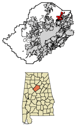 Location of Pinson in Jefferson County, Alabama. | |
| Coordinates: 33°41′10″N 86°40′54″W / 33.68611°N 86.68167°W | |
| Country | United States |
| State | Alabama |
| County | Jefferson |
| Area[1] | |
| • Total | 11.05 sq mi (28.63 km2) |
| • Land | 11.03 sq mi (28.56 km2) |
| • Water | 0.03 sq mi (0.07 km2) |
| Elevation | 620 ft (189 m) |
| Population (2010)[2] | |
| • Total | 7,163 |
| • Estimate (2017)[3] | 7,532 |
| • Density | 683.11/sq mi (263.74/km2) |
| Time zone | UTC-6 (Central (CST)) |
| • Summer (DST) | UTC-5 (CDT) |
| ZIP code | 35126, 35123, 35215 |
| Area code(s) | 205 |
| FIPS code | 01-60648 |
| GNIS feature ID | 0152950 |
| Website | http://www.thecityofpinson.com/ |
Pinson is a city in Jefferson County near Birmingham, Alabama, United States, northwest of Center Point. It incorporated in March 2004.[4] As of the 2010 census, the population was 7,163.
Geography
This city is located at 33°41′11″N 86°40′55″W / 33.68639°N 86.68194°W (33.686301, -86.681913).[5]
According to the U.S. Census Bureau, the community has a total area of 7.0 square miles (18 km2), of which 7.0 square miles (18 km2) is land and 0.04 square miles (0.10 km2) (0.43%) is water.
Pinson is located in an area of SW - NE parallel ridges, with occasional rock outcrops, especially toward the east-facing ridge crests. Pinson is home to the Turkey Creek Nature Preserve and the Alabama Butterbean Festival.
The Palmerdale Homesteads are located within the city limits of Pinson. The Palmerdale Homesteads were the first of five farmers' resettlement communities built in Alabama under President Franklin Roosevelt's New Deal in the 1930s. The first of the 102 homesteads were completed in 1935. A community store and elementary school/community center were completed in 1937 to serve the farming community.
Demographics
| Historical population | |||
|---|---|---|---|
| Census | Pop. | %± | |
| 1990 | 10,987 | — | |
| 2000 | 5,033 | −54.2% | |
| 2010 | 7,163 | 42.3% | |
| Est. 2017 | 7,532 | [3] | 5.2% |
| U.S. Decennial Census[6] 2013 Estimate[7] | |||
Note: Census demographic data were enumerated for the Census-Designated Place (CDP) for somewhat different boundaries prior to incorporation in 2004. The 1990 population of 10,987 was for the CDP of Pinson-Clay-Chalkville,[8] which was subdivided in 2000 into their own separate CDPs.[9] Therefore, exact population for the Pinson portion in 1990 cannot be ascertained
As of the census of 2000, there were 5,033 people, 1,853 households, and 1,450 families residing in the community. The population density was 721.2 people per square mile (278.4/km²). There were 1,953 housing units at an average density of 279.8 per square mile (108.0/km²). The racial makeup of the community was 89.85% White, 8.33% Black or African American, 0.32% Native American, 0.40% Asian, 0.02% Pacific Islander, 0.34% from other races, and 0.76% from two or more races. 2.27% of the population were Hispanic or Latino of any race.
There were 1,853 households out of which 41.4% had children under the age of 18 living with them, 59.8% were married couples living together, 15.3% had a female householder with no husband present, and 21.7% were non-families. 19.0% of all households were made up of individuals and 6.3% had someone living alone who was 65 years of age or older. The average household size was 2.71 and the average family size was 3.08.
In the community the population was spread out with 28.3% under the age of 18, 9.7% from 18 to 24, 31.7% from 25 to 44, 20.6% from 45 to 64, and 9.8% who were 65 years of age or older. The median age was 33 years. For every 100 females, there were 93.5 males. For every 100 females age 18 and over, there were 88.8 males.
The median income for a household in the community was $39,583, and the median income for a family was $48,707. Males had a median income of $33,843 versus $25,112 for females. The per capita income for the community was $17,704. About 8.6% of families and 10.3% of the population were below the poverty line, including 12.2% of those under age 18 and 10.9% of those age 65 or over.
2010 census
As of the census of 2010, there were 7,163 people, 2,731 households, and 2,074 families residing in the community. The population density was 1023.3 people per square mile (393.6/km²). There were 2,948 housing units at an average density of 421.1 per square mile (162.0/km²). The racial makeup of the community was 79.0% White, 17.0% Black or African American, 0.2% Native American, 0.4% Asian, 0.0% Pacific Islander, 2.2% from other races, and 1.0% from two or more races. 3.7% of the population were Hispanic or Latino of any race.
There were 2,731 households out of which 32.0% had children under the age of 18 living with them, 58.0% were married couples living together, 13.7% had a female householder with no husband present, and 24.1% were non-families. 20.9% of all households were made up of individuals and 6.5% had someone living alone who was 65 years of age or older. The average household size was 2.62 and the average family size was 3.04.
In the community the population was spread out with 24.4% under the age of 18, 8.0% from 18 to 24, 27.8% from 25 to 44, 27.9% from 45 to 64, and 11.9% who were 65 years of age or older. The median age was 38 years. For every 100 females, there were 91.7 males. For every 100 females age 18 and over, there were 89.9 males.
The median income for a household in the community was $56,863, and the median income for a family was $63,221. Males had a median income of $41,719 versus $36,066 for females. The per capita income for the community was $23,902. About 4.5% of families and 5.7% of the population were below the poverty line, including 8.1% of those under age 18 and 3.2% of those age 65 or over.
Media
Three newspapers serve Pinson:
- The Trussville Tribune, a weekly newspaper based in nearby Trussville, which publishes on Wednesdays
- The North Jefferson News, a weekly newspaper based in nearby Gardendale, which publishes on Wednesdays
- The Birmingham News, the major metro-area newspaper that publishes Wednesdays, Fridays and Sundays
Schools
Pinson Valley High School- Located on Highway 75 in Pinson. Grades 9-12.
Rudd Middle School- Grades 6-8.
Kermit Johnson Elementary- Grades 3-5.
Pinson Elementary School- Grades k-2.
Pinson Public Library opened its doors on October 1, 2011.
Notable people
- Ed Chandler, former Major League Baseball player
- Melinda Toole Gunter - Former Miss Alabama
- Phil Sims - Former ombudsman to former Texas Governor George W. Bush.[11]
- Terry Jones - Former outfielder for the Montreal Expos and Colorado Rockies
- Desmond Jennings- Major League Baseball player
- Terry Hoeppner- Assistant coach at Pinson (1974–75), Later head coach for the Indiana University football team
- Warren Lyles, former Noseguard for the University of Alabama and member of the Cotton Bowl Hall of Fame
- Samantha Francis- Contestant on Americas Next Top Model cycle 8, Professional international Model
References
- ↑ "2017 U.S. Gazetteer Files". United States Census Bureau. Retrieved Jul 7, 2018.
- ↑ "Population Estimates". United States Census Bureau. Retrieved 2014-06-07.
- 1 2 "Population and Housing Unit Estimates". Retrieved March 24, 2018.
- ↑ http://www.encyclopediaofalabama.org/article/h-3480
- ↑ "US Gazetteer files: 2010, 2000, and 1990". United States Census Bureau. 2011-02-12. Retrieved 2011-04-23.
- ↑ United States Census Bureau. "Census of Population and Housing". Archived from the original on May 12, 2015. Retrieved August 10, 2013.
- ↑ "Annual Estimates of the Resident Population: April 1, 2010 to July 1, 2013". Retrieved June 7, 2014.
- ↑ https://www.census.gov/prod/cen1990/cph2/cph-2-2.pdf
- ↑ https://www.census.gov/prod/cen2000/phc-1-2.pdf
- ↑ R J Barnette - Barnette, a native of Pinson and graduate of Pinson Valley High, is the front tire carrier for Jimmie Johnson's team, which won NASCAR's Pit Crew Challenge last spring. http://www.al.com/sports/index.ssf/2012/10/alabama_gang_rj_barnette_makes.html
- ↑ http://texashistory.unt.edu/ark:/67531/metapth162515/m1/401/?q=governor%20ombudsman
External links
- City of Pinson Official website
- The Pinson News
- Pinson Public Library
- Alabama Butterbean Festival website
- Palmerdale Homesteads Community Center website
Municipalities and communities of Jefferson County, Alabama, United States | ||
|---|---|---|
| Cities | 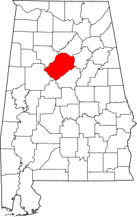 | |
| Towns | ||
| CDPs | ||
| Unincorporated communities | ||
| Former towns | ||
| Footnotes | ‡This populated place also has portions in an adjacent county or counties | |