Edgewater, Alabama
| Edgewater, Alabama | |
|---|---|
| CDP | |
 Location in Jefferson County and the state of Alabama | |
| Coordinates: 33°31′23″N 86°57′23″W / 33.52306°N 86.95639°W | |
| Country | United States |
| State | Alabama |
| County | Jefferson |
| Area[1] | |
| • Total | 1.24 sq mi (3.20 km2) |
| • Land | 1.21 sq mi (3.14 km2) |
| • Water | 0.02 sq mi (0.06 km2) |
| Elevation | 531 ft (162 m) |
| Population (2010) | |
| • Total | 883 |
| • Estimate (2016)[2] | N/A |
| Time zone | UTC-6 (Central (CST)) |
| • Summer (DST) | UTC-5 (CDT) |
| FIPS code | 01-23032 |
| GNIS feature ID | 0117862 |
Edgewater is a census-designated place in Jefferson County, Alabama, United States. It is northeast from the Birmingham suburb of Pleasant Grove. Its population was 883 at the 2010 census.[3] This area was damaged by tornadoes on April 15, 1956 and April 8, 1998. The 1998 tornado was rated an F5 on the Fujita scale.[4][5]
Geography
Edgewater is located at 33°31′23″N 86°57′23″W / 33.52306°N 86.95639°W (33.523106, -86.956525).[6]
According to the U.S. Census Bureau, the CDP has a total area of 1.2 square miles (3.1 km2), of which 1.2 square miles (3.1 km2) is land and 0.04 square miles (0.10 km2) (1.67%) is water.
Demographics
| Historical population | |||
|---|---|---|---|
| Census | Pop. | %± | |
| 1950 | 1,984 | — | |
| 2000 | 730 | — | |
| 2010 | 883 | 21.0% | |
| U.S. Decennial Census[7] | |||
Edgewater was initially listed on the 1950[8] U.S. Census as an unincorporated community. It did not appear again until 2000 when it was designated a CDP (Census Designated Place).
As of the census[9] of 2000, there were 730 people, 295 households, and 192 families residing in the CDP. The population density was 622.3 people per square mile (240.9/km2). There were 323 housing units at an average density of 275.3 per square mile (106.6/km2). The racial makeup of the CDP was 37.95% White, 61.10% Black or African American, 0.14% from other races, and 0.82% from two or more races. 1.10% of the population were Hispanic or Latino of any race.
There were 295 households out of which 25.1% had children under the age of 18 living with them, 34.6% were married couples living together, 24.1% had a female householder with no husband present, and 34.6% were non-families. 31.9% of all households were made up of individuals and 14.9% had someone living alone who was 65 years of age or older. The average household size was 2.47 and the average family size was 3.12.
In the CDP, the population was spread out with 22.5% under the age of 18, 7.4% from 18 to 24, 25.2% from 25 to 44, 27.8% from 45 to 64, and 17.1% who were 65 years of age or older. The median age was 42 years. For every 100 females, there were 97.3 males. For every 100 females age 18 and over, there were 85.6 males.
The median income for a household in the CDP was $21,322, and the median income for a family was $47,240. Males had a median income of $26,786 versus $20,962 for females. The per capita income for the CDP was $14,240. About 2.5% of families and 10.2% of the population were below the poverty line, including 9.3% of those under age 18 and 14.4% of those age 65 or over.
Notable people
- Sam Frazier Jr., blues singer, songwriter, guitar and harmonica player[10]
- Mule Suttles, Negro League baseball player and member of the Baseball Hall of Fame[11]
References
- ↑ "2016 U.S. Gazetteer Files". United States Census Bureau. Retrieved Jul 17, 2017.
- ↑ "Population and Housing Unit Estimates". Retrieved June 9, 2017.
- ↑ "American FactFinder". United States Census Bureau. Archived from the original on 2013-09-11. Retrieved 2011-05-14.
- ↑ "Other Birmingham Area Tornadoes". Web.archive.org. Archived from the original on 2011-06-03. Retrieved 2017-05-30.
- ↑ "Archived copy". Archived from the original on 2009-05-10. Retrieved 2009-05-10.
- ↑ "US Gazetteer files: 2010, 2000, and 1990". United States Census Bureau. 2011-02-12. Retrieved 2011-04-23.
- ↑ "U.S. Decennial Census". Census.gov. Archived from the original on May 12, 2015. Retrieved June 6, 2013.
- ↑ "General Characteristics : Alabama : List of Tables" (PDF). 2.census.gov. Retrieved 2016-06-15.
- ↑ "American FactFinder". United States Census Bureau. Archived from the original on 2013-09-11. Retrieved 2008-01-31.
- ↑ "Music Maker Revue: Cool John Ferguson with Sam Frazier, Jr". Duke Performances. Duke University. Retrieved 29 April 2015.
- ↑ "Mule Suttles Negro League Statistics & History". Baseballreference.com. foxsports.com. Retrieved 29 April 2015.
External links
| Wikimedia Commons has media related to Edgewater, Alabama. |
Coordinates: 33°31′23″N 86°57′23″W / 33.523106°N 86.956525°W
Municipalities and communities of Jefferson County, Alabama, United States | ||
|---|---|---|
| Cities | 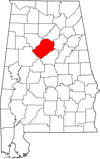 | |
| Towns | ||
| CDPs | ||
| Unincorporated communities | ||
| Former towns | ||
| Footnotes | ‡This populated place also has portions in an adjacent county or counties | |