Minor, Alabama
| Minor, Alabama | |
|---|---|
| CDP | |
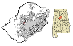 Location in Jefferson County and the state of Alabama | |
| Coordinates: 33°32′22″N 86°56′23″W / 33.53944°N 86.93972°W | |
| Country | United States |
| State | Alabama |
| County | Jefferson |
| Area[1] | |
| • Total | 0.70 sq mi (1.81 km2) |
| • Land | 0.70 sq mi (1.81 km2) |
| • Water | 0.00 sq mi (0.00 km2) |
| Elevation | 581 ft (177 m) |
| Population (2010) | |
| • Total | 1,094 |
| • Estimate (2016)[2] | N/A |
| Time zone | UTC-6 (Central (CST)) |
| • Summer (DST) | UTC-5 (CDT) |
| Area code(s) | 205 |
| FIPS code | 01-49072 |
| GNIS feature ID | 0122875 |
Minor is a census-designated place in Jefferson County, Alabama, United States. It is located north of the Birmingham suburb, Pleasant Grove. At the 2010 census the population was 1,094.[3] This area was damaged by an F5 tornado on April 6–9, 1998 tornado outbreak sequenceApril 8, 1998 including the non-denominational Open Door Church.It is home to the famous Westmont Baptist Church who helped the April 27, 2011 tornado victims and the members of the church were on their local news as following: JoAnn Terpo, Leigh Ann Powell, Monica Nix, Carrie Terpo, Emma Nix, Samuel Nix, Cecil Terpo, and others.
Geography
Minor is located at 33°32′23″N 86°56′24″W / 33.53972°N 86.94000°W (33.539656, -86.940000).[4]
According to the U.S. Census Bureau, the CDP has a total area of 0.7 square miles (1.8 km2), all land.
Demographics
| Historical population | |||
|---|---|---|---|
| Census | Pop. | %± | |
| 1990 | 3,313 | — | |
| 2000 | 1,116 | −66.3% | |
| 2010 | 1,094 | −2.0% | |
| U.S. Decennial Census[5] | |||
As of the census[6] of 2000, there were 1,116 people, 456 households, and 340 families residing in the CDP. The population density was 1,607.3 people per square mile (624.5/km²). There were 471 housing units at an average density of 678.3 per square mile (263.6/km²). The racial makeup of the CDP was 97.67% White, 0.90% Black or African American, 0.72% Native American, 0.09% Asian, and 0.63% from two or more races. 0.36% of the population were Hispanic or Latino of any race.
There were 456 households out of which 26.1% had children under the age of 18 living with them, 65.1% were married couples living together, 7.9% had a female householder with no husband present, and 25.4% were non-families. 23.0% of all households were made up of individuals and 13.6% had someone living alone who was 65 years of age or older. The average household size was 2.45 and the average family size was 2.87.
In the CDP, the population was spread out with 20.7% under the age of 18, 9.3% from 18 to 24, 26.2% from 25 to 44, 21.4% from 45 to 64, and 22.4% who were 65 years of age or older. The median age was 40 years. For every 100 females, there were 92.4 males. For every 100 females age 18 and over, there were 91.1 males.
The median income for a household in the CDP was $33,710, and the median income for a family was $38,250. Males had a median income of $28,295 versus $24,042 for females. The per capita income for the CDP was $14,690. About 2.0% of families and 1.6% of the population were below the poverty line, including none of those under age 18 and 8.2% of those age 65 or over.
2010 census
As of the census[7] of 2010, there were 1,094 people, 405 households, and 294 families residing in the CDP. The population density was 1,600 people per square mile (610/km²). There were 462 housing units at an average density of 660 per square mile (256.7/km²). The racial makeup of the CDP was 77.6% White, 20.9% Black or African American, 0.3% Native American, 0.0% Asian, and 0.5% from two or more races. 1.5% of the population were Hispanic or Latino of any race.
There were 405 households out of which 27.2% had children under the age of 18 living with them, 52.8% were married couples living together, 14.3% had a female householder with no husband present, and 27.4% were non-families. 23.0% of all households were made up of individuals and 10.6% had someone living alone who was 65 years of age or older. The average household size was 2.70 and the average family size was 3.13.
In the CDP, the population was spread out with 23.1% under the age of 18, 6.9% from 18 to 24, 27.6% from 25 to 44, 25.4% from 45 to 64, and 16.9% who were 65 years of age or older. The median age was 39.8 years. For every 100 females, there were 95.4 males. For every 100 females age 18 and over, there were 106.3 males.
The median income for a household in the CDP was $49,583, and the median income for a family was $57,955. Males had a median income of $38,438 versus $27,011 for females. The per capita income for the CDP was $24,406. About 16.0% of families and 18.3% of the population were below the poverty line, including 18.3% of those under age 18 and 0% of those age 65 or over.
History
In 1922, a new high school was built and was named after a recently retired Jefferson County school superintendent, John W. Minor. Thus the community area became known as Minor. The land for the school property was donated by the Young family. The location was at the center of the different coal mine communities (Bayview, Brookside, Docena, Edgewater and Mulga) and other communities and later communities (Adamsville, Alden, Coalburg, Crumly Chapel, Forestdale, Fieldstown, Graysville, Hillview, Maytown, McDonald Chapel, Midway, Mineral Springs, Republic, Sandusky and Sylvan Springs) thus making it a great location for a high school. The school building burned down in 1926 and rebuilt and reopened in 1928. Mr. W. C. PETTY was named principal in 1922 and served through May 1958. The building served as the high school through May 1988 when a new high school was built in Adamsville with classes beginning in the fall of 1988.
In the 1960s, Minor Christian School was established on McDonald Chapel Road. The school closed in. .
Businesses: Over the years a few businesses were established: Minor Grocery (owner Grace Houk), Powell/Motley Grocery, Top Hat Inn (a night club), Donaldson Filling Station, Minor Ice Cream Bar (started by the Blevins family and later operated by Tommy and Jones Pender, the Marshman's, the Alexander's and Mr. and Mrs. Floyd), Anthony/Gardner/Lucas Bus Lines, Stowe Florist, Reach's Hair Salon, Pit Stop gas station, Jones Florist, Rankin's TV Repair and Stouts Watch Repair. At the fork of Mulga Loop Road and Docena Road (later changed to Minor Parkway) there was Pete's and Bud's Bar-B-que and later a Shell service station was built there. Frank Baker built a service station across the road but the 4-lane took it. Tillman's service station was up the road toward Ensley and later became Plunkett's Bar-B-Que. Still later, Charlie's (a nightclub) was built near Docena Road and Birmingport. A small stripmall was built on Birmingport Road by the Echert's. It had a Shell service station, a restaurant and a convient store. Later, all but the gas station portion burned down. By 2017, only the Pit Stop was in business.
Churches: Minor First Baptist, Minor United Methodist (on land donated by the Young family), Westmont Baptist, Minor church of Christ, Open Door (located on Birmingport Road and later partially operating out of the old Minor Christian School and later the old Methodist Church lo ation), Minor church of God (formerly Docena church of God).
References
- ↑ "2016 U.S. Gazetteer Files". United States Census Bureau. Retrieved Jul 17, 2017.
- ↑ "Population and Housing Unit Estimates". Retrieved June 9, 2017.
- ↑ "American FactFinder". United States Census Bureau. Retrieved 2011-05-14.
- ↑ "US Gazetteer files: 2010, 2000, and 1990". United States Census Bureau. 2011-02-12. Retrieved 2011-04-23.
- ↑ "U.S. Decennial Census". Census.gov. Retrieved June 6, 2013.
- ↑ "American FactFinder". United States Census Bureau. Retrieved 2008-01-31.
- ↑ "American FactFinder". United States Census Bureau. Retrieved 2015-07-29.
Coordinates: 33°32′23″N 86°56′24″W / 33.539656°N 86.94°W
Municipalities and communities of Jefferson County, Alabama, United States | ||
|---|---|---|
| Cities | 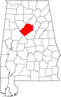 | |
| Towns | ||
| CDPs | ||
| Unincorporated communities | ||
| Former towns | ||
| Footnotes | ‡This populated place also has portions in an adjacent county or counties | |