Maytown, Alabama
| Maytown, Alabama | |
|---|---|
| Town | |
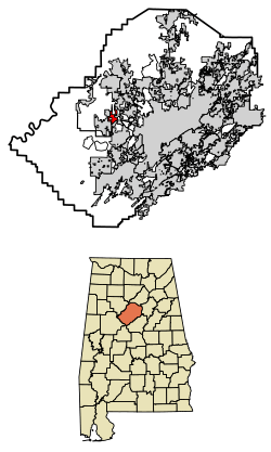 Location of Maytown in Jefferson County, Alabama. | |
| Coordinates: 33°33′13″N 86°59′40″W / 33.55361°N 86.99444°W | |
| Country | United States |
| State | Alabama |
| County | Jefferson |
| Area[1] | |
| • Total | 2.68 sq mi (6.95 km2) |
| • Land | 2.68 sq mi (6.95 km2) |
| • Water | 0.00 sq mi (0.00 km2) |
| Elevation | 709 ft (216 m) |
| Population (2010) | |
| • Total | 385 |
| • Estimate (2017)[2] | 370 |
| • Density | 137.96/sq mi (53.27/km2) |
| Time zone | UTC-6 (Central (CST)) |
| • Summer (DST) | UTC-5 (CDT) |
| ZIP code | 35118 |
| Area code(s) | 205 |
| FIPS code | 01-47728 |
| GNIS feature ID | 0122432 |
Maytown is a town in Jefferson County, Alabama, United States. It is northwest from the Birmingham suburb of Pleasant Grove. It incorporated in October 1956.[3] At the 2010 census the population was 385, down from 435 in 2000. This area was damaged by an F5 tornado on April 8, 1998.
Geography
Maytown is located at 33°33′13″N 86°59′40″W / 33.55361°N 86.99444°W (33.553498, -86.994471).[4]
According to the U.S. Census Bureau, the town has a total area of 2.7 square miles (7.0 km2), all land.
Demographics
| Historical population | |||
|---|---|---|---|
| Census | Pop. | %± | |
| 1960 | 297 | — | |
| 1970 | 667 | 124.6% | |
| 1980 | 538 | −19.3% | |
| 1990 | 651 | 21.0% | |
| 2000 | 435 | −33.2% | |
| 2010 | 385 | −11.5% | |
| Est. 2017 | 370 | [2] | −3.9% |
| U.S. Decennial Census[5] 2013 Estimate[6] | |||
As of the census[7] of 2000, there were 435 people, 161 households, and 129 families residing in the town. The population density was 158.8 people per square mile (61.3/km²). There were 176 housing units at an average density of 64.3 per square mile (24.8/km²). The racial makeup of the town was 79.31% White, 19.08% Black or African American, 0.69% Native American, 0.23% Asian, and 0.69% from two or more races.
There were 161 households out of which 26.7% had children under the age of 18 living with them, 65.2% were married couples living together, 13.7% had a female householder with no husband present, and 19.3% were non-families. 17.4% of all households were made up of individuals and 8.1% had someone living alone who was 65 years of age or older. The average household size was 2.70 and the average family size was 3.05.
In the town, the population was spread out with 21.8% under the age of 18, 8.5% from 18 to 24, 26.4% from 25 to 44, 28.0% from 45 to 64, and 15.2% who were 65 years of age or older. The median age was 39 years. For every 100 females, there were 95.1 males. For every 100 females age 18 and over, there were 87.8 males.
The median income for a household in the town was $42,083, and the median income for a family was $44,038. Males had a median income of $31,250 versus $22,250 for females. The per capita income for the town was $15,125. About 7.9% of families and 10.0% of the population were below the poverty line, including 15.1% of those under age 18 and 12.7% of those age 65 or over.
References
- ↑ "2017 U.S. Gazetteer Files". United States Census Bureau. Retrieved Jul 7, 2018.
- 1 2 "Population and Housing Unit Estimates". Retrieved March 24, 2018.
- ↑ http://www.encyclopediaofalabama.org/article/h-3589
- ↑ "US Gazetteer files: 2010, 2000, and 1990". United States Census Bureau. 2011-02-12. Retrieved 2011-04-23.
- ↑ "U.S. Decennial Census". Census.gov. Archived from the original on May 12, 2015. Retrieved June 6, 2013.
- ↑ "Annual Estimates of the Resident Population: April 1, 2010 to July 1, 2013". Retrieved June 3, 2014.
- ↑ "American FactFinder". United States Census Bureau. Archived from the original on September 11, 2013. Retrieved 2008-01-31.
Coordinates: 33°33′13″N 86°59′40″W / 33.553498°N 86.994471°W
Municipalities and communities of Jefferson County, Alabama, United States | ||
|---|---|---|
| Cities | 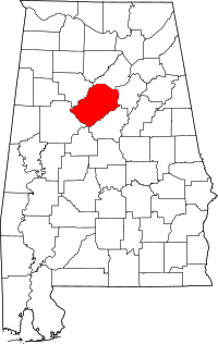 | |
| Towns | ||
| CDPs | ||
| Unincorporated communities | ||
| Former towns | ||
| Footnotes | ‡This populated place also has portions in an adjacent county or counties | |