Phlox, Wisconsin
| Phlox, Wisconsin | |
|---|---|
| Unincorporated community | |
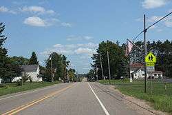 Downtown Phlox | |
 Phlox, Wisconsin  Phlox, Wisconsin | |
| Coordinates: 45°03′04″N 89°00′51″W / 45.05111°N 89.01417°WCoordinates: 45°03′04″N 89°00′51″W / 45.05111°N 89.01417°W | |
| Country | United States |
| State | Wisconsin |
| County | Langlade |
| Elevation | 1,306 ft (398 m) |
| Time zone | UTC-6 (Central (CST)) |
| • Summer (DST) | UTC-5 (CDT) |
| ZIP code | 54464 |
| Area code(s) | 715 & 534 |
| GNIS feature ID | 1571305[1] |
Phlox is an unincorporated community in the Town of Norwood, Langlade County, Wisconsin, United States. It is situated on Wisconsin Highway 47 southeast of Antigo. Phlox has a post office with ZIP code 54464.[2] In the Menominee language it is called Omāhkahkow-Menīkān which means "frog town".[3] It lies within ancestral Menominee territory which was ceded to the United States in the 1836 Treaty of the Cedars.
Climate
The Köppen Climate Classification subtype for this climate is "Dfb" (Warm Summer Continental Climate).[4]
| Climate data for Phlox, Wisconsin | |||||||||||||
|---|---|---|---|---|---|---|---|---|---|---|---|---|---|
| Month | Jan | Feb | Mar | Apr | May | Jun | Jul | Aug | Sep | Oct | Nov | Dec | Year |
| Average high °C (°F) | −6 (21) |
−3 (27) |
3 (37) |
12 (53) |
19 (67) |
24 (75) |
26 (79) |
24 (76) |
19 (67) |
13 (55) |
3 (37) |
−4 (25) |
11 (52) |
| Average low °C (°F) | −18 (0) |
−15 (5) |
−8 (17) |
−1 (30) |
5 (41) |
10 (50) |
13 (55) |
12 (53) |
7 (45) |
1 (34) |
−6 (21) |
−13 (8) |
−1 (30) |
| Average precipitation mm (inches) | 23 (0.9) |
23 (0.9) |
43 (1.7) |
64 (2.5) |
97 (3.8) |
104 (4.1) |
104 (4.1) |
100 (4) |
71 (2.8) |
48 (1.9) |
33 (1.3) |
66 (2.6) |
790 (31.1) |
| Source: Weatherbase [5] | |||||||||||||
Images
 Downtown Phlox
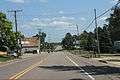
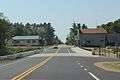 Looking west at downtown Phlox
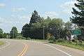 Looking east at the sign for Phlox
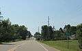 Looking west at the sign for Phlox
References
| Wikimedia Commons has media related to Phlox, Wisconsin. |
- ↑ U.S. Geological Survey Geographic Names Information System: Phlox, Wisconsin
- ↑ ZIP Code Lookup
- ↑ Hoffman, Mike. "Menominee Place Names in Wisconsin". The Menominee Clans Story. Retrieved 2018-10-06.
- ↑ Climate Summary for Phlox, Wisconsin
- ↑ "Weatherbase.com". Weatherbase. 2013. Retrieved on July 26, 2013.
Municipalities and communities of Langlade County, Wisconsin, United States | ||
|---|---|---|
| City | 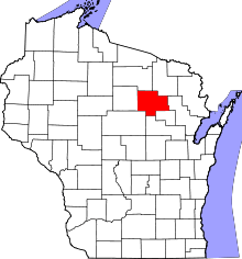 | |
| Village | ||
| Towns | ||
| CDPs | ||
| Unincorporated communities | ||
| Ghost towns/neighborhoods |
| |
This article is issued from
Wikipedia.
The text is licensed under Creative Commons - Attribution - Sharealike.
Additional terms may apply for the media files.