Pearson, Wisconsin
| Pearson, Wisconsin | |
|---|---|
| Unincorporated community | |
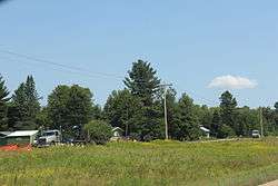 Housing in Pearson | |
 Pearson, Wisconsin  Pearson, Wisconsin | |
| Coordinates: 45°21′51″N 89°00′59″W / 45.36417°N 89.01639°WCoordinates: 45°21′51″N 89°00′59″W / 45.36417°N 89.01639°W | |
| Country | United States |
| State | Wisconsin |
| County | Langlade |
| Elevation | 1,526 ft (465 m) |
| Time zone | UTC-6 (Central (CST)) |
| • Summer (DST) | UTC-5 (CDT) |
| ZIP code | 54462 |
| Area code(s) | 715 & 534 |
| GNIS feature ID | 1571127[1] |
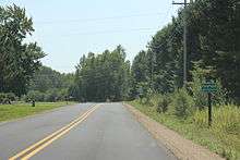
The sign for Pearson
Pearson is an unincorporated community in the Town of Ainsworth, Langlade County, Wisconsin, United States. Pearson is 5 miles (8.0 km) west of Pickerel and 17 miles (27 km) north-northeast of Antigo, the county seat of Langlade County. The community is situated on Pickerel Creek near its confluence with the Wolf River. County Highway T runs through Pearson; the closest state highway to the community is Wisconsin State Highway 55 in Pickerel.[2] Pearson had a post office, which closed on May 4, 1996; ZIP code 54462 still serves the community.[3][4] The Northeast Illinois Council of the Boy Scouts of America runs a summer camp, Ma-Ka-Ja-Wan Scout Reservation, in Pearson.
References
- ↑ U.S. Geological Survey Geographic Names Information System: Pearson, Wisconsin
- ↑ Langlade County Map (pdf) (Map). Wisconsin Department of Transportation. Retrieved 2010-08-28.
- ↑ "Postmaster Finder - Post Offices by ZIP Code". United States Postal Service. Retrieved September 25, 2011.
- ↑ United States Postal Service (2012). "USPS - Look Up a ZIP Code". Retrieved 2012-02-15.
Municipalities and communities of Langlade County, Wisconsin, United States | ||
|---|---|---|
| City | 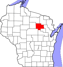 | |
| Village | ||
| Towns | ||
| CDPs | ||
| Unincorporated communities | ||
| Ghost towns/neighborhoods |
| |
This article is issued from
Wikipedia.
The text is licensed under Creative Commons - Attribution - Sharealike.
Additional terms may apply for the media files.