Penokee, Wisconsin
| Penokee, Wisconsin | |
|---|---|
| Unincorporated community | |
 Penokee  Penokee | |
| Coordinates: 46°18′52″N 90°41′37″W / 46.31444°N 90.69361°WCoordinates: 46°18′52″N 90°41′37″W / 46.31444°N 90.69361°W | |
| Country | United States |
| State | Wisconsin |
| County | Ashland |
| Town | Morse |
| Elevation | 1,265 ft (386 m) |
| Time zone | UTC-6 (Central (CST)) |
| • Summer (DST) | UTC-5 (CDT) |
| Area code(s) | 715 & 534 |
Penokee is an unincorporated community located in the town of Morse, Ashland County, Wisconsin, United States. Penokee is located on County Highway GG and the Canadian National Railway 1.75 miles (2.82 km) west-southwest of Mellen[1] The community takes its name from the Native American work apinikan, which means "wild potato ground".[2] It was marked on local property maps through 1992, and is still marked on Wisconsin Department of Transportation maps.[1][3][4]
References
- 1 2 Ashland County (PDF) (Map). Wisconsin Department of Transportation. 2012. Retrieved June 5, 2012.
- ↑ "Penokee [origin of place name]". Dictionary of Wisconsin History. Wisconsin Historical Society. Retrieved June 5, 2012.
- ↑ Morse T44N-R3W (Map). Rockford Map Publishers, Inc. 1992. Retrieved June 5, 2012.
- ↑ Morse T44N-R3W (Map). Farm and Home Publishers, LTD. 2000. Retrieved June 5, 2012.
Municipalities and communities of Ashland County, Wisconsin, United States | ||
|---|---|---|
| Cities | 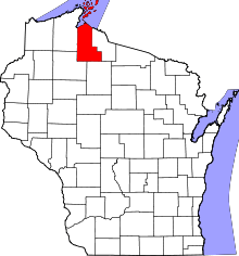 | |
| Village | ||
| Towns | ||
| CDPs | ||
| Unincorporated communities | ||
| Indian reservation | ||
| Footnotes | ‡This populated place also has portions in an adjacent county or counties | |
This article is issued from
Wikipedia.
The text is licensed under Creative Commons - Attribution - Sharealike.
Additional terms may apply for the media files.