Pedakurapadu
| Pedakurapadu | |
|---|---|
| Village | |
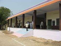
 New railway station of Pedakurapadu, Guntur | |
 Pedakurapadu Location in Andhra Pradesh, India  Pedakurapadu Pedakurapadu (India) | |
| Coordinates: 16°29′00″N 80°16′00″E / 16.4833°N 80.2667°ECoordinates: 16°29′00″N 80°16′00″E / 16.4833°N 80.2667°E | |
| Country | India |
| State | Andhra Pradesh |
| District | Guntur |
| Mandal | Pedakurapadu |
| Elevation[1] | 52 m (171 ft) |
| Population (2011)[2] | |
| • Total | 13,122 |
| Languages | |
| • Official | TeluguUrdu |
| Time zone | UTC+5:30 (IST) |
| PIN | 522402 |
| Telephone code | 08640 |
| Vehicle registration | AP |
Pedakurapadu is a town in Guntur district of the Indian state of Andhra Pradesh. It is a municipality and the headquarters of Sattenapalle mandal under Guntur revenue division.[3]
Transport
By road
Sattenapalle is the nearest town to Pedakurapadu. Sattenapalle is 16 km from Pedakurapadu. Road connectivity is there from Sattenapalle to Pedakurapadu.
By rail
Pedakurapadu railway station is situated on Nallapadu–Pagidipalli section. It falls under the administration of Guntur railway division of the South Central Railway zone.[4] Pedakurapadu Railway Station and Lingamgunta Railway Station are the very nearby railway stations to Pedakurapadu. Also one can consider railway stations from the nearby town Sattenapalle. Sattenapalle Railway Station and Gudipudi Railway Station are the railway stations near to Sattenapalle. One can reach from Sattenapalle to Pedakurapadu by road after. However Guntur Railway Station is 30 km away Pedakurapadu.
By bus
Sattenapalle APSRTC Bus Station, Mangalagiri Bypass APSRTC Bus Station, and Svn Colony APSRTC Bus Station are the nearby bus stations to Pedakurapadu. APSRTC runs a number of busses from major cities to here.
Gas filling stations
There two gas filling stations near the village outskirts, one located by the way to Aamaravathi from Pedakurapadu, and another by the way to Lingamgunta.
Medical facilities
There are a 30-bed government hospital, a private hospital known as Reddy hospital and a few small hospitals run by RMP doctors.
Almost all medical stores are located at the center of the village (known as Kacheyri centre).
Government offices
- Panchayat office
- MRO office
- VRO office
- Police station
- No judicial courts
See also
References
- ↑ "Elevation for Pedakurapadu". Veloroutes. Retrieved 31 July 2014.
- ↑ "Census 2011". The Registrar General & Census Commissioner, India. Retrieved 26 July 2014.
- ↑ "District Census Handbook - Guntur" (PDF). Census of India. p. 14,408. Retrieved 30 January 2016.
- ↑ "Pedakurapadu railway station info". India Rail Info. Retrieved 19 November 2015.
External links