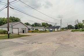
Paxton, Indiana
| Paxton, Indiana | |
|---|---|
| Unincorporated community | |
 | |
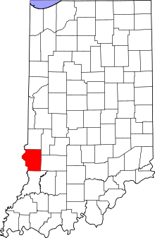 Sullivan County's location in Indiana | |
 Paxton Sullivan County, Indiana | |
| Coordinates: 39°01′16″N 87°23′19″W / 39.02111°N 87.38861°WCoordinates: 39°01′16″N 87°23′19″W / 39.02111°N 87.38861°W | |
| Country | United States |
| State | Indiana |
| County | Sullivan |
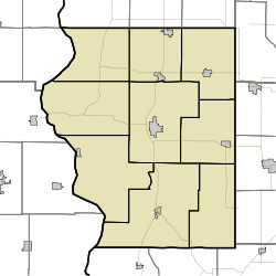
| Township | Haddon |
| Elevation[1] | 522 ft (159 m) |
| Time zone | UTC-5 (Eastern (EST)) |
| • Summer (DST) | UTC-4 (EDT) |
| ZIP code | 47865 |
| Area code(s) | 812, 930 |
| FIPS code | 18-58500[2] |
| GNIS feature ID | 449706 |
Paxton is an unincorporated community in Haddon Township, Sullivan County, in the U.S. state of Indiana.[3]
The community is part of the Terre Haute Metropolitan Statistical Area.
History
Paxton was laid out in 1868, and was named after James H. Paxton, a local merchant.[4] The post office at Paxton has been in operation since 1864.[5]
Geography
Paxton is located off Highway 41 between Carlisle and Sullivan at 39°01′16″N 87°23′19″W / 39.02111°N 87.38861°W.
References
- ↑ "US Board on Geographic Names". United States Geological Survey. 2007-10-25. Retrieved 2008-01-31.
- ↑ "American FactFinder". United States Census Bureau. Retrieved 2008-01-31.
- ↑ "Paxton, Indiana". Geographic Names Information System. United States Geological Survey. Retrieved August 5, 2017.
- ↑ Baker, Ronald L. (October 1995). From Needmore to Prosperity: Hoosier Place Names in Folklore and History. Indiana University Press. p. 258. ISBN 978-0-253-32866-3.
...honors Dr. James H. Paxton, an early merchant and physician of Carlisle.
- ↑ "Sullivan County". Jim Forte Postal History. Retrieved September 27, 2016.
Municipalities and communities of Sullivan County, Indiana, United States | ||
|---|---|---|
| Cities | ||
| Towns | ||
| Townships | ||
| Unincorporated communities |
| |
| Ghost towns | ||
| Footnotes | ‡This populated place also has portions in an adjacent county or counties | |
This article is issued from
Wikipedia.
The text is licensed under Creative Commons - Attribution - Sharealike.
Additional terms may apply for the media files.