Baldridge, Indiana
| Baldridge, Indiana | |
|---|---|
| Unincorporated community | |
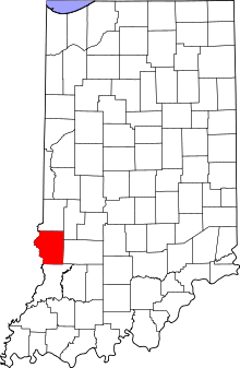 Sullivan County's location in Indiana | |
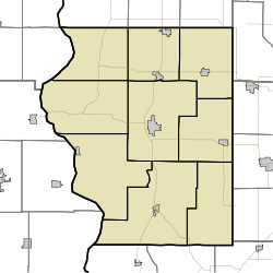 Baldridge Location in Sullivan County, Indiana | |
| Coordinates: 39°13′22″N 87°22′13″W / 39.22278°N 87.37028°WCoordinates: 39°13′22″N 87°22′13″W / 39.22278°N 87.37028°W | |
| Country | United States |
| State | Indiana |
| County | Sullivan |
| Township | Curry |
| Elevation[1] | 591 ft (180 m) |
| Time zone | UTC-5 (Eastern (EST)) |
| • Summer (DST) | UTC-4 (EDT) |
| ZIP code | 47850 |
| Area code(s) | 812, 930 |
| GNIS feature ID | 430450 |
Baldridge is an unincorporated community in Curry Township, Sullivan County, in the U.S. state of Indiana.[2]
The community is part of the Terre Haute Metropolitan Statistical Area.
History
Baldridge likely takes its name from a nearby coal mine.[3]
Geography
Baldridge is located at 39°13′22″N 87°22′13″W / 39.22278°N 87.37028°W.
References
- ↑ "US Board on Geographic Names". United States Geological Survey. October 25, 2007. Retrieved 2016-08-30.
- ↑ "Baldridge, Indiana". Geographic Names Information System. United States Geological Survey. Retrieved August 5, 2017.
- ↑ Baker, Ronald L. (October 1995). From Needmore to Prosperity: Hoosier Place Names in Folklore and History. Indiana University Press. p. 59. ISBN 978-0-253-32866-3.
...this village was named for a local coal mine.
Municipalities and communities of Sullivan County, Indiana, United States | ||
|---|---|---|
| Cities | ||
| Towns | ||
| Townships | ||
| Unincorporated communities |
| |
| Ghost towns | ||
| Footnotes | ‡This populated place also has portions in an adjacent county or counties | |
This article is issued from
Wikipedia.
The text is licensed under Creative Commons - Attribution - Sharealike.
Additional terms may apply for the media files.