Pawa Union Council
| Pawa | |
|---|---|
| Union council | |
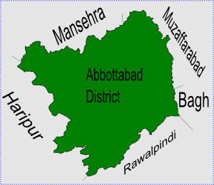 Pawa is located in Abbottabad District | |
| Coordinates: 34°12′0″N 73°10′0″E / 34.20000°N 73.16667°ECoordinates: 34°12′0″N 73°10′0″E / 34.20000°N 73.16667°E | |
| Country |
|
| Province | Khyber Pakhtunkhwa |
| District | Abbottabad |
| Tehsil | Abbottabad |
| Population (2017)[1] | |
| • Total | 11,555 |
| [2] | |
Pawa is one of the 51 union councils of Abbottabad District in the Khyber Pakhtunkhwa province of Pakistan.[3]
Location
The union council of Pawa is situated in the North West of the district (and to the north west of Abbottabad city) towards Mansehra District. Neighbouring union councils are Kothiala to the south and [UC Jhangi] to the East. Pawa town has an average elevation of 1350 metres (4432 feet).
Tribes
- Sulaimankhel
- Qureshi
- Tanoli
- Syed
- Turks
- Mughals
- Awans
Subdivisions
•Bandi phullan •Gandhian •Bandian •Sohlna •Kakot •Shahkot •Pawa •Kumar bandi •Richbehn •Pando thana
References
- ↑ "POPULATION AND HOUSEHOLD DETAIL FROM BLOCK TO DISTRICT LEVEL: KHYBER PAKHTUNKHWA (ABBOTTABAD DISTRICT)" (PDF). Pakistan Bureau of Statistics. 2018-01-03. Retrieved 2018-04-17.
- ↑ Falling Rain - Location of Pawa
- ↑ Administrative Units of District Abbottabad Archived 2007-04-03 at the Wayback Machine.
This article is issued from
Wikipedia.
The text is licensed under Creative Commons - Attribution - Sharealike.
Additional terms may apply for the media files.