Passerano Marmorito
| Passerano Marmorito | |
|---|---|
| Comune | |
| Comune di Passerano Marmorito | |
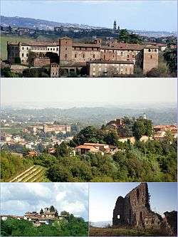 From above: Medieval Castle; the borough and castle of Primeglio with Passerano in the background; Schierano (lower left) and (right) remains of the castle of Marmorito. | |
 Passerano Marmorito Location of Passerano Marmorito in Italy | |
| Coordinates: 45°3′N 8°1′E / 45.050°N 8.017°E | |
| Country | Italy |
| Region | Piedmont |
| Province | Asti (AT) |
| Frazioni | Primeglio, Schierano, Marmorito, Rocco, Boscorotondo, Serra |
| Government | |
| • Mayor | Davide Massaglia |
| Area | |
| • Total | 12.1 km2 (4.7 sq mi) |
| Elevation | 320 m (1,050 ft) |
| Population (1-1-2017)[1] | |
| • Total | 449 |
| • Density | 37/km2 (96/sq mi) |
| Demonym(s) | Passeranesi |
| Time zone | UTC+1 (CET) |
| • Summer (DST) | UTC+2 (CEST) |
| Postal code | 14020 |
| Dialing code | 0141 |
Passerano Marmorito is a small rural comune (‘municipality’) in the Province of Asti in the Italian region Piedmont, located about 25 kilometres (16 mi) east of Turin and about 20 kilometres (12 mi) northwest of Asti.
Geography
The capoluogo of the commune, and the site of its town hall, is Passerano. The communal statute identifies three further villages or hamlets within the boundaries of the commune: Marmorito, Primeglio and Schierano (after which the wine grape Malvasia di Schierano is named). Further localities include Boscorotondo, Serra and Rocco.[2][3]
Passerano Marmorito borders the following municipalities: Albugnano, Aramengo, Capriglio, Castelnuovo Don Bosco, Cerreto d'Asti, Cocconato, Pino d'Asti, and Piovà Massaia.
Twin towns — sister cities
Passerano Marmorito is twinned with:

References
- ↑ All demographics and other statistics: Italian statistical institute Istat.
- ↑ Statuto comunale, Comune di Passerano Marmorito.
- ↑ "Comune di Passerano Marmorito (AT)". Comuni-Italiani.it.
