Park Place (BMT Franklin Avenue Line)
Park Place | |||||||
|---|---|---|---|---|---|---|---|
|
| |||||||
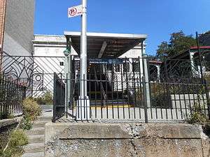 Station entrance from Park Place | |||||||
| Station statistics | |||||||
| Address |
Park Place & Franklin Avenue Brooklyn, NY 11238 | ||||||
| Borough | Brooklyn | ||||||
| Locale | Crown Heights | ||||||
| Coordinates | 40°40′28″N 73°57′28″W / 40.674357°N 73.957858°WCoordinates: 40°40′28″N 73°57′28″W / 40.674357°N 73.957858°W | ||||||
| Division | B (BMT) | ||||||
| Line | BMT Franklin Avenue Line | ||||||
| Services |
S | ||||||
| Structure | Embankment | ||||||
| Platforms | 1 side platform | ||||||
| Tracks | 1 | ||||||
| Other information | |||||||
| Opened | June 19, 1899 | ||||||
| Rebuilt |
1906 (elevated railway) October 18, 1999 (shuttle refurbishment) | ||||||
| Station code | 141[1] | ||||||
| Accessible |
| ||||||
| Former/other names |
Butler Street Sterling Place | ||||||
| Traffic | |||||||
| Passengers (2017) |
575,188[2] | ||||||
| Rank | 401 out of 425 | ||||||
| Station succession | |||||||
| Next north |
Franklin Avenue: S Dean Street (demolished): no regular service | ||||||
| Next south |
Botanic Garden: S | ||||||
|
| |||||||
| Next |
Franklin Avenue: S | ||||||
| Next |
Prospect Park: S | ||||||
| |||||||
| |||||||
| |||||||


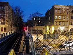
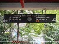
Park Place is a station on the BMT Franklin Avenue Line of the New York City Subway in Crown Heights, Brooklyn. Served by the Franklin Avenue Shuttle at all times, it is the only solitary station in the subway system to be served solely by a shuttle service without any connections to non-shuttle services. It is also the only station in the subway system with a single track where trains approach from both directions.
History
The station is located at the point where the tracks of the original Brooklyn, Flatbush & Coney Island Railway left the street surface and began running in an open-cut right-of-way on its route to Brighton Beach and Coney Island.[3][4] The Kings County Elevated Railway (KCER) had begun serving the line in 1896.[5]
A station was established at this spot on June 19, 1899 to provide local residents access to KCER trains. This station consisted of two simple compacted earth platforms at the side of each track running south of Park Place.
During 1905–1906, this portion of the line was rebuilt as a raised elevated railway and embankment structure,[3] and a new station was built at this location, with a single floor-level island platform and a station house between the tracks. The new station was located with the station house over Park Place and the platform extending north from that point.
The station deteriorated over the years as the New York City Transit Authority considered whether to abandon or rehabilitate the station and the line. Community support in the Bedford–Stuyvesant and Crown Heights communities persuaded the city to rebuild the line. The station closed in 1998,[6] was completely rebuilt, and reopened in 1999.[7]
Station layout
| P Platform Level |
Side platform, doors will open on the left or right | |
| Single track | ← → →(Demolished: Dean Street) | |
| G Street Level |
Exit/ Entrance, station house | |
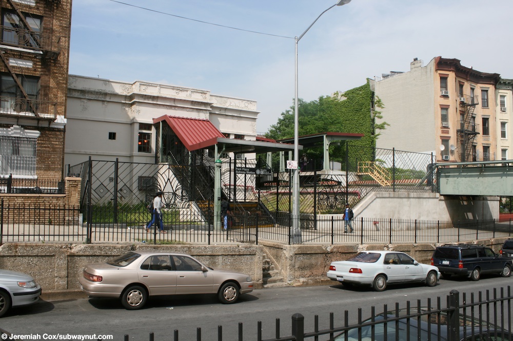
The rebuilt 1999 station consists of a single side platform and a single track serving trains traveling in both directions.[8] The new, wider, station platform was built partly over the former southbound track. The large station house is built in a style reminiscent of station houses built in the World War I era on the BMT Brighton Line such as Parkside Avenue and a number of stations on the BMT Sea Beach Line.[7]
Exit
The station has a turnstile bank, token booth, a short staircase on the south side going down to the north side of Park Place, and a long ADA-accessible ramp and staircase going to the south side of Prospect Place on the north side of the station house.[9][7]
References
- ↑ "Station Developers' Information". Metropolitan Transportation Authority. Retrieved June 13, 2017.
- ↑ "Facts and Figures: Annual Subway Ridership 2012–2017". Metropolitan Transportation Authority. July 12, 2018. Retrieved July 12, 2018.
- 1 2 Walsh, Kevin (October 4, 1998). "The lore of the FRANKLIN AVENUE SHUTTLE". forgotten-ny.com. Retrieved June 21, 2016.
- ↑ Anderson, Bob. "Joint LIRR / BRT Elevated/Rapid Transit Service". www.lirrhistory.com. Retrieved June 21, 2016.
- ↑ "UNION OF BROOKLYN ROADS.; Kings County Elevated Leases Part of Brooklyn and Brighton Beach". The New York Times. February 6, 1896. Retrieved March 30, 2018.
- ↑ Blair, Jayson (July 25, 1998). "18-Month Renovation for Brooklyn Shuttle". The New York Times. ISSN 0362-4331. Retrieved July 21, 2016.
- 1 2 3 "The lore of the FRANKLIN AVENUE SHUTTLE - Forgotten New York". forgotten-ny.com. Retrieved July 21, 2016.
- ↑ Dougherty, Peter (2006) [2002]. Tracks of the New York City Subway 2006 (3rd ed.). Dougherty. OCLC 49777633 – via Google Books.
- ↑ "MTA Neighborhood Maps: Crown Heights" (PDF). mta.info. Metropolitan Transportation Authority. 2015. Retrieved January 1, 2017.
External links
| Wikimedia Commons has media related to Park Place (BMT Franklin Avenue Line). |
- nycsubway.org – BMT Franklin: Park Place
- Station Reporter — Franklin Shuttle
- The Subway Nut — Park Place Pictures
- MTA's Arts For Transit — Park Place (BMT Franklin Avenue Line)
- Station house entrance as seen from Park Place
- Park Place entrance from Google Maps Street View
- Prospect Place entrance from Google Maps Street View
- Platform from Google Maps Street View
| |
| Franklin Ave. Line | |
|---|---|
| |