Park Creek (Little Neshaminy Creek tributary)
| Park Creek | |
|---|---|
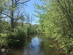 Park Creek in Kohler Park in Horsham Township, Pennsylvania | |
 Park Creek | |
| Country | United States |
| State | Pennsylvania |
| County | Bucks |
| Township |
Doylestown New Britain |
| Physical characteristics | |
| Main source |
400 feet (120 m) 40°13′15″N 75°13′57″W / 40.22083°N 75.23250°W |
| River mouth |
220 feet (67 m) 40°13′24″N 75°8′41″W / 40.22333°N 75.14472°WCoordinates: 40°13′24″N 75°8′41″W / 40.22333°N 75.14472°W |
| Length | 6.36 miles (10.24 km) |
| Basin features | |
| Progression | Park Creek → Little Neshaminy Creek → Neshaminy Creek → Delaware River → Delaware Bay |
| River system | Delaware River |
| Basin size | 11.8 square miles (31 km2) |
| Landmarks |
Springhouse Quarry Cedar Hill Rd Park Kohler Park Whitemarsh Memorial Park Deep Meadow Park Carpenter Park Graeme Park Strawbridge Park |
| Bridges | See table |
| Slope (Main Branch) | 28.3 feet per mile (5.36 m/km) |
Park Creek is a tributary of the Little Neshaminy Creek, part of the Delaware River Watershed meeting its confluence at the Little Neshaminy's 9.00 river mile.
History
Park Creek is named for Graeme Park near Horsham, Pennsylvania.[1]
Statistics
Park Creek's watershed covers 11.80 square miles (30.6 km2), passing through suburban areas in Warrington Township, Horsham Township, Montgomery Township, and Lower Gwynedd Township. The Geographic Name Information System I.D. is 1183295[2], U.S. Department of the Interior Geological Survey I.D. is 02661.[3]
Course
The northern branch of Park Creek rises near Hartman Road (SR 2014) in Montgomery Township, running southeast for about 0.83 miles (1.34 km) then turns east for 0.63 miles (1.01 km), then back to southeast for 1.35 miles (2.17 km) to its confluence with the west branch. The west branch rises near Tennis Avenue in Lower Gwynedd Township, flowing northeast for about 1.75 miles (2.82 km) to the confluence. Together they form the main course of Park Creek, which runs northeast for 2.67 miles (4.30 km) to its confluence at the Little Neshaminy Creek 9.00 river mile. The main creek bed passes through Kohler Park, Deep Meadow Park, and flows along the northwest border of Graeme Park.[4]
Geology
The Little Neshaminy lies entirely within the Lockatong geologic formation, consisting of argillite, shale, limestone, and calcareous shale.[5]
Municipalities
Crossings and Bridges
| Crossing | NBI Number | Length | Lanes | Spans | Material/Design | Built | Reconstructed | Latitude | Longitude |
|---|---|---|---|---|---|---|---|---|---|
| Main Branch | |||||||||
| Pennsylvania Route 463 (Horsham Road) | - | - | - | - | - | - | - | - | |
| Davis Grove Road | 27798 | - | - | - | - | - | - | - | |
| Keith Valley Road | 28000 | - | - | - | - | - | - | - | |
| County Line Road | 7270 | 17 metres (56 ft) | 2 | 1 | Box beam or girders - multiple design, prestressed concrete | 1985 | - | 40°13'10"N | 75°9'6"W |
| West Branch Park Creek | |||||||||
| Pennsylvania Route 63 (Welsh Road) | - | - | - | - | - | - | - | - | |
| Talamore Drive | - | - | - | - | - | - | - | - | |
| Pennsylvania Route 152 (Limekiln Pike) | 27319 | 10 metres (33 ft) | 2 | 1 | Tee Beam design, concrete construction | 1928 | - | - | |
| North Branch Park Creek | |||||||||
| Hartman Road (SR 2014) | - | - | - | - | - | - | - | - | |
| Regency Drive | - | - | - | - | - | - | - | - | |
| Lower State Road | - | - | - | - | - | - | - | - | |
| Cedar Hill Road | 27949 | 20 metres (66 ft) | 2 | 1 | Box beam or girder - single or spread, prestressed concrete | 2003 | - | - | |
| Pennsylvania Route 152 (Limekiln Pike) | - | - | - | - | - | - | - | - | |
See also
References
- ↑ MacReynolds, George, Place Names in Bucks County, Pennsylvania, Doylestown, Bucks County Historical Society, Doylestown, PA, 1942, P1.
- ↑ http://geonames.usgs.gov/apex/f?p=gnispq:3:::NO::P3_FID:1193295
- ↑ http://www.lycoming.edu/cwi/pdfs/paGazetterOfStreams.pdf, page 108
- ↑ https://www.google.com/maps/place/Park+Creek/@40.2043317,-75.1909742,14z/data=!3m1!4b1!4m5!3m4!1s0x89c6af5fb00046dd:0x910d268b9db1ac64!8m2!3d40.2068119!4d-75.1749638
- ↑ "Pennsylvania Geological Survey". PaGEODE. Pennsylvania Department of Conservation and Natural Resources. Retrieved 19 November 2017.