Parafield Gardens, South Australia
| Parafield Gardens Adelaide, South Australia | |||||||||||||||
|---|---|---|---|---|---|---|---|---|---|---|---|---|---|---|---|
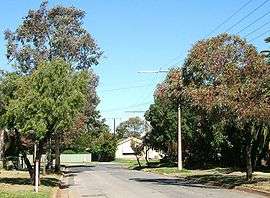 Street in Parafield Gardens | |||||||||||||||
| Population |
| ||||||||||||||
| • Density | 2,157/km2 (5,590/sq mi) | ||||||||||||||
| Postcode(s) | 5107 | ||||||||||||||
| Area | 7.1 km2 (2.7 sq mi) | ||||||||||||||
| Location | 16 km (10 mi) from Adelaide | ||||||||||||||
| LGA(s) | City of Salisbury | ||||||||||||||
| State electorate(s) | Playford | ||||||||||||||
| Federal Division(s) | Port Adelaide | ||||||||||||||
| |||||||||||||||
Parafield Gardens is a suburb of Adelaide, South Australia. The suburb is largely residential, with a pocket of industrial land in the southwest corner. There are two small shopping centres in the area, one on Salisbury Highway which has a Foodland, and another on Sheperdson Road which has an Independent Grocers of Australia.
History
Aboriginal people occupied the land around Parafield Gardens prior to European settlement. An Aboriginal heritage site within the Greenfield Industrial Estate indicates that Aboriginal settlement may have existed in the area for thousands of years.
In 1881 the government proposed the creation of a general cemetery on the land now occupied by the Pine Lakes Estate (to the south of the intersection of Salisbury Highway and Kings Road). The plan was abandoned, and in 1906 the land became used as an experimental agricultural farm, followed by a poultry farm in 1911. At this stage, the area between Salisbury Highway and Martins Road was known as Parafield Farm, although this name transformed over the years to become Parafield Gardens.
In 1958, Matters & Co. offered residential land in the area bounded by Salisbury Highway, Shepherdson Road, Sutherland Avenue, and Catalina Avenue. In the 1970s the South Australian Housing Trust began building properties in the area.
Parafield Gardens Post Office opened on 25 September 1961.[3]
Schools
Parafield Gardens has five schools in its area and four of which are public. Karrendi Primary School, founded in 1969, is a public primary school on Bradman Road.[4] Parafield Gardens High School, opened in 1976,[5] is a public secondary school situated next to Parafield Gardens R-7 School, a public primary school like Karrendi except larger.[6] Parafield Gardens Primary, Parafield Gardens High and the private primary school, Holy Family Catholic School[7] are all on Sheperdson Road. A fourth primary school, The Pines School, is located on Andrew Smith Drive.[8]
References
- ↑ Australian Bureau of Statistics (31 October 2012). "Parafield Gardens (State Suburb)". 2011 Census QuickStats. Retrieved 14 February 2015.

- ↑ Australian Bureau of Statistics (25 October 2007). "Parafield Gardens (State Suburb)". 2006 Census QuickStats. Retrieved 14 February 2015.
- ↑ Premier Postal History. "Post Office List". Premier Postal Auctions. Retrieved 26 May 2011.
- ↑ "Karrendi Primary School".
- ↑ "Parafield Gardens High School".
- ↑ "Parafield Gardens R-7 School".
- ↑ "Holy Family Catholic School".
- ↑ "The Pines School".
| Wikimedia Commons has media related to Parafield Gardens, South Australia. |