Papineauville, Quebec
| Papineauville | |
|---|---|
| Municipality | |
 | |
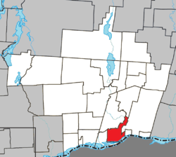 Location within Papineau RCM | |
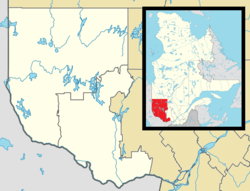 Papineauville Location in western Quebec | |
| Coordinates: 45°37′N 75°01′W / 45.617°N 75.017°WCoordinates: 45°37′N 75°01′W / 45.617°N 75.017°W[1] | |
| Country |
|
| Province |
|
| Region | Outaouais |
| RCM | Papineau |
| Settled | c. 1850 |
| Constituted | November 29, 2000 |
| Government[2] | |
| • Mayor | Gilles Clément |
| • Federal riding | Argenteuil—Papineau—Mirabel |
| • Prov. riding | Papineau |
| Area[2][3] | |
| • Total | 64.90 km2 (25.06 sq mi) |
| • Land | 61.22 km2 (23.64 sq mi) |
| Population (2011)[3] | |
| • Total | 2,165 |
| • Density | 35.4/km2 (92/sq mi) |
| • Pop 2006-2011 |
|
| • Dwellings | 1,078 |
| Time zone | UTC−5 (EST) |
| • Summer (DST) | UTC−4 (EDT) |
| Postal code(s) | J0V 1R0 |
| Area code(s) | 819 |
| Highways |
|
| Website |
www.mun- papineauville.qc.ca |
Papineauville is a town and municipality in the Outaouais region of Quebec, Canada. It is the seat of the Papineau Regional County Municipality. In 2001 its population was 2247.
The municipality is bordered on the north side by the Petite-Nation River and on the south side by Pentecost Bay of the Ottawa River.
History
The Parish of Sainte-Angélique was formed in 1851, and the parish municipality with the same name was created in 1855. It was named after Angélique-Louise Cornud, wife of Denis-Benjamin Papineau, who donated land for the construction of the church and the rectory.[4]
Also in 1855, a post office was established with the name Papineauville. This may be named in honour of one of two persons named Papineau: Joseph Papineau (1752–1841), father of Louis-Joseph Papineau, who in 1801 bought the lordship of the Petite-Nation where the town formed; or Denis-Benjamin Papineau (1789–1854), brother of Louis-Joseph and husband of Angélique-Louise, and considered the founder of this place.[5]
In 1896, the Village Municipality of Papineauville separated from Sainte-Angélique. Its first mayor was Henri Bourassa.[5]
On November 29, 2000, the Village Municipality of Papineauville and the Parish Municipality of Sainte-Angélique were reunited and merged into the new Municipality of Papineauville.[5] The name Sainte-Angélique now identifies the sector of Papineauville which corresponds to the territory of the former parish municipality.[4]
On January 1, 2002, about 13 km2 of the Presqu'île Peninsula in the Ottawa River was transferred to the municipality of Plaisance.
Demographics
Population trend:[6]
- Population in 2011: 2165 (2006 to 2011 population change: -0.1 %)
- Population in 2006: 2167 (2001 to 2006 population change: 0.8%)
- Population in 2001: 2150 (adjusted for boundary change)
Private dwellings (occupied by usual residents): 973
Languages:[7]
- English as first language: 1.6%
- French as first language: 97.9%
- Other as first language: 0.5%

Education
The community is served by the French school board Commission Scolaire au Coeur des Vallees including École secondaire Louis-Joseph Papineau.
References
- ↑ Reference number 364753 of the Commission de toponymie du Québec (in French)
- 1 2 Geographic code 80037 in the official Répertoire des municipalités (in French)
- 1 2 "(Code 2480037) Census Profile". 2011 census. Statistics Canada. 2012.
- 1 2 "Sainte-Angélique (Municipalité de paroisse)" (in French). Commission de toponymie du Québec. Retrieved 2008-10-06.
- 1 2 3 "Papineauville (Municipalité de village)" (in French). Commission de toponymie du Québec. Archived from the original on 2016-03-03. Retrieved 2008-10-06.
- ↑ Statistics Canada: 2001, 2006, 2011 census
- ↑ Statistics Canada 2006 Census
External links
| Wikimedia Commons has media related to Papineauville. |
- Web site (French language only)
Places adjacent to Papineauville, Quebec | |
|---|---|
| Cities | |
|---|---|
| Municipalities | |
| Townships | |
| |