Lochaber, Quebec
| Lochaber | |
|---|---|
| Township municipality | |
 | |
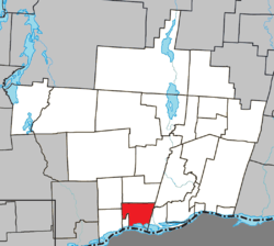 Location within Papineau RCM. | |
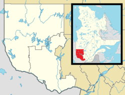 Lochaber Location in western Quebec. | |
| Coordinates: 45°38′N 75°13′W / 45.633°N 75.217°WCoordinates: 45°38′N 75°13′W / 45.633°N 75.217°W[1] | |
| Country |
|
| Province |
|
| Region | Outaouais |
| RCM | Papineau |
| Constituted | July 1, 1855 |
| Government[2] | |
| • Mayor | Georges Leduc |
| • Federal riding | Argenteuil—Papineau—Mirabel |
| • Prov. riding | Papineau |
| Area[2][3] | |
| • Total | 70.00 km2 (27.03 sq mi) |
| • Land | 62.04 km2 (23.95 sq mi) |
| Population (2011)[3] | |
| • Total | 409 |
| • Density | 6.6/km2 (17/sq mi) |
| • Pop 2006-2011 |
|
| • Dwellings | 167 |
| Time zone | UTC−5 (EST) |
| • Summer (DST) | UTC−4 (EDT) |
| Postal code(s) | J0X 3B0 |
| Area code(s) | 819 |
| Highways |
|
Lochaber is a township municipality in the Canadian province of Quebec, located within the Papineau Regional County Municipality. The township had a population of 409 in the Canada 2011 Census.
Demographics
Population trend:[4]
- Population in 2011: 409 (2006 to 2011 population change: -17.7%)
- Population in 2006: 497
- Population in 2001: 446 (adjusted for boundary change)
- 2001 to 2006 population change: 11.4%
- Population in 1996: 510
- Population in 1991: 492
Private dwellings (occupied by usual residents): 153
Languages:
- English as first language: 5.5%
- French as first language: 89%
- English and French as first language: 0%
- Other as first language: 5.5%
References
- ↑ Reference number 36335 of the Commission de toponymie du Québec (in French)
- 1 2 Geographic code 80055 in the official Répertoire des municipalités (in French)
- 1 2 "(Code 2480055) Census Profile". 2011 census. Statistics Canada. 2012.
- ↑ Statistics Canada: 1996, 2001, 2006, 2011 census
Places adjacent to Lochaber, Quebec | |
|---|---|
| Cities | |
|---|---|
| Municipalities | |
| Townships | |
| |
This article is issued from
Wikipedia.
The text is licensed under Creative Commons - Attribution - Sharealike.
Additional terms may apply for the media files.