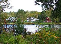
Namur, Quebec
| Namur | |
|---|---|
| Municipality | |
 | |
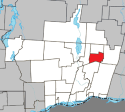 Location within Papineau RCM. | |
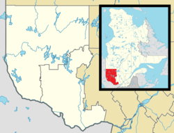 Namur Location in western Quebec. | |
| Coordinates: 45°54′N 74°56′W / 45.900°N 74.933°WCoordinates: 45°54′N 74°56′W / 45.900°N 74.933°W[1] | |
| Country |
|
| Province |
|
| Region | Outaouais |
| RCM | Papineau |
| Settled | 1865 |
| Constituted | January 1, 1964 |
| Government[2] | |
| • Mayor | Gilbert Dardel |
| • Federal riding | Argenteuil—Papineau—Mirabel |
| • Prov. riding | Papineau |
| Area[2][3] | |
| • Total | 58.10 km2 (22.43 sq mi) |
| • Land | 56.37 km2 (21.76 sq mi) |
| Population (2011)[3] | |
| • Total | 596 |
| • Density | 10.6/km2 (27/sq mi) |
| • Pop 2006-2011 |
|
| • Dwellings | 348 |
| Time zone | UTC−5 (EST) |
| • Summer (DST) | UTC−4 (EDT) |
| Postal code(s) | J0V 1N0 |
| Area code(s) | 819 |
| Highways |
|
Namur is a town and municipality in the Outaouais region of Quebec, Canada, part of the Papineau Regional County Municipality. It is nicknamed "la Nouvelle Belgique" (New Belgium).[4]
The vast majority of the local population lives off the timber industry, which is marked by the Loggers Summer Festival. Furthermore, the area's excellent fishing and hunting opportunities attract many tourists annually.[4]
History
The first settlers arrived in the area in 1865, the majority originating from the Belgian Province of Namur and mostly Presbyterian Walloons; their family names were Edain, Frison, Pinon, Roquet, Fluhamann, and Van Vanious. In 1874, the Namur Post Office opened.[4]
From 1886 onward, the area was known as the United Township Municipality of Suffolk-et-Addington. Piece by piece, portions of this united township were detached to form new municipalities: Vinoy in 1920 (since 1996 part of Chénéville), Lac-des-Plages in 1950, and finally Namur in 1964.[4]
Demographics
Population trend:[5]
- Population in 2011: 596 (2006 to 2011 population change: 22.4%)
- Population in 2006: 487
- Population in 2001: 532
- 2001 to 2006 population change: -8.5 %
- Population in 1996: 543
- Population in 1991: 512
Private dwellings occupied by usual residents: 256 (total dwellings: 348)
Mother tongue
- English as first language: 5.5%
- French as first language: 89%
- English and French as first language: 5.5%
- Other as first language: 0%
Education
Sir Wilfrid Laurier School Board operates Anglophone public schools:
References
- ↑ Reference number 43342 of the Commission de toponymie du Québec (in French)
- 1 2 Geographic code 80110 in the official Répertoire des municipalités (in French)
- 1 2 "(Code 2480110) Census Profile". 2011 census. Statistics Canada. 2012.
- 1 2 3 4 "Namur (Municipalité)" (in French). Commission de toponymie du Québec. Retrieved 2009-01-12.
- ↑ Statistics Canada: 1996, 2001, 2006, 2011 census
- ↑ "LAURENTIAN REGIONAL HS ZONE." Sir Wilfrid Laurier School Board. Retrieved on September 4, 2017.
Places adjacent to Namur, Quebec | |
|---|---|
| Cities | |
|---|---|
| Municipalities | |
| Townships | |
| |