Panther Forest, Arkansas
| Panther Forest, Arkansas | |
|---|---|
| Unincorporated community | |
 Panther Forest  Panther Forest | |
| Coordinates: 33°24′13″N 91°15′04″W / 33.40361°N 91.25111°WCoordinates: 33°24′13″N 91°15′04″W / 33.40361°N 91.25111°W | |
| Country | United States |
| State | Arkansas |
| County | Chicot |
| Elevation | 128 ft (39 m) |
| Time zone | UTC-6 (Central (CST)) |
| • Summer (DST) | UTC-5 (CDT) |
| Area code(s) | 870 |
| GNIS feature ID | 2741530[1] |
Panther Forest is an unincorporated community in Chicot County, Arkansas, United States. Panther Forest is located on the east bank of the Connerly Bayou, 5.3 miles (8.5 km) north-northeast of Lake Village.[2]
References
- ↑ "Panther Forest". Geographic Names Information System. United States Geological Survey.
- ↑ Chicot County, Arkansas General Highway Map (PDF) (Map). Arkansas State Highway and Transportation Department. 2010. Retrieved October 11, 2012.
Municipalities and communities of Chicot County, Arkansas, United States | ||
|---|---|---|
| Cities | 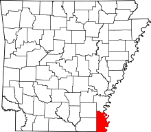 | |
| Unincorporated communities | ||
| Ghost town | ||
This article is issued from
Wikipedia.
The text is licensed under Creative Commons - Attribution - Sharealike.
Additional terms may apply for the media files.