Panindícuaro Municipality
| Panindícuaro | |
|---|---|
| Municipality | |
|
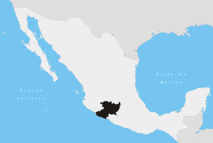
Panindícuaro Location in Mexico | |
| Coordinates: 19°59′1″N 101°45′40″W / 19.98361°N 101.76111°WCoordinates: 19°59′1″N 101°45′40″W / 19.98361°N 101.76111°W | |
| Country |
|
| State | Michoacán |
| Municipal seat | Panindícuaro |
| Area[1] | |
| • Total | 259.44 km2 (100.17 sq mi) |
| Population (2010)[2] | |
| • Total | 16,064 |
| • Density | 62/km2 (160/sq mi) |
Panindícuaro is one of the 113 municipalities of Michoacán, in central Mexico. The municipal seat lies at the town of the same name.
References
- ↑ "http://www.municipios.mx/michoacan/panindicuaro/". External link in
|title=(help) - ↑ Instituto Nacional de Estadística y Geografía (2010). "Principales resultados por localidad 2010 (ITER)".
This article is issued from
Wikipedia.
The text is licensed under Creative Commons - Attribution - Sharealike.
Additional terms may apply for the media files.