Chavinda
| Chavinda | |
|---|---|
|
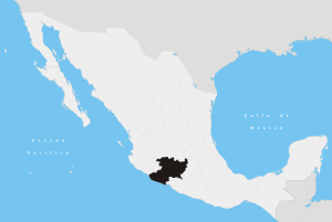
Chavinda Location of Chavinda in México | |
| Coordinates: 20°01′N 102°27′W / 20.017°N 102.450°WCoordinates: 20°01′N 102°27′W / 20.017°N 102.450°W | |
| Country | México |
| State | Michoacán |
| Municipality | Chavinda |
| Elevation | 1,572 m (5,157 ft) |
| Population (2015) | |
| • Total | 10,258 |
| Time zone | UTC-6 (Central) |
| • Summer (DST) | UTC-7 (Central) |
| Area code(s) | 383 |
| Website |
Official website |
Chavinda, which translates to "place of four winds" in the Purépecha language, is a small town in the Mexican state of Michoacán. It is located at an elevation of 1,572 metres (5,157 feet) and is 196 kilometres (122 miles) northwest of Morelia and is 282 kilometres (175 mi) southeast of Guadalajara. The 2015 population was 10,258.[1]
Chavinda is the municipal seat for the municipality of Chavinda, in the state of Michoacán de Ocampo. Other small towns and villages included in the municipality are La Esperanza, San Juan Palmira, and El Tepehuaje.
Residents of Chavinda have found seasonal employment in the Napa Valley of California via the United States' H-2A temporary agricultural workers' visa program.[2]
History

Chavinda was founded in 1840. The small town was developed as a religious center, and its early inhabitants believed Chavinda to be the doorway to heaven where the gods ascended and descended. The Purépecha people first settled in Chavinda in 1494, led by Rey Curateme. It has always been of interest to Mexican history buffs because it was central to the careers of two diametrically opposed characters in Mexico's colonial past.
Chavinda has many traditions and customs like the great salcedas known as "los musiquitas". The small village is hidden high in the mountains of Michoacán. It is veiled from the outside world by a curtain of very tall pine trees. To the east, 28 kilometres (17 mi) away, is Zamora, one of Mexico's quaintest towns.
The town retains its ancient atmosphere. It consists of largely one-story adobe or plaster-over-brick buildings with red tile roofs. The streets are dusty cobblestones traveled by horse and car. La Plaza (the plaza) is Chavinda's central square. Bricks cover the plaza, and a kiosk stands in its center with many tiendas (stores) around.
References
- ↑ "División municipal. Michoacán de Ocampo". cuentame.inegi.org.mx. INEGI. Retrieved 27 October 2017.
- ↑ Villatoro, Carlos (10 November 2007). "From Chavinda to Carneros, legally". Napa Valley Register. Retrieved 27 October 2017.