Pajacuarán Municipality
| Pajacuarán | |
|---|---|
| Municipality | |
|
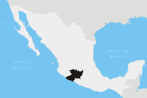
Pajacuarán Location in Mexico | |
| Coordinates: 20°7′5″N 102°33′54″W / 20.11806°N 102.56500°WCoordinates: 20°7′5″N 102°33′54″W / 20.11806°N 102.56500°W | |
| Country |
|
| State | Michoacán |
| Municipal seat | Pajacuarán |
| Area | |
| • Total | 174.06 km2 (67.20 sq mi) |
| Population (2010)[1] | |
| • Total | 19,450 |
| • Density | 110/km2 (290/sq mi) |
Pajacuarán is one of the 113 municipalities of Michoacán, in central Mexico. The municipal seat lies at the town of the same name.
Localities
The main towns and their population are the following:
| Locality | Population |
| Total | 19,450 |
| Pajacuarán | 9,766 |
| La Luz | 3,689 |
| San Gregorio | 2,384 |
References
- ↑ Instituto Nacional de Estadística y Geografía (2010). "Principales resultados por localidad 2010 (ITER)".
This article is issued from
Wikipedia.
The text is licensed under Creative Commons - Attribution - Sharealike.
Additional terms may apply for the media files.