Pangode
| Pangode | |
|---|---|
| village | |
 Pangode Location in Kerala, India  Pangode Pangode (India) | |
| Coordinates: 8°45′55″N 76°57′49″E / 8.76528°N 76.96361°ECoordinates: 8°45′55″N 76°57′49″E / 8.76528°N 76.96361°E | |
| Country |
|
| State | Kerala |
| District | Thiruvananthapuram |
| Taluka | Nedumangad |
| Government | |
| • Body | Gram panchayat |
| Languages | |
| • Official | Malayalam, English |
| Time zone | UTC+5:30 (IST) |
| PIN | 695609[1] |
| Telephone code | 0472 |
| Vehicle registration | KL-16 KL-21 |
| TRIVANDRUM | Thiruvananthapuram |
| Lok Sabha constituency | Attingal |
| Kerala Legislative Assembly constituency | Vamanapuram |
Pangode is a village and a Grama Panchayat[2] in Trivandrum district, state of Kerala, India.[3] The village is known for its participation in the Indian Independence Movement, through the Kallara-Pangode Struggle. Situated on the foot hills of westernghats (ponmudi)
Location
There are two more places with the same name "Pangode," one in Trivandrum district itself and the other in neighboring Kollam district. Of the other two places with the same name, one is located within Trivandrum city, where an Indian military establishment is based at and the other one is where an Ayurvedic Medical College is located.
This Pangode is a village on the north east of Trivandrum district, located 45 km north-east of Trivandrum (Thiruvananthapuram) city, the capital of Southern Indian state of Kerala.
Pangode Gram Panchayat falls under Vamanapuram block of Trivandrum district and is on the Karette-Palode Road. It is a border village of Kollam and Trivandrum districts. Pangode village is where the Grama Panchayat office and major government offices of the Panchayat are situated. Pangode Grama Panchayat was carved out of Kallara and Vamanapuram Grama Panchayats in 1977 by Government Order No: 883/77/LA dated 30/09/1977 with P A Rahim as its first President and Pattanikkada Shahul Hameed as first Vice President. Pangode Grama Panchayat is spread over an area of 23.31 km2, with a population of 30225, a female:male ratio of 1092:1000 and a literacy rate of over 90 per cent.[4]
Infrastructure
A government Lower Primary School, a government aided Upper Primary School (KVUPS, Pazhavila)[5] and an aided college are situated in Pangode village. A government High School is located in the nearby village of Bharathannoor, which is part of the Pangode Grama Panchayat, and is two kilometers away. The government aided college, Mannaniya College of Arts & Science, is established in 1995 by a charitable society Jamiya Mannaniya Islamiya and runs undergraduate courses under the University of Kerala.[6] Also located in the village are a Police Station, a Post Office (PIN: 695609), a revenue Village Office, a State Bank of Travancore (SBT)[7] branch and a Cooperative Bank. An Indian Overseas Bank branch[8] is located in the nearby Bharathanoor.
Economy
Pangode is predominantly an agriculture-dependent village and most of the people have directly or indirectly been involved in agriculture for their livelihood. With the spread of rubber cultivations in the 1970s and 1980s in the eastern regions of Kerala, farmers of Pangode quickly moved over from Coconut and Paddy cultivations to Rubber, attracted by its high Return on Investment. In the 1990s, a lot of village youth traveled to the Middle East countries in search of jobs and, by now, a good number of adults from the village is working abroad and, therefore, remittance is also a good source of income. Flow of remittance has resulted in increase in the number of concrete buildings, replacing the old thatched and tiled houses.
History
Pangode has a history of participation in Indian Independence Movement. The Civil Disobedience Movement led by Mahatma Gandhi (M K Gandhi) found its ripples in the village and a section of village farmers resorted to tax resistance. They refused to pay taxes for selling commodities at the Pangode and nearby Kallara markets in September 1939. A few local progressive thinkers and leaders led this mass movement against the British Raj and its representative who was ruling the Travancore province at the time, C. P. Ramaswami Iyer. A series of events led to a bloody incident in which a charged mob of agitated farmers attacking the Pangode police outpost and killing a policeman.[9] In the ensued crossfire between the police and the agitators, two freedom fighters - Plankeezhil Krishna Pillai and Cheruvalam Kochu Narayanan Achary - were also killed. Soon, the police which was under the control of the Travancore Diwan C. P. Ramaswami Iyer cracked down on the movement. People involved in the ambush were arrested and later tried. First and 13th accused in the case - Kochappi Pillai and Pattalam Krishnan - were hanged till death on 17/18 December 1940 after the High Court confirmed the sentences awarded to them by the Sessions Court.[10]
Kallara-Pangode Struggle is declared by the Government of India as one of the 39 struggles that led to India gaining independence in 1947 from the British Raj.[11][12][13][14] The 75th anniversary of the Kallara-Pangode Struggle was celebrated on 29 September 2013 inaugurated by the Kerala Chief Minister Oommen Chandy.[15]
How to Reach
Pangode is well connected through road, rail transport and air. Direct buses are available frequently to Nedumangadu,Palode, Kadakkal, Kilimanoor, Attingal, Thiruvananthapuram. Nearest Kerala State Road Transport Corporation Operating Centre is Palode (10 km) on the Thiruvananthapuram-Sengottai interstate highway and nearest KSRTC Sub Depot is Kilimanoor (15 km) on the Main Centre road (MC Road) connecting Thiruvananthapuram to Kottayam.[16]
Nearest railhead is Varkala which is 35 km away. Other closest railheads are Chirayinkeezhu and Thiruvananthapuram.[17] Nearest domestic/international airport is Trivandrum International Airport located 50 km away.[18]
References
- ↑ "India Post :Pincode Search". Archived from the original on 2012-05-20. Retrieved 2008-12-16.
- ↑ Pangode, Panchayat. "Pangode Panchayat". Government of Kerala. Retrieved 25 January 2014.
- ↑ Census Village code = 00130400 "Census of India : Villages with population 5000 & above". Registrar General & Census Commissioner, India. Retrieved 2008-12-10.
- ↑ Census Commissioner, India 2001 Census. "List of Villages having Population greater than 5000". Ministry of Home Affairs, Government of India. Retrieved 28 January 2014.
- ↑ School Listing in Kerala. "KVUPS School, Pangode". Retrieved 25 January 2014.
- ↑ Kerala University, Trivandrum. "Mannaniya College of Arts & Science". University of Kerala. Retrieved 25 January 2014.
- ↑ SBT, Pangode. "SBT Branch Locator". State Bank of Travancore. Retrieved 26 January 2014.
- ↑ IOB, Bank. "IOB Branch Locator". Indian Overseas Bank. Retrieved 26 January 2014.
- ↑ Kilimanoor, Chandran (2004). Chorappookkal viriyicha Kallara - Pangode - Freedom Struggle. Trivandrum: Chintha Publishers.
- ↑ Kallara, Pangode. "Freedom Struggle". The Hindu. Retrieved 25 January 2014.
- ↑ Freedom Struggles. "List of Freedom Struggle" (PDF). Ministry of Home Affairs, Government of India. Retrieved 25 January 2014.
- ↑ Freedom Struggles, India. "List of Freedom Struggles". Government of India. Retrieved 25 January 2014.
- ↑ Freedom, Struggles. "List of Freedom Struggles India". Income Tax Department, Government of India. Retrieved 25 January 2014.
- ↑ Freedom Struggles, India, Kerala. "List of Freedom Struggles in Kerala". Government of Kerala. Retrieved 25 January 2014.
- ↑ Freedom Struggles 75th year Celebrations, India, Kerala. "Freedom Struggles in Kerala". The Hindu. Retrieved 25 January 2014.
- ↑ Bus Stands, Depots, Kerala. "Kerala Road Transport Corporation". KSRTC, Govt of Kerala. Retrieved 1 February 2014.
- ↑ Southern, Railway. "Station Locator, Southern Railway". Indian Railways. Retrieved 1 February 2014.
- ↑ Airport, National/International. "Thiruvananthapuram Airport". Airport Authority of India. Archived from the original on 2 September 2016. Retrieved 1 February 2014.
District HQ: Thiruvananthapuram | |||||||
| History | 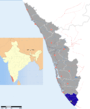 | ||||||
| Geography | |||||||
| Cities and Taluks |
| ||||||
| Transport | |||||||
| Education |
| ||||||
| Buildings | |||||||
| Culture | |||||||
| Lok Sabha constituencies | |||||||
| Sports | |||||||
| Museums | |||||||