Palonín
| Palonín | |||
|---|---|---|---|
| Municipality | |||
 | |||
| |||
 Palonín | |||
| Coordinates: 49°43′38″N 16°57′48″E / 49.72722°N 16.96333°ECoordinates: 49°43′38″N 16°57′48″E / 49.72722°N 16.96333°E | |||
| Country |
| ||
| Region | Olomouc | ||
| District | Šumperk | ||
| Area | |||
| • Total | 5.37 km2 (2.07 sq mi) | ||
| Elevation | 272 m (892 ft) | ||
| Population (2006) | |||
| • Total | 337 | ||
| • Density | 63/km2 (160/sq mi) | ||
| Postal code | 789 83 | ||
| Website | http://www.palonin.cz | ||


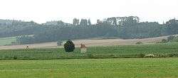
Palonín is a village and municipality (obec) in Šumperk District in the Olomouc Region of the Czech Republic.
The municipality covers an area of 5.37 square kilometres (2.07 sq mi), and has a population of 337 (as at 28 August 2006).
Palonín lies approximately 27 kilometres (17 mi) south of Šumperk, 26 km (16 mi) north-west of Olomouc, and 187 km (116 mi) east of Prague.
References
| Wikimedia Commons has media related to Palonín. |
This article is issued from
Wikipedia.
The text is licensed under Creative Commons - Attribution - Sharealike.
Additional terms may apply for the media files.