Päijänne Tavastia
| Päijänne Tavastia Päijät-Häme Päijät-Hämeen maakunta landskapet Päijänne-Tavastland | |||
|---|---|---|---|
| Region | |||
| |||
 Päijänne Tavastia on a map of Finland | |||
| Country | Finland | ||
| Historical province | Tavastia | ||
| Area | |||
| • Total | 6,256.66 km2 (2,415.71 sq mi) | ||
| Population (2013) | |||
| • Total | 202,424 | ||
| • Density | 32/km2 (84/sq mi) | ||
| ISO 3166 code | FI-16 | ||
| NUTS | 185 | ||
| Regional bird | White-backed woodpecker (Dendrocopos leucotos) | ||
| Regional fish | Carp bream (Abramis brama) | ||
| Regional flower | Cornflower (Centaurea cyanus) | ||
| Website | paijat-hame.fi | ||


Päijänne Tavastia or, officially, Päijät-Häme[1] (Finnish: Päijät-Häme; Swedish: Päijänne-Tavastland) is a region in Southern Finland south of the lake Päijänne. It borders the regions of Uusimaa, Tavastia Proper (Kanta-Häme), Pirkanmaa, Central Finland, Southern Savonia (Etelä-Savo) and Kymenlaakso. The biggest city in the region is Lahti.[2]
Historical provinces
For history, geography and culture see: Tavastia
Municipalities
There are 9 municipalities in Päijänne Tavastia. Cities and towns are marked in bold.
Heraldry
Blazon: Azure, a mermaid and in dexter chief a cuckoo close Or.
In laymen's terms: The coat of arms sports a depiction of the ancient water goddess Vellamo as a mermaid, with a cuckoo.
Politics
Results of the Finnish parliamentary election, 2011 in Päijänne Tavastia:
- National Coalition Party 23.2%
- True Finns 22.7%
- Social Democratic Party 22.0%
- Centre Party 11.6%
- Christian Democrats 7.5%
- Left Alliance 6.1%
- Green League 4.5%
See also
Gallery
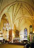 Medieval church in Hollola
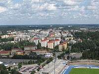 A view of Lahti centre
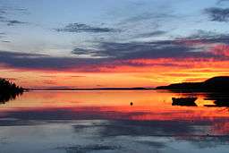 Lake Päijänne in Sysmä
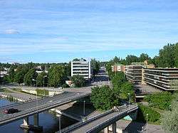 Heinola town centre
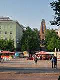 Lahti Market Place with the City Hall by Eliel Saarinen in the background
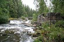 Virenoja Rapids and ruins of an old mill, Orimattila
 Hartola Church
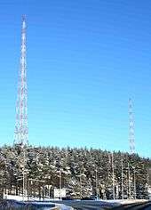 The radio masts in Lahti, symbols for the city
 Vääksy Canal, Asikkala
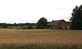 Rural landscape in Orimattila
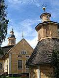 Nastola Church
 Rural landscape in Kärkölä
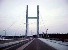 A bridge in Heinola
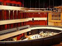 The celebrated Sibelius Hall is the heart of Lahti's cultural life
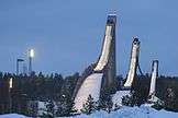 Ski jumping hills in Lahti; also an venue for Ski Jumping WC
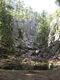 A rock cleft in Hollola
 The Gothic Revival church in Kärkölä
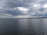 Lake Vesijärvi in Asikkala
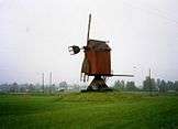 A windmill in Hartola
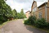 A typical traditional Tavastian village view, Orimattila
 National romantic municipal house in Hollola
 Architecture in Lahti
 Pyhäniemi Manor, Hollola
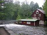 An old mill at River Vääksynjoki, Asikkala
References
- ↑ https://www.stat.fi/meta/luokitukset/maakunta/001-2018/index_en.html
- ↑ "EURES - Labour market information - Päijät-Häme - European Commission". ec.europa.eu. Retrieved 2016-08-09.
External links
| Wikimedia Commons has media related to Päijänne Tavastia. |
This article is issued from
Wikipedia.
The text is licensed under Creative Commons - Attribution - Sharealike.
Additional terms may apply for the media files.