Central Ostrobothnia
| Central Ostrobothnia Keski-Pohjanmaan maakunta landskapet Mellersta Österbotten | |||
|---|---|---|---|
| Region | |||
| |||
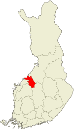 Central Ostrobothnia on a map of Finland | |||
| Country | Finland | ||
| Historical province | Ostrobothnia | ||
| Area | |||
| • Total | 5,706.39 km2 (2,203.25 sq mi) | ||
| Population (2013) | |||
| • Total | 68,677 | ||
| • Density | 12/km2 (31/sq mi) | ||
| Time zone | UTC+2 (EET) | ||
| • Summer (DST) | UTC+3 (EEST) | ||
| ISO 3166 code | FI-07 | ||
| NUTS | 1A1 | ||
| Regional bird | Skylark (Alauda arvensis) | ||
| Regional fish | - | ||
| Regional flower | Bluebell (Harebell) | ||
| Website | keski-pohjanmaa.fi | ||

Central Ostrobothnia (Finnish: Keski-Pohjanmaa; Swedish: Mellersta Österbotten) is a region in Finland. It borders the regions of Ostrobothnia, North Ostrobothnia, Central Finland and South Ostrobothnia.
Historical provinces
Municipalities
The region of Central Ostrobothnia is made up of eight municipalities, of which two have city status (marked in bold).
Gallery
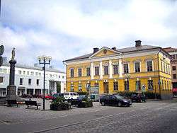 Kokkola Town Hall
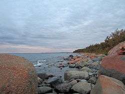 Gulf of Bothnia in Lohtaja
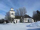 Kaarlela Church in Kokkola originally built in late 15th century
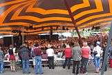 An annual folk music festival takes place in Kaustinen; the area used to have a strong tradition in folk music
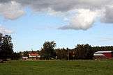 Rural landscape in Kälviä
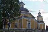 Veteli Church
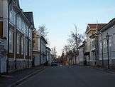 A street view in Kokkola Old Town
 Lake Lestijärvi, Lestijärvi
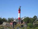 Tankar lighthouse, Kokkola
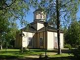 Halsua Church
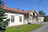 Kannus Railway Station
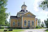 Kaustinen Church
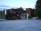 Folk Arts Centre in Kaustinen
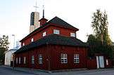 A former school building from 1696 in Kokkola; oldest preserved non-religious wooden building in Finland
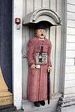 A poor man statue at Kälviä Church
External links
| Wikimedia Commons has media related to Central Ostrobothnia. |
This article is issued from
Wikipedia.
The text is licensed under Creative Commons - Attribution - Sharealike.
Additional terms may apply for the media files.