Pári
| Pári | |
|---|---|
 Pári Location of Pári | |
| Coordinates: 46°34′47″N 18°15′28″E / 46.57972°N 18.25778°ECoordinates: 46°34′47″N 18°15′28″E / 46.57972°N 18.25778°E | |
| Country |
|
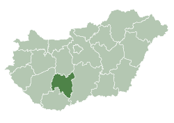
| County | Tolna |
| Area | |
| • Total | 13.06 km2 (5.04 sq mi) |
| Population (2010) | |
| • Total | 657 |
| • Density | 50.31/km2 (130.3/sq mi) |
| Time zone | UTC+1 (CET) |
| • Summer (DST) | UTC+2 (CEST) |
| Postal code | 7091 |
| Area code(s) | 74 |
Pári is a village in Tolna county, Hungary. It is independent again from 2006 (previously it belonged to the municipality of Tamási).
The former railway section of line 49 between Pári and Tamási were converted into a bicycle trail in 2010.
External links
- Pári on Google Maps
- Website of the municipality of Pári (in Hungarian)
| City with county rights |
|   |
|---|---|---|
| Towns | ||
| Large villages | ||
| Villages |
| |
| Other topics |
| |
This article is issued from
Wikipedia.
The text is licensed under Creative Commons - Attribution - Sharealike.
Additional terms may apply for the media files.