Otsego Lake (New York)
| Otsego Lake | |
|---|---|
.jpg) | |
| Location |
Otsego County, New York, United States |
| Coordinates | 42°45′23″N 74°53′46″W / 42.7564°N 74.8961°WCoordinates: 42°45′23″N 74°53′46″W / 42.7564°N 74.8961°W |
| Primary inflows | Hayden Creek, Shadow Brook, Trout Brook, Cripple Creek, Leatherstocking Creek, Willow Brook, Mohican Brook, Brookwood Creek, Glimmer Glen Creek |
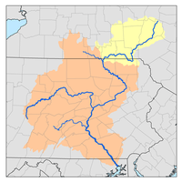
| Primary outflows | Susquehanna River |
| Catchment area | 74 sq mi (190 km2)[1] |
| Basin countries | United States |
| Max. length | 7.8 miles (12.6 km) |
| Surface area | 4,046 acres (16.37 km2) |
| Average depth | 82 feet (25 m) |
| Max. depth | 167 feet (51 m) |
| Surface elevation | 1,191 feet (363 m)[2] |
| Islands |
Sunken Island(sunken) Eel Island(sunken) |
| Settlements | Cooperstown, New York |
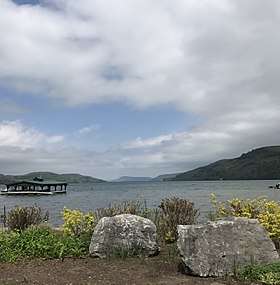
Otsego Lake is a 4,046-acre (16.37 km2) lake located in Otsego County, New York[2] and is the source of the Susquehanna River.[1] The Village of Cooperstown is located at the lake's southern end. Glimmerglass State Park is located on the lake's northeastern shore, and includes Hyde Hall, a large mansion constructed in 1817 that overlooks the lake. Glimmerglass Opera is located on the western shore.
History
The name Otsego is from a Mohawk or Oneida word meaning "place of the rock", referring to the large boulder near the lake's outlet,[3] today known as "Council Rock".
Pieter Quackenboss, Jr (1710-1774), an early settler of the Mohawk Valley, dealt extensively with the natives and became known as "The Old Indian Trader." The following incident in his life is recorded in the 1848 book Women of the American Revolution:
Pieter Quackenboss was among the early settlers of the [Montgomery] County, and did not escape the difficulties. He was a trader with the Indians, who placed great confidence in him, frequently consulting him. They were disposed to bestow on him some particular mark of regard, and after meeting for consultation, they decided on giving him the name " Otsego" and christening the lake for him. The ceremony of naming both him and the lake was performed by pouring liquor upon his head as he knelt on the ground, a portion being afterwards poured into the water. It is probable that few are acquainted with this origin of the name of Otsego Lake; but that family tradition has been confirmed by the recollection of some who witnessed the occurrence.[4]
Description
Otsego Lake is 7.8 miles (12.6 km) long with a surface area of 4,046 acres (16.37 km2). Its average depth is 82 feet (25 m), with a maximum depth of 167 feet (51 m). Portions of the lake are within the towns of Springfield, Middlefield and Otsego.[5]
It is geologically related to the Finger Lakes but is not counted among them. One difference is that Otsego Lake is situated at a higher elevation (1,191 feet [363 m])[2] than the Finger Lakes (approximately 400 feet [122 m]).
Council Rock

Located near the shore of Otsego Lake in Cooperstown is Council Rock, a large boulder whose top is above the water's surface and can be seen from shore. At low water, the oval rock rises approximately 4.5 feet (1.4 m) above the water, and is about nine feet (2.7 m) long by six feet (1.8 m) wide. It is believed to have been a meeting place for Native Americans prior to the American Revolutionary War.[6]
A small parcel of land near Council Rock was presented to the Village of Cooperstown in 1957, on the condition that it remain open to the public as a park. The park, today known as Council Rock Park, also includes a set of concrete steps leading to a lake-level terrace that was built in 1937.[7]
Sunken Islands
Sunken Island is a submerged sandy plot located near the western shore of Otsego Lake, approximately 6 miles (9.7 km) north from Cooperstown. It is the supposed remains of an island described in the writings of James Fenimore Cooper upon which a structure once stood. Today Sunken Island is several feet below the surface of the lake and is marked with 4 buoys to prevent boats from running aground.
Eel Island is a submerged island (sunken) located approximately 7 miles (11 km) north of Cooperstown.
Three Mile Point
Three Mile Point is a public swimming beach located three miles from Cooperstown along the western shore of Otsego Lake accessible via state highway 80. It is open during the summer and offers changing rooms, a picnic area, and a pavilion.
Fairy Springs
Fairy Springs is a public swimming area located one mile from Cooperstown along the eastern shore of Otsego lake accessible via county road 31. It is open May through September and offers changing rooms, a picnic area, and a pavilion.
Locations
- Blackbird Bay – A bay located on the south end of the lake.
- Brookwood Point – A projection into the west side of the lake.
- Clarke Point – A projection into the north end of the lake.
- Five Mile Point – A projection into the west side of the lake.
- Glimmerglass State Park – A New York State Park located on Hyde Bay.
- Gravelly Point – A projection into the east side of the lake.
- Hutter Point – A projection into the west side of the lake.
- Hyde Bay – A bay located on the north end of the lake by Glimmerglass State Park.
- Mount Wellington – A mountain located on the north end of the lake, east of Hyde Bay.
- Peggs Point – A projection into the east side of the lake.
- Point Judith – A projection into the east side of the lake.
- Point Florence – A projection into the east side of the lake.
- Six Mile Point – A projection into the west side of the lake.
- Three Mile Point – A projection into the west side of the lake.[8]
- Waterlily Bay – A bay located on the lake.
Appearances in literature
The lake was known to James Fenimore Cooper as Glimmerglass and was a principal feature in his novels The Pioneers and The Deerslayer, in which local landmarks such as Council Rock and Sunken Island are mentioned.
Otsego Lake is also referenced in The Secret of Mirror Bay, a novel in the Nancy Drew Mystery Stories series.
See also

References
- 1 2 "Biological Field Station - About Otsego Lake". Oneonta.edu. SUNY Oneonta. 2015. Retrieved August 11, 2015.
- 1 2 3 "Otsego Lake". Geographic Names Information System. United States Geological Survey. Retrieved August 11, 2015.
- ↑ Beauchamp, William Martin (1907). Aboriginal Place Names of New York (New York State Museum Bulletin, Volume 108). New York State Education Department. p. 174. Retrieved August 12, 2015.
- ↑ Andrew, Adriana Suydam Quackenbush (1909). The Quackenbush family in Holland and America. The Library of Congress. Paterson, N.J., Quackenbush & co.
- ↑ NYS Department of Environmental Conservation. "Otsego Lake". Dec.ny.gov. Retrieved August 11, 2015.
- ↑ Halsey, Francis Whiting (1901). "Indian Villages in the Upper Valley". The Old New York Frontier: Its Wars with Indians and Tories, Its Missionary Schools, Pioneers, and Land Titles, 1614-1800. C. Scribner's Sons. pp. 21–23. Retrieved August 30, 2015.
- ↑ MacDougall, Hugh Cooke (1989). "Council Rock Park". Cooper's Otsego County: A Bicentennial Guide of Sites in Otsego County Associated with the Life and Fiction of James Fenimore Cooper, 1789-1851. Cooperstown, NY: New York State Historical Association. p. 94. Retrieved August 30, 2015.
- ↑ Sportsman's Connection (Firm) (2004-01-01), Southeastern New York fishing map guide: includes lakes & streams for the following counties: Albany, Bronx, Columbia, Delaware, Dutchess, Greene, Kings, Montgomery, Nassau, New York, Orange, Otsego, Putnam, Queens, Rensselaer, Richmond, Rockland, Schenectady, Schoharie, Suffolk, Sullivan, Ulster, Westchester, Sportsman's Connection, ISBN 1885010648, retrieved 2018-01-23