Conodoguinet Creek
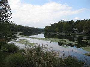
Conodoguinet Creek from its southern bank in Mechanicsburg, near Orrs Bridge Road
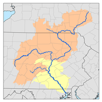
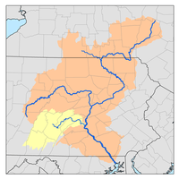
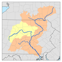
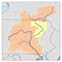
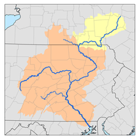
Conodoguinet Creek is a 104-mile-long (167 km)[1] tributary of the Susquehanna River in South central Pennsylvania in the United States.[2] The name is Native American, and means "A Long Way with Many Bends".[3]
Conodoguinet Creek joins the Susquehanna River upstream of Harrisburg.[2]
The water divide between Conodoguinet Creek and Conococheague Creek is sometimes used as the boundary between the Hagerstown Valley and the Cumberland Valley. It flows past many mills, including Maclay's Mill. The Appalachian Trail crosses the creek near Carlisle.
Bridges
- The Ramp Covered Bridge crosses Conodoguinet Creek at Hopewell Township in Cumberland County, Pennsylvania.[4]
- There were formerly four more wooden covered bridges over the creek, but two were destroyed by storms ("Good Hope Mill" and "Watts Bridge") and the other three ("Erb's," "Orr's," and "Oyster Mill") were replaced by modern concrete bridges after they became so old as to be unreliable. Watts Bridge, near Creekside, the home of Frederick Watts, was also replaced by a concrete structure in the 1980s-90s; the Good Hope Mill bridge was never replaced after its destruction.
- Wolfs Bridge in Middlesex Township, in Cumberland County, crosses the Conodoguinet Creek near Schlusser. It failed inspection in 2013, but has yet to be replaced.
See also
Notes
- ↑ "The National Map". U.S. Geological Survey. Archived from the original on 2012-04-05. Retrieved Feb 15, 2011.
- 1 2 Gertler, Edward. Keystone Canoeing, Seneca Press, 2004. ISBN 0-9749692-0-6
- ↑ "The Conodoguinet and the Chesapeake Bay" (PDF). Retrieved 30 August 2010.
- ↑ "National Historic Landmarks & National Register of Historic Places in Pennsylvania" (Searchable database). CRGIS: Cultural Resources Geographic Information System. Note: This includes Susan M. Zacher (n.d.). "National Register of Historic Places Inventory Nomination Form: Ramp Covered Bridge" (PDF). Retrieved 2012-01-21.
References
External links

Coordinates: 40°16′17″N 76°54′49″W / 40.27139°N 76.91361°W
This article is issued from
Wikipedia.
The text is licensed under Creative Commons - Attribution - Sharealike.
Additional terms may apply for the media files.