Ormeau, Queensland
| Ormeau Gold Coast, Queensland | |||||||||||||||
|---|---|---|---|---|---|---|---|---|---|---|---|---|---|---|---|
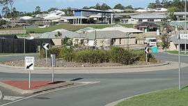 Looking from Jasmine Crescent across new housing developments towards the Mother Teresa Catholic Primary School, Ormeau, 2014 | |||||||||||||||
| Population | 14,460 (2016 census)[1] | ||||||||||||||
| Postcode(s) | 4208 | ||||||||||||||
| Location | 49 km (30 mi) south of Brisbane CBD | ||||||||||||||
| LGA(s) | City of Gold Coast | ||||||||||||||
| State electorate(s) | Coomera | ||||||||||||||
| Federal Division(s) | Forde | ||||||||||||||
| |||||||||||||||
Ormeau is a hinterland town and suburb in the City of Gold Coast, Queensland, Australia.[2][3] In the 2011 census, Ormeau had a population of 12,439 people.[4]
History
The name of the town came from Ormeau House the estate of Major Alexander Jenyns Boyd, a sugar planter of the 1860s. His first wife, Isabella (née Dawson) was born at Ormeau Road, Belfast, Ulster, Ireland. The word "ormeau" is French, meaning ‘young elm’.[2]
Location
Ormeau is located in the northern Gold Coast, approximately 41 kilometres (25 mi) north of Surfers Paradise, and 49 kilometres (30 mi) south of Brisbane.
Schools
- Ormeau State School
- Norfolk Village State Primary School
- Livingstone Christian College
- Ormeau Woods State High School
- Lutheran Ormeau Rivers District School (LORDS)
- The Toogoolawa School
- Mother Teresa Catholic Primary School
Amenities
The Gold Coast City Council operates a fortnightly mobile library service which makes four visits to Ormeau:[5]
- the corner of Eggersdorf and Stewarts Road
- Peachey Road
- Reedmans Road, between Toogoolawa and Livingstone schools
- Norfolk Park at Halfway Drive
Sport and recreation
A number of well-known sporting teams represent the local area, including the Ormeau Shearers is the local rugby league club who play home games at Ormeau Oval. The Ormeau Bulldogs are the local football (AFL) team for both juniors and masters (over 35's), which had two new ovals open for use in 2014.[6]
The Darlington Park Raceway, which was located here and once used for an assignment on the third season of The Mole, was shut down in 2005 after complaints from the local council.
Transport
References
- ↑ Australian Bureau of Statistics (27 June 2017). "Ormeau (State Suburb)". 2016 Census QuickStats. Retrieved 9 February 2018.

- 1 2 "town (entry 25575)". Queensland Place Names. Queensland Government. Retrieved 29 May 2016.
- ↑ "suburb (entry 46073)". Queensland Place Names. Queensland Government. Retrieved 29 May 2016.
- ↑ Australian Bureau of Statistics (31 October 2012). "Ormeau (State Suburb)". 2011 Census QuickStats. Retrieved 14 October 2013.
- ↑ "Mobile Library 2018 timetable" (PDF). Gold Coast City Council. Archived (PDF) from the original on 30 January 2018. Retrieved 30 January 2018.
- ↑ "Ormeau Bulldogs Junior AFL Club". Retrieved 13 January 2015.
External links
| Wikimedia Commons has media related to Ormeau, Queensland. |