Clagiraba, Queensland
| Clagiraba Gold Coast, Queensland | |||||||||||||||
|---|---|---|---|---|---|---|---|---|---|---|---|---|---|---|---|
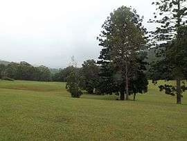 Little Clagiraba Reserve, 2016 | |||||||||||||||
 Clagiraba | |||||||||||||||
| Coordinates | 27°59′29″S 153°14′34″E / 27.99139°S 153.24278°ECoordinates: 27°59′29″S 153°14′34″E / 27.99139°S 153.24278°E | ||||||||||||||
| Population | 561 (2011 census)[1] | ||||||||||||||
| Postcode(s) | 4211 | ||||||||||||||
| LGA(s) | City of Gold Coast | ||||||||||||||
| State electorate(s) | |||||||||||||||
| Federal Division(s) | Forde | ||||||||||||||
| |||||||||||||||
Clagiraba is a suburb of City of Gold Coast, Queensland, Australia approximately 25 kilometres (16 mi) west of Surfers Paradise in the Gold Coast's hinterland. At the 2011 Australian Census the suburb recorded a population of 561.[1]
It is nestled between Mount Nathan and Witheren and also encompasses the southern end of Tamborine Mountain. Though zoned rural, it is a comparatively short (10-15 minute) drive to more populous suburbs such as Nerang, Oxenford and Pacific Pines. It is approximately a 30-minute drive to many of the Gold Coast region's beach destinations such as Surfers Paradise, Main Beach and the Spit.
Clagiraba is named from Clagiraba Creek, a tributary of the Coomera River. The name Clagiraba is derived from the indigenous name 'Kalagareebah' meaning young or single men's ground. This was a region where young indigenous men were taken during their initiation ceremony.
Clagiraba is also home to Miss Universe Australia 2010, Jesinta Campbell, who placed second runner up.
References
- 1 2 Australian Bureau of Statistics (31 October 2012). "Clagiraba (State Suburb)". 2011 Census QuickStats. Retrieved 22 September 2014.

External links
| Wikimedia Commons has media related to Clagiraba, Queensland. |
- "Gold Coast Inner Hinterland". Queensland Places. Centre for the Government of Queensland, University of Queensland. — includes Clagiraba