Mermaid Beach, Queensland
| Mermaid Beach Gold Coast, Queensland | |||||||||||||||
|---|---|---|---|---|---|---|---|---|---|---|---|---|---|---|---|
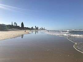 Mermaid Beach, looking North | |||||||||||||||
| Population | 6,533 (2016 census)[1] | ||||||||||||||
| Postcode(s) | 4218 | ||||||||||||||
| LGA(s) | City of Gold Coast | ||||||||||||||
| State electorate(s) | Mermaid Beach | ||||||||||||||
| Federal Division(s) | Moncrieff | ||||||||||||||
| |||||||||||||||
Mermaid Beach is a suburb on the Gold Coast in Queensland, Australia.[2] At the 2011 Census, Mermaid Beach had a population of 5,722.
Geography
.jpg)
The suburb is bounded to the west by the artificial canals of adjacent Mermaid Waters and to the east by the Pacific Ocean. To the north is the suburb of Broadbeach, to the south Miami. The Gold Coast Highway passes through Mermaid Beach.
History
.jpg)
Mermaid Beach receives its name from the cutter HMS Mermaid. Explorer John Oxley sailed aboard the Mermaid in 1823 when he discovered the nearby Tweed and Brisbane rivers.[2]
Mermaid Beach was used during World War II by US servicemen, and was named Los Angeles Beach as well as Miami Beach to the south.
Transport
The Gold Coast Oceanway travels along Hedges Avenue.[3]
References
- ↑ Australian Bureau of Statistics (27 June 2017). "Mermaid Beach (State Suburb)". 2016 Census QuickStats. Retrieved 6 February 2018.

- 1 2 "Mermaid Beach (suburb) (entry 46061)". Queensland Place Names. Queensland Government. Retrieved 13 September 2015.
- ↑ Millionaires Mile Archived 2006-08-21 at the Wayback Machine.
External links
- Gold Coast City Council
- University of Queensland: Queensland Places: Mermaid Beach
- Mermaid Beach Surf Lifesaving Club
Coordinates: 28°02′38″S 153°26′13″E / 28.044°S 153.437°E