Oregon Township, Clark County, Indiana
| Oregon Township | |
|---|---|
| Township | |
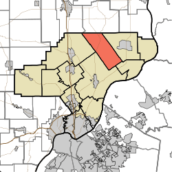 Location of Oregon Township in Clark County | |
| Coordinates: 38°33′02″N 85°38′28″W / 38.55056°N 85.64111°WCoordinates: 38°33′02″N 85°38′28″W / 38.55056°N 85.64111°W | |
| Country | United States |
| State | Indiana |
| County | Clark |
| Government | |
| • Type | Indiana township |
| Area | |
| • Total | 31.27 sq mi (81.0 km2) |
| • Land | 31.08 sq mi (80.5 km2) |
| • Water | 0.19 sq mi (0.5 km2) |
| Elevation[1] | 666 ft (203 m) |
| Population (2010) | |
| • Total | 1,769 |
| • Density | 56.9/sq mi (22.0/km2) |
| FIPS code | 18-56898[2] |
| GNIS feature ID | 453693 |
Oregon Township is one of twelve townships in Clark County, Indiana. As of the 2010 census, its population was 1,769 and it contained 692 housing units.[3]
History
Oregon Township was organized in 1852.[4] Oregon Township was purportedly so named because at the time of the township's organization, it was sparsely inhabited and considered as remote as the Oregon Territory.[5]
Geography
According to the 2010 census, the township has a total area of 31.27 square miles (81.0 km2), of which 31.08 square miles (80.5 km2) (or 99.39%) is land and 0.19 square miles (0.49 km2) (or 0.61%) is water.[3]
Unincorporated towns
- Marysville
- New Market
(This list is based on USGS data and may include former settlements.)
Adjacent townships
- Lexington Township, Scott County (north)
- Washington Township (east)
- Owen Township (southeast)
- Charlestown Township (south)
- Monroe Township (west)
- Vienna Township, Scott County (northwest)
Major highways
Cemeteries
The township contains several cemeteries: Beswick (aka Walnut Hill), Covert, Emmanuel United Methodist Church, Goben, Hebron, Kern, Otisco, New Market Christian Church, New Market Presbyterian Church (aka Mt. Vernon), Sawmill Road, States, and Webb Farm.[6]
References
- ↑ "US Board on Geographic Names". United States Geological Survey. 2007-10-25. Retrieved 2008-01-31.
- ↑ "American FactFinder". United States Census Bureau. Retrieved 2008-01-31.
- 1 2 "Population, Housing Units, Area, and Density: 2010 - County -- County Subdivision and Place -- 2010 Census Summary File 1". United States Census. Retrieved 2013-05-10.
- ↑ Biographical and Historical Souvenir for the Counties of Clark, Crawford, Harrison, Floyd, Jefferson, Jennings, Scott, and Washington, Indiana. Chicago Printing Company. 1889. p. 14.
- ↑ History of the Ohio Falls Cities and Their Counties: Precincts of Jefferson County, Ky. General histories of Clark and Floyd counties, Ind. New Albany and Floyd County. Clark County and Jeffersonville. L. A. Williams & Company. 1882. p. 369.
- ↑ Mauk, Lois. "Clark County, Indiana Cemeteries". usgennet.org. USGenNet. Retrieved 7 September 2014.
External links
Municipalities and communities of Clark County, Indiana, United States | ||
|---|---|---|
| Cities | ||
| Towns | ||
| Townships | ||
| CDPs | ||
| Unincorporated communities |
| |
| Footnotes | ‡This populated place also has portions in an adjacent county or counties | |