Carr Township, Clark County, Indiana
| Carr Township | |
|---|---|
| Township | |
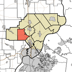 Location of Carr Township in Clark County | |
| Coordinates: 38°26′46″N 85°50′11″W / 38.44611°N 85.83639°WCoordinates: 38°26′46″N 85°50′11″W / 38.44611°N 85.83639°W | |
| Country | United States |
| State | Indiana |
| County | Clark |
| Government | |
| • Type | Indiana township |
| Area | |
| • Total | 26.89 sq mi (69.6 km2) |
| • Land | 26.36 sq mi (68.3 km2) |
| • Water | 0.53 sq mi (1.4 km2) |
| Elevation[1] | 499 ft (152 m) |
| Population (2010) | |
| • Total | 3,452 |
| • Density | 130.9/sq mi (50.5/km2) |
| FIPS code | 18-10432[2] |
| GNIS feature ID | 453158 |
Carr Township is one of twelve townships in Clark County, Indiana. As of the 2010 census, its population was 3,452 and it contained 1,378 housing units.[3]
History
Carr Township was organized in 1854.[4] It was named for General John Carr, a pioneer settler.[5]
Geography
According to the 2010 census, the township has a total area of 26.89 square miles (69.6 km2), of which 26.36 square miles (68.3 km2) (or 98.03%) is land and 0.53 square miles (1.4 km2) (or 1.97%) is water.[3]
Unincorporated towns
Adjacent townships
- Monroe Township (northeast)
- Union Township (northeast)
- Silver Creek Township (southeast)
- New Albany Township, Floyd County (south)
- Lafayette Township, Floyd County (southwest)
- Wood Township (west)
Major highways
Cemeteries
The township contains Several cemeteries: Adkins, Allen (aka Jenkins), Hagest (aka Keibler and Hitch), Hickory Grove, Merrill-Ward, Miller, St. John the Baptist Catholic, Stone Grave at Deam Lake, and Wagner.[6]
References
- "Carr Township, Clark County, Indiana". Geographic Names Information System. United States Geological Survey. Retrieved 2009-09-24.
- United States Census Bureau cartographic boundary files
- ↑ "US Board on Geographic Names". United States Geological Survey. 2007-10-25. Retrieved 2008-01-31.
- ↑ "American FactFinder". United States Census Bureau. Archived from the original on 2013-09-11. Retrieved 2008-01-31.
- 1 2 "Population, Housing Units, Area, and Density: 2010 - County -- County Subdivision and Place -- 2010 Census Summary File 1". United States Census. Retrieved 2013-05-10.
- ↑ History of the Ohio Falls Cities and Their Counties: Precincts of Jefferson County, Ky. General histories of Clark and Floyd counties, Ind. New Albany and Floyd County. Clark County and Jeffersonville. L. A. Williams & Company. 1882. p. 327.
- ↑ Biographical and Historical Souvenir for the Counties of Clark, Crawford, Harrison, Floyd, Jefferson, Jennings, Scott, and Washington, Indiana. Chicago Printing Company. 1889. pp. 20–22.
- ↑ Mauk, Lois. "Clark County, Indiana Cemeteries". usgennet.org. USGenNet. Retrieved 7 September 2014.
External links
Municipalities and communities of Clark County, Indiana, United States | ||
|---|---|---|
| Cities | ||
| Towns | ||
| Townships | ||
| CDPs | ||
| Unincorporated communities |
| |
| Footnotes | ‡This populated place also has portions in an adjacent county or counties | |
This article is issued from
Wikipedia.
The text is licensed under Creative Commons - Attribution - Sharealike.
Additional terms may apply for the media files.