Oran Township, Fayette County, Iowa
| Oran Township | |
|---|---|
| Township | |
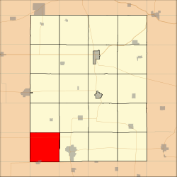 Location in Fayette County | |
| Coordinates: 42°41′05″N 92°01′27″W / 42.68472°N 92.02417°WCoordinates: 42°41′05″N 92°01′27″W / 42.68472°N 92.02417°W | |
| Country |
|
| State |
|
| County | Fayette |
| Area | |
| • Total | 36.66 sq mi (94.94 km2) |
| • Land | 36.65 sq mi (94.91 km2) |
| • Water | 0.01 sq mi (0.03 km2) 0.03% |
| Elevation | 1,027 ft (313 m) |
| Population (2010) | |
| • Total | 760 |
| • Density | 21/sq mi (8.0/km2) |
| Time zone | UTC-6 (CST) |
| • Summer (DST) | UTC-5 (CDT) |
| ZIP codes | 50629, 50662 |
| GNIS feature ID | 0468467 |
Oran Township is one of twenty townships in Fayette County, Iowa, USA. As of the 2010 census, its population was 760.[1]
Geography
According to the United States Census Bureau, Oran Township covers an area of 36.66 square miles (94.94 square kilometers); of this, 36.65 square miles (94.91 square kilometers, 99.97 percent) is land and 0.01 square miles (0.03 square kilometers, 0.03 percent) is water.
Cities, towns, villages
- Fairbank (partial)
Unincorporated towns
(This list is based on USGS data and may include former settlements.)
Adjacent townships
- Fremont Township (north)
- Harlan Township (northeast)
- Jefferson Township (east)
- Hazleton Township, Buchanan County (southeast)
- Fairbank Township, Buchanan County (south)
- Lester Township, Black Hawk County (southwest)
- Franklin Township, Bremer County (west)
- Dayton Township, Bremer County (northwest)
Cemeteries
The township contains these four cemeteries: Fairbank, Immaculate Conception, Oran Township and Oran Township.
Major highways
Airports and landing strips
- Oelwein Municipal Airport
School districts
- Oelwein Community School District
- Wapsie Valley Community School District
- West Central Community School District
Political districts
- Iowa's 1st congressional district
- State House District 18
- State House District 23
- State Senate District 12
- State Senate District 9
References
- United States Census Bureau 2008 TIGER/Line Shapefiles
- United States Board on Geographic Names (GNIS)
- United States National Atlas
- ↑ "Profile of General Population and Housing Characteristics: 2010 Demographic Profile Data (DP-1): Oran township, Fayette County, Iowa". U.S. Census Bureau, American Factfinder. Retrieved March 5, 2012.
External links
Municipalities and communities of Fayette County, Iowa, United States | ||
|---|---|---|
| Cities | ||
| Townships | ||
| Unincorporated communities | ||
| Footnotes | ‡This populated place also has portions in an adjacent county or counties | |
This article is issued from
Wikipedia.
The text is licensed under Creative Commons - Attribution - Sharealike.
Additional terms may apply for the media files.