Fremont Township, Fayette County, Iowa
| Fremont Township | |
|---|---|
| Township | |
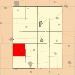 Location in Fayette County | |
| Coordinates: 42°46′27″N 92°01′11″W / 42.77417°N 92.01972°WCoordinates: 42°46′27″N 92°01′11″W / 42.77417°N 92.01972°W | |
| Country |
|
| State |
|
| County | Fayette |
| Area | |
| • Total | 37.03 sq mi (95.92 km2) |
| • Land | 37.03 sq mi (95.92 km2) |
| • Water | 0 sq mi (0 km2) 0% |
| Elevation | 1,079 ft (329 m) |
| Population (2010) | |
| • Total | 560 |
| • Density | 15/sq mi (5.8/km2) |
| Time zone | UTC-6 (CST) |
| • Summer (DST) | UTC-5 (CDT) |
| ZIP codes | 50629, 50655, 50662, 50674, 50681 |
| GNIS feature ID | 0467878 |
Fremont Township is one of twenty townships in Fayette County, Iowa, USA. As of the 2010 census, its population was 560.[1]
Geography
According to the United States Census Bureau, Fremont Township covers an area of 37.03 square miles (95.92 square kilometers).
Cities, towns, villages
Adjacent townships
- Banks Township (north)
- Center Township (northeast)
- Harlan Township (east)
- Jefferson Township (southeast)
- Oran Township (south)
- Franklin Township, Bremer County (southwest)
- Dayton Township, Bremer County (west)
- Sumner No. 2 Township, Bremer County (northwest)
Cemeteries
The township contains these three cemeteries: Calvary, Greenwood and Saint Peter.
Landmarks
- Downing County Park
School districts
- Sumner-Fredericksburg Community School District
- Wapsie Valley Community School District
- West Central Community School District
Political districts
- Iowa's 1st congressional district
- State House District 18
- State Senate District 9
References
- United States Census Bureau 2008 TIGER/Line Shapefiles
- United States Board on Geographic Names (GNIS)
- United States National Atlas
- ↑ "Profile of General Population and Housing Characteristics: 2010 Demographic Profile Data (DP-1): Fremont township, Fayette County, Iowa". U.S. Census Bureau, American Factfinder. Archived from the original on September 11, 2013. Retrieved March 5, 2012.
External links
Municipalities and communities of Fayette County, Iowa, United States | ||
|---|---|---|
| Cities | ||
| Townships | ||
| Unincorporated communities | ||
| Footnotes | ‡This populated place also has portions in an adjacent county or counties | |
This article is issued from
Wikipedia.
The text is licensed under Creative Commons - Attribution - Sharealike.
Additional terms may apply for the media files.