Dover Township, Fayette County, Iowa
| Dover Township | |
|---|---|
| Township | |
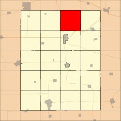 Location in Fayette County | |
| Coordinates: 43°02′17″N 91°46′43″W / 43.03806°N 91.77861°WCoordinates: 43°02′17″N 91°46′43″W / 43.03806°N 91.77861°W | |
| Country |
|
| State |
|
| County | Fayette |
| Area | |
| • Total | 37.33 sq mi (96.68 km2) |
| • Land | 37.33 sq mi (96.68 km2) |
| • Water | 0 sq mi (0 km2) 0% |
| Elevation | 965 ft (294 m) |
| Population (2010) | |
| • Total | 465 |
| • Density | 12/sq mi (4.8/km2) |
| Time zone | UTC-6 (CST) |
| • Summer (DST) | UTC-5 (CDT) |
| ZIP codes | 52133, 52135, 52141, 52161, 52175 |
| GNIS feature ID | 0467739 |
Dover Township is one of twenty townships in Fayette County, Iowa, USA. As of the 2010 census, its population was 465.[1]
Geography
According to the United States Census Bureau, Dover Township covers an area of 37.33 square miles (96.68 square kilometers).
Unincorporated towns
- Dover Mills at 43°01′10″N 91°43′46″W / 43.019423°N 91.729323°W
- Eldorado at 43°03′02″N 91°50′08″W / 43.050532°N 91.835439°W
(This list is based on USGS data and may include former settlements.)
Adjacent townships
- Military Township, Winneshiek County (north)
- Bloomfield Township, Winneshiek County (northeast)
- Clermont Township (east)
- Pleasant Valley Township (southeast)
- Union Township (south)
- Windsor Township (southwest)
- Auburn Township (west)
- Washington Township, Winneshiek County (northwest)
Cemeteries
The township contains these six cemeteries: Auburn Township, Bethany, Dover Township, George, Nutting and Saint Peter.
Major highways
Landmarks
- Dutton Cave County Park
- Goeken County Park
School districts
- North Fayette Valley Community School District
Political districts
- Iowa's 1st congressional district
- State House District 18
- State Senate District 9
References
- United States Census Bureau 2008 TIGER/Line Shapefiles
- United States Board on Geographic Names (GNIS)
- United States National Atlas
- ↑ "Profile of General Population and Housing Characteristics: 2010 Demographic Profile Data (DP-1): Dover township, Fayette County, Iowa". U.S. Census Bureau, American Factfinder. Archived from the original on September 11, 2013. Retrieved March 5, 2012.
External links
Municipalities and communities of Fayette County, Iowa, United States | ||
|---|---|---|
| Cities | ||
| Townships | ||
| Unincorporated communities | ||
| Footnotes | ‡This populated place also has portions in an adjacent county or counties | |
This article is issued from
Wikipedia.
The text is licensed under Creative Commons - Attribution - Sharealike.
Additional terms may apply for the media files.