Opole, Minnesota
| Opole, Minnesota | |
|---|---|
| Unincorporated community | |
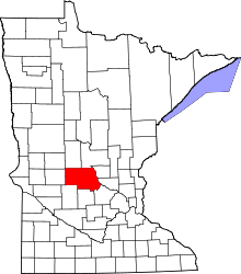
 Opole, Minnesota Location of the community of Opole within Brockway Township, Stearns County  Opole, Minnesota Opole, Minnesota (the US) | |
| Coordinates: 45°44′48″N 94°22′08″W / 45.74667°N 94.36889°WCoordinates: 45°44′48″N 94°22′08″W / 45.74667°N 94.36889°W | |
| Country | United States |
| State | Minnesota |
| County | Stearns |
| Township | Brockway Township |
| Elevation | 1,165 ft (355 m) |
| Time zone | UTC-6 (Central (CST)) |
| • Summer (DST) | UTC-5 (CDT) |
| ZIP code | 56340 |
| Area code(s) | 320 |
| GNIS feature ID | 648980[1] |
Opole is an unincorporated community in Brockway Township, Stearns County, Minnesota, United States. The community is located along Stearns County Road 17 near 125th Avenue. Stearns County Road 3 is also in the immediate area. Nearby places include Holdingford, St. Stephen, and Rice.
References
Municipalities and communities of Stearns County, Minnesota, United States | ||
|---|---|---|
| Cities |
|  |
| Townships |
| |
| CDP | ||
| Unincorporated communities | ||
| Ghost towns/Neighborhoods | ||
| Footnotes | ‡This populated place also has portions in an adjacent county or counties | |
This article is issued from
Wikipedia.
The text is licensed under Creative Commons - Attribution - Sharealike.
Additional terms may apply for the media files.