Olho d'Água do Casado
| Olho d'Água do Casado | |
|---|---|
| Municipality | |
 Location of Olho d'Água do Casado in Alagoas | |
 Olho d'Água do Casado Location in Brazil | |
| Coordinates: 9°32′10″S 37°17′38″W / 9.536°S 37.294°WCoordinates: 9°32′10″S 37°17′38″W / 9.536°S 37.294°W | |
| Country | Brazil |
| Region | Northeast |
| State | Alagoas |
| Area | |
| • Total | 323 km2 (125 sq mi) |
| Population (2005) | |
| • Total | 7,463 |
| Time zone | UTC−03:00 |
Olho d'Água do Casado is a municipality located in the western of the Brazilian state of Alagoas. Its population is 7,463 (2005) and its area is 323 square kilometres (125 sq mi).[1]
The municipality holds part of the 26,736 hectares (66,070 acres) Rio São Francisco Natural Monument, which protects the spectacular canyons of the São Francisco River between the Paulo Afonso Hydroelectric Complex and the Xingó Dam.[2]
References
- ↑ IBGE -
- ↑ Unidade de Conservação: Monumento Natural do Rio São Francisco (in Portuguese), MMA: Ministério do Meio Ambiente, retrieved 2016-05-21
Capital: Maceió | ||
| Arapiraca | 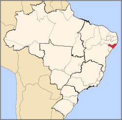 | |
| Palmeira dos Índios | ||
| Traipu | ||
| Litoral Norte Alagoano | ||
| Maceió | ||
| Mata Alagoana | ||
| Penedo | ||
| São Miguel dos Campos | ||
| Serrana dos Quilombos | ||
| Alagoana do Sertão do São Francisco | ||
| Batalha | ||
| Santana do Ipanema | ||
| Serrana do Sertão Alagoano | ||
This article is issued from
Wikipedia.
The text is licensed under Creative Commons - Attribution - Sharealike.
Additional terms may apply for the media files.