São Vicente, Cape Verde (municipality)
| São Vicente | ||
|---|---|---|
| Municipality | ||
| ||
 | ||
| Coordinates: 16°51′N 24°58′W / 16.85°N 24.97°WCoordinates: 16°51′N 24°58′W / 16.85°N 24.97°W | ||
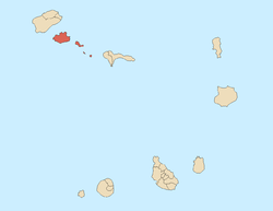
| Country | Cape Verde | |
| Island | São Vicente | |
| Area | ||
| • Total | 226.7 km2 (87.5 sq mi) | |
| Population (2010)[1] | ||
| • Total | 76,140 | |
| • Density | 340/km2 (870/sq mi) | |
| Website |
www | |

São Vicente is a concelho (municipality) of Cape Verde. It covers the whole island of São Vicente. Its seat is the city Mindelo, home to nearly 93% of the municipality's population.
Subdivisions
The municipality consists of one freguesia (civil parish), Nossa Senhora da Luz, which also covers the whole island. The freguesia is subdivided into the following settlements:
- Baía das Gatas
- Lameirão
- Mindelo (city)[2]
- Monte Verde
- Norte da Baía
- Ribeira da Vinha
- Ribeira de Calhau
- Ribeira Julião
- Salamansa
- São Pedro
Politics
Since 2004, the Movement for Democracy (MpD) is the ruling party of the municipality. The results of the latest elections, in 2016:[3]
| Party | Municipal Council | Municipal Assembly | ||
|---|---|---|---|---|
| Votes% | Seats | Votes% | Seats | |
| MpD | 48.97 | 9 | 46.75 | 11 |
| UCID | 28.28 | 0 | 29.72 | 6 |
| PAICV | 20.07 | 0 | 20.75 | 4 |
Presidents
- Henrique Teixeira de Sousa, in the 1960s
- Onésimo Silveira, in the late-1990s and the early 2000s
- Isaura Gomes 2004-2005 and 2008-2011
- Augusto Neves (since 2011)
Twin towns and sister cities
The municipality of São Vicente is twinned with the following municipalities in Portugal:[4]
References
- ↑ "2010 Census results". Instituto Nacional de Estatística Cabo Verde (in Portuguese). 24 November 2016.
- ↑ Cabo Verde, Statistical Yearbook 2015, Instituto Nacional de Estatística, p. 32-33
- ↑ Official results local elections 2016, Boletim Oficial I Série, Número 53, 23 September 2016
- ↑ Geminações de Cidades e Vilas
This article is issued from
Wikipedia.
The text is licensed under Creative Commons - Attribution - Sharealike.
Additional terms may apply for the media files.