Nong Khae District
| Nong Khae หนองแค | |
|---|---|
| Amphoe | |
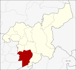 Amphoe location in Saraburi Province | |
| Coordinates: 14°20′21″N 100°51′42″E / 14.33917°N 100.86167°ECoordinates: 14°20′21″N 100°51′42″E / 14.33917°N 100.86167°E | |
| Country |
|
| Province | Saraburi |
| Area | |
| • Total | 262.867 km2 (101.494 sq mi) |
| Population (2000) | |
| • Total | 88,213 |
| • Density | 340/km2 (870/sq mi) |
| Time zone | UTC+7 (THA) |
| Postal code | 18140 |
| Geocode | 1903 |
Nong Khae (Thai: หนองแค, pronounced [nɔ̌ːŋ kʰɛ̄ː]) is a district (amphoe) in the southern part of Saraburi Province, central Thailand.
History
There were records that the district already existed in 1899.
Amphoe Nong Khae has the Na Roeng Khlong (canal) that connects to the Pa Sak River. The Ayutthaya kingdom army moved their troops by this canal for military purposes.
Recently there has been immigration of people from Lanna and Vientiane to this district.
Geography
Neighboring district are (from the north clockwise) Nong Saeng, Mueang Saraburi and Wihan Daeng of Saraburi Province, Nong Suea of Pathum Thani Province, and Wang Noi, Uthai and Phachi of Ayutthaya Province.
Administration
The district is subdivided into 18 subdistricts (tambon), which are further subdivided into 181 villages (muban). There are three municipal (thesaban) areas, and further 16 Tambon administrative organizations (TAO).
| No. | Name | Thai |
|---|---|---|
| 1. | Nong Khae | หนองแค |
| 2. | Kum Hak | กุ่มหัก |
| 3. | Khotchasit | คชสิทธิ์ |
| 4. | Khok Tum | โคกตูม |
| 5. | Khok Yae | โคกแย้ |
| 6. | Bua Loi | บัวลอย |
| 7. | Phai Tam | ไผ่ต่ำ |
| 8. | Phon Thong | โพนทอง |
| 9. | Huai Khamin | ห้วยขมิ้น |
| 10. | Huai Sai | ห้วยทราย |
| 11. | Nong Khai Nam | หนองไข่น้ำ |
| 12. | Nong Khaem | หนองแขม |
| 13. | Nong Chik | หนองจิก |
| 14. | Nong Chorakhe | หนองจรเข้ |
| 15. | Nong Nak | หนองนาก |
| 16. | Nong Pla Mo | หนองปลาหมอ |
| 17. | Nong Pling | หนองปลิง |
| 18. | Nong Rong | หนองโรง |