Naumule
| Naumule नौमुले | |
|---|---|
| Rural municipality | |
 Naumule Location in Nepal | |
| Coordinates: 28°55′N 81°50′E / 28.91°N 81.83°ECoordinates: 28°55′N 81°50′E / 28.91°N 81.83°E | |
| Country |
|
| Province | Karnali |
| District | Dailekh |
| Wards | 8 |
| Established | 10 March 2017 |
| Government | |
| • Type | Rural council |
| • Chairperson | Mr. Bhade Budha Magar |
| • Vice-chairperson | Mrs. Amrita Singh |
| Area | |
| • Total | 228.59 km2 (88.26 sq mi) |
| Population (2011) | |
| • Total | 20,802 |
| • Density | 91/km2 (240/sq mi) |
| Time zone | UTC+5:45 (NST) |
| Website | official website |
Naumule (Nepali: नौमुले) is a rural municipality located in Dailekh District of Karnali Province of Nepal.[1][2]
Naumule, Toli, Baluwatar Dwari, Kalika, Salleri and Chauratha which previously were all separate Village development committees merged to form this new local level body. Fulfilling the requirement of the new Constitution of Nepal 2015, Ministry of Federal Affairs and General Administration replaced all old VDCs and Municipalities into 753 new local level bodies.[3]
The total area of the rural municipality is 228.59 square kilometres (88.26 sq mi) and the total population of the rural municipality as of 2011 Nepal census is 20,802 individuals. The rural municipality is divided into total 8 wards. The headquarters of the municipality is situated at Naumule.[4]
References
- ↑ "स्थानीय तहहरुको विवरण" [Details of the local level bodies]. www.mofald.gov.np/en (in Nepali). Ministry of Federal Affairs and General Administration. Retrieved 4 September 2018.
- ↑ "District Corrected Last for RAJAPATRA" (PDF). www.mofald.gov.np. Ministry of Federal Affairs and General Administration. Retrieved 4 September 2018.
- ↑ "Map of Naumule". Mapcarta. Retrieved 5 September 2018.
- ↑ "Naumule Rural Municipality in Nepal". CITY POPULATION. Retrieved 5 September 2018.
External links
Headquarter: Dailekh | ||
| Municipalities: 4 | 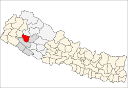 | |
| Rural municipalities: 7 | ||
List of municipalities and rural municipalities of Nepal | ||