Nigadoo
| Nigadoo | |
|---|---|
| Village | |
 | |
 Nigadoo Location within New Brunswick. | |
| Coordinates: 47°44′17″N 65°42′40″W / 47.73805°N 65.711°W | |
| Country |
|
| Province |
|
| County | Gloucester |
| Parish | Beresford |
| Village Status | 1967 |
| Electoral Districts Federal |
Acadie—Bathurst |
| Provincial | Nigadoo-Chaleur |
| Government[1] | |
| • Type | Town council |
| • Mayor | Charles Doucet |
| Area[2] | |
| • Land | 7.69 km2 (2.97 sq mi) |
| Population (2011)[2] | |
| • Total | 952 |
| • Density | 123.8/km2 (321/sq mi) |
| • Pop 2006-2011 |
|
| • Dwellings | 410 |
| Time zone | UTC-4 (AST) |
| • Summer (DST) | UTC-3 (ADT) |
| Postal code(s) | E8K |
| Area code(s) | 506 |
| Highways |
|
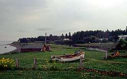
Nigadoo (2011 pop.: 952) is a Canadian village in Gloucester County, New Brunswick.[3] The village is located at the mouth of the Nigadoo River on Chaleur Bay, 15 km northwest of Bathurst and adjacent to Beresford.
In the Mi'kmaq language "nigadoo" roughly translates as "place to hide."
History
Demographics
Approximately 87% of residents are francophone Acadians.
Population
| Canada census – Nigadoo, New Brunswick community profile | |||
|---|---|---|---|
| 2011 | 2006 | ||
| Population: | 952 (+2.7% from 2006) | 927 (-3.2% from 2001) | |
| Land area: | 7.69 km2 (2.97 sq mi) | 7.69 km2 (2.97 sq mi) | |
| Population density: | 123.8/km2 (321/sq mi) | 120.6/km2 (312/sq mi) | |
| Median age: | 45.2 (M: 44.2, F: 46.4) | 43.5 (M: 42.1, F: 45.0) | |
| Total private dwellings: | 410 | 401 | |
| Median household income: | $48,782 | $43,357 | |
| References: 2011[2] 2006[4] earlier[5] | |||
| Historical Census Data - Nigadoo, New Brunswick[6] | |||||||||||||||||||||||||||||
|---|---|---|---|---|---|---|---|---|---|---|---|---|---|---|---|---|---|---|---|---|---|---|---|---|---|---|---|---|---|
|
|
| |||||||||||||||||||||||||||
(A) adjustment due to boundary change. | |||||||||||||||||||||||||||||
Language
| Canada Census Mother Tongue - Nigadoo, New Brunswick[6] | ||||||||||||||||||
|---|---|---|---|---|---|---|---|---|---|---|---|---|---|---|---|---|---|---|
| Census | Total | French |
English |
French & English |
Other | |||||||||||||
| Year | Responses | Count | Trend | Pop % | Count | Trend | Pop % | Count | Trend | Pop % | Count | Trend | Pop % | |||||
2011 |
955 |
855 | 89.53% | 80 | 8.38% | 15 | 1.57% | 5 | 0.52% | |||||||||
2006 |
920 |
865 | 94.02% | 55 | 5.98% | 0 | 0.00% | 0 | 0.00% | |||||||||
2001 |
980 |
860 | 87.76% | 120 | 12.24% | 0 | 0.00% | 0 | 0.00% | |||||||||
1996 |
930 |
830 | n/a | 89.25% | 90 | n/a | 9.68% | 10 | n/a | 1.07% | 0 | n/a | 0.00% | |||||
Notable people
See also
References
- ↑ Government of New Brunswick website: Nigadoo
- 1 2 3 2011 Statistics Canada Census Profile: Nigadoo, New Brunswick
- ↑ New Brunswick Provincial Archives - Nigadoo
- ↑ "2006 Community Profiles". Canada 2006 Census. Statistics Canada. March 30, 2011. Retrieved 2014-04-02.
- ↑ "2001 Community Profiles". Canada 2001 Census. Statistics Canada. February 17, 2012.
- 1 2 Statistics Canada: 1996, 2001, 2006, 2011 census
Places adjacent to Nigadoo | |
|---|---|
Coordinates: 47°44′17″N 65°42′40″W / 47.73806°N 65.71111°W
This article is issued from
Wikipedia.
The text is licensed under Creative Commons - Attribution - Sharealike.
Additional terms may apply for the media files.