Ngorongoro Conservation Area
| Ngorongoro Conservation Area | |
|---|---|
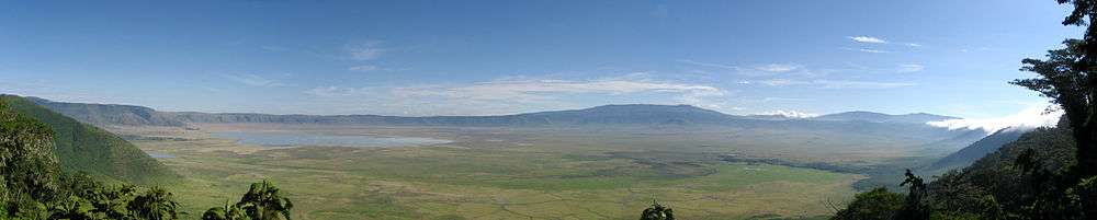
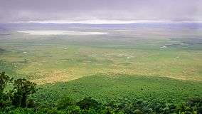 View of the crater | |
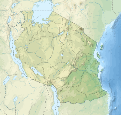 | |
| Location | Arusha Region, Tanzania |
| Coordinates | 3°12′S 35°27′E / 3.200°S 35.450°ECoordinates: 3°12′S 35°27′E / 3.200°S 35.450°E |
| Area | 8,292 km2 (3,202 sq mi)[1] |
| Established | 1959 |
| Visitors | Over 500,000 per year[2] |
| Governing body | Tanzania National Parks Authority |
| Type | Natural |
| Criteria | (iv)(vii)(viii)(ix)(x) |
| Designated | 1979 (3rd session) |
| Reference no. | 39 |
| State Party | Tanzania |
| Region | Africa |
| Endangered | 1984–1989 |
The Ngorongoro Conservation Area (NCA) is a protected area and a World Heritage Site located 180 km (110 mi) west of Arusha in the Crater Highlands area of Tanzania. The area is named after Ngorongoro Crater, a large volcanic caldera within the area. The conservation area is administered by the Ngorongoro Conservation Area Authority, an arm of the Tanzanian government, and its boundaries follow the boundary of the Ngorongoro Division of the Arusha Region.
The 2009 Ngorogoro Wildlife Conservation Act placed new restrictions on human settlement and subsistence farming in the Crater, displacing Maasai pastoralists, most of whom had been relocated to Ngorongoro from their ancestral lands to the north when the British colonial government established Serengeti National Park in 1959. The construction of luxury tourist hotels in the Conservation Area allows people to access "the unparalleled beauty of one of the world's most unchanged wildlife sanctuaries", according to a government brochure, even as thousands of Maasai have suffered forcible eviction and have been denied access to water sources for their livestock.[3][4]
History and geography
The name of the crater has an onomatopoeic origin; it was named by the Maasai pastoralists after the sound produced by the cowbell (ngoro ngoro). Based on fossil evidence found at the Olduvai Gorge, various hominid species have occupied the area for 3 million years.
Hunter-gatherers were replaced by pastoralists a few thousand years ago. The Mbulu[5] came to the area about 2,000 years ago and were joined by the Datooga around the year 1700. Both groups were driven from the area by the Maasai in the 1800s.[6]
Massive fig trees in the northwest of the Lerai Forest are sacred to the Maasai and the Datooga. Some of them may have been planted on the grave of a Datago leader who died in battle with the Maasai around 1840.[7]
No Europeans are known to have set foot in the Ngorongoro Crater until 1892, when it was visited by Oscar Baumann. Two German brothers (Adolph and Friedrich Siedentopf) farmed in the crater until the outbreak of World War I, after leasing the land from the administration of German East Africa. The brothers regularly organized shooting parties to entertain their German friends. They also attempted to drive the wildebeest herds out of the crater.[1][6][8]
In 1921, the first game preservation ordinance was passed, which restricted hunting to permit holders throughout Tanzania. In 1928, hunting was prohibited on all land within the crater rim, except the former Siedentopf farms. The National Park Ordinance of 1948 (implemented in 1951) created the Serengeti National Park (SNP). This, however, caused problems with the Maasai and other tribes, resulting in the Ngorongoro Conservation Area (NCA) Ordinance (1959) that separated the NCA from the SNP. Maasai pastoralists living in Serengeti National Park were systematically relocated to Ngorongoro, increasing the population of Maasai and livestock living in the Crater.[9][4]:48 The Ngorongoro Conservation Area Authority was established by the Game Park Laws (miscellaneous amendments) Act, 1976 and owns the majority of NCA land, including the Crater. The area became a UNESCO World Heritage Site in 1979.[10] The Wildlife Conservation Act of 2009 further restricted human use of Ngorongoro Crater and created a legal framework to politically disenfranchise and forcibly displace traditional pastoralists.[4]:57-59
Land in the conservation area is multi-use and unique because it is the only conservation area in Tanzania that protects wildlife while allowing human habitation. Land use is controlled to prevent negative effects on the wildlife population. For example, cultivation is prohibited at all but subsistence levels.
The area is part of the Serengeti ecosystem and, to the northwest, adjoins the SNP and is contiguous with the southern Serengeti plains. These plains also extend to the north into the unprotected Loliondo division and are kept open to wildlife through transhumance pastoralism practiced by the Maasai. The south and west of the area are volcanic highlands, including the famous Ngorongoro Crater and the lesser known Empakaa Crateri. The southern and eastern boundaries are approximately defined by the rim of the East African Rift wall, which also prevents animal migration in these directions.
Ngorongoro Crater
The main feature of the Ngorongoro Conservation Authority is the Ngorongoro Crater, the world's largest inactive, intact and unfilled volcanic caldera.[11] The crater, which formed when a large volcano exploded and collapsed on itself two to three million years ago, is 610 metres (2,000 feet) deep and its floor covers 260 square kilometres (100 square miles).[8][12] Estimates of the height of the original volcano range from 4,500 to 5,800 metres (14,800 to 19,000 feet) high.[12][13][14] The elevation of the crater floor is 1,800 metres (5,900 feet) above sea level.[1] The Crater was voted by Seven Natural Wonders [15] as one of the Seven Natural Wonders of Africa in Arusha, Tanzania in February 2013.[16]
The volcanic eruptions like that of Ngorongoro, which resulted in the formation of Ngorongoro Crater in Tanzania, were very common. Similar collapses occurred in the case of Olmoti and Empakaai, but they were much smaller in magnitude and impact.
Out of the two recent volcanoes lying to the northeast of the Empakaai caldera, Kerimasi and Ol Doinyo Lengai, the Doinyo Lengai is still active, and the last erupted major eruptions were in 2007 and 2008. Smaller ash eruptions and lava flows continue to slowly fill the current crater. This volcano is also known as the Maasai’s ‘Mountain of God’.
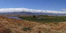
The crater highlands on the side facing the easterly trade winds receives 800 to 1,200 millimetres (31 to 47 inches) of rain a year and are covered largely in montane forest.[11] The less-steep west wall receives only 400 to 600 millimetres (16 to 24 inches) and is grassland and bushland dotted with Euphorbia bussei trees.[11] The crater floor is mostly open grassland with two small wooded areas dominated by fever tree (Vachellia xanthophloea).[11]
.jpg)
The Munge Stream drains Olmoti Crater to the north, and is the main water source draining into the seasonal salt lake in the center of the crater. This lake is known by two names: Makat as the Maasai called it, meaning salt; and Magadi.[17] The Lerai Stream drains the humid forests to the south of the Crater, and it feeds the Lerai Forest on the crater floor - when there is enough rain, the Lerai drains into Lake Magadi as well. Extraction of water by lodges and NCA headquarters reduces the amount of water entering Lerai by around 25 percent.[18]
The other major water source in the crater is the Ngoitokitok Spring, near the eastern crater wall. There is a picnic site here open to tourists and a huge swamp fed by the spring, and the area is inhabited by hippopotamus, elephants, lions and many others. Many other small springs can be found around the crater's floor, and these are important water supplies for the animals and local Maasai, especially during times of drought.
Following the recommendations of the ad hoc committee of scientists convened after the year 2000 drought, an ecological burning program was implemented in the crater, which entails annual or biannual controlled burns of up to 20 percent of the grasslands.[19] Maasai are now permitted to graze their cattle within the crater, but must enter and exit daily.[9]
Oldurai or Olduvai Gorge
The Ngorongoro Conservation Area also protects Oldurai or Olduvai Gorges , situated in the plains area. It is considered to be the seat of humanity after the discovery of the earliest known specimens of the human genus, Homo habilis as well as early hominidae, such as Paranthropus boisei.
The Olduvai Gorge is a steep-sided ravine in the Great Rift Valley, which stretches along eastern Africa. Olduvai is in the eastern Serengeti Plains in northern Tanzania and is about 50 kilometres (31 mi) long. It lies in the rain shadow of the Ngorongoro highlands and is the driest part of the region.[20] The gorge is named after 'Oldupaai', the Maasai word for the wild sisal plant, Sansevieria ehrenbergii.
It is one of the most important prehistoric sites in the world and research there has been instrumental in furthering understanding of early human evolution. Excavation work there was pioneered by Mary and Louis Leakey in the 1950s and is continued today by their family. Some believe that millions of years ago, the site was that of a large lake, the shores of which were covered with successive deposits of volcanic ash. Around 500,000 years ago seismic activity diverted a nearby stream which began to cut down into the sediments, revealing seven main layers in the walls of the gorge.
Wildlife
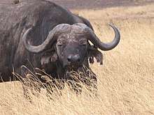
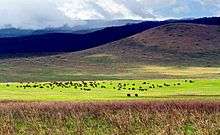
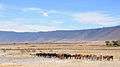
Approximately 25,000 large animals, mostly ungulates, live in the crater.[21] Large animals in the crater include the black rhinoceros (Diceros bicornis michaeli), the local population of which declined from about 108 in 1964-66 to between 11-14 in 1995, the African buffalo or Cape buffalo (Syncerus caffer), and the hippopotamus (Hippopotamus amphibius).[21] There also are many other ungulates: the blue wildebeest (Connochaetes taurinus) (7,000 estimated in 1994), Grant's zebra (Equus quagga boehmi) (4,000), the common eland (Taurotragus oryx), and Grant's (Nanger granti) and Thomson's gazelles (Eudorcas thomsonii) (3,000).[21] Waterbucks (Kobus ellipsiprymnus) occur mainly near Lerai Forest.[21] There are no topis (Damaliscus lunatus), oribis (Ourebia oribi), or crocodiles (Crocodylus niloticus).[11] Impala (Aepyceros melampus) are absent because the open woodland they prefer does not exist.[1] Giraffe also are absent, possibly because of a lack of browse species.[1] cheetah (Acinonyx jubatus raineyi), East African wild dog (Lycaon pictus lupinus), and African leopard (Panthera pardus pardus) are rarely seen.[1][22]
Although thought of as "a natural enclosure" for a very wide variety of wildlife, 20 percent or more of the wildebeest and half the zebra populations vacate the crater in the wet season.[11] Buffalo (Syncerus caffer) and eland do the opposite. Their highest numbers are during the rains.[11]
Since 1986, the crater's wildebeest population has fallen from 14,677 to 7,250 (2003-2005).[11] The numbers of eland and Thomson's gazelle also have declined while the buffalo population has increased greatly, probably due to the long prevention of fire which favors high-fibrous grasses over shorter, less fibrous types.[11][21]
Servals (Leptailurus serval) occur widely in the crater.[21]
Lake Magadi, a large lake in the southwest of the crater, is often inhabited by thousands of mainly lesser flamingoes.[23]
Crater lions

The crater has one of the densest known population of lions,[24] numbering 62 in 2001.[21]
A side effect of the crater being a natural enclosure is that the lion population is significantly inbred. This is due to the very small amount of new bloodlines that enter the local gene pool, as very few migrating male lions enter the crater from the outside. Those who do enter the crater are often prevented from contributing to the gene pool by the crater's male lions, who expel any outside competitors.[1]
Long-term data imply that lions in the crater were struck by four deadly disease outbreaks between 1962 and 2002.[25] Drought in 1961 and rains throughout the 1962 dry season caused a massive build-up of blood-sucking stable flies (Stomoxys calcitrans) by May 1962. They drained blood and caused painful skin sores that became infected, causing lion numbers to crash from 75-100 to 12. The population recovered to around 100 by 1975 and remained stable until 1983, when a persistent decline began. Numbers have generally remained below 60 animals since 1993, reaching a low of 29 in 1998. In 2001, 34 percent of the lion population died between January and April from a combination of tick-borne disease and canine distemper.[26][27][28]
The lion population is also influenced to some extent by the takeover of prides by incoming males, which typically kill small cubs.[25] The biggest influence, however, appears to be disease, particularly canine distemper.[29]
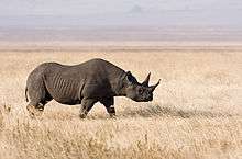 Hook-lipped (black) rhinoceros in the crater.
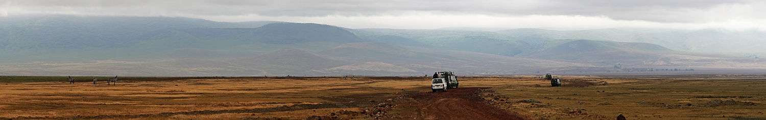
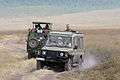 Safari vehicles in the crater.
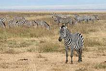 Plains zebras in the crater.
 Fire is used to manage vegetation in the crater.
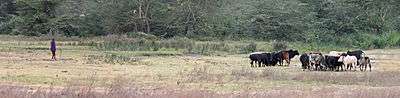 Masaai herdsman with cattle inside the crater.
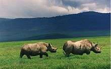 Hook-lipped (black) rhinoceros in the crater.
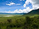 Inside the crater.
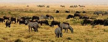 Wildebeest and zebra in a herd.
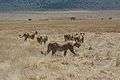 Female lions on the hunt in the crater.
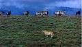 Lioness, zebras and wildebeest in the crater.
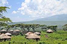
 Maasai cattle
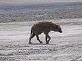 Hyena in the crater
Outside Ngorongoro Crater
The Ngorongoro Conservation Area (NCA) has a healthy resident population of most species of wildlife. The Ndutu Lake area to in the west of the NCA has particularly strong cheetah and lion populations. Common in the NCA are hartebeest (Alcelaphus buselaphus), spotted hyenas (Crocuta crocuta), and jackals.[21] The population of African wild dog in the NCA may have declined recently.[21] Servals occur widely on the plains to the west of the Ngorongoro Crater.[21]
The annual ungulate migration passes through the NCA, with 1.7 million wildebeest, 260,000 zebra, and 470,000 gazelles moving south into the area in December and moving north in June. This movement changes seasonally with the rains, but the migration traverses almost the entire plains in search of food.[21]
Cultural references
- Richard Scarry's children's book What Do People Do All Day has a character named Ngorongoro Crater, a hyena cameraman.
See also
References
- 1 2 3 4 5 6 7 "The historical ecology of the large mammal populations of Ngorongoro Crater, Tanzania, east Africa", Mammal Review, authored by Louise Oates and Paul A. Rees, 2012
- ↑ "Dar registers "three wonders"". Daily News (Tanzania). 20 August 2012. Archived from the original on 22 September 2012. Retrieved 28 January 2013.
- ↑ 'Tourism is a curse to us', Guardian, 6 September 2009
- 1 2 3 Laltaika, Elifuraha (2013). "Pastoralists' Right to Land and Natural Resources in Tanzania" (PDF). Oregon Review of International Law. 15 (1): 43–62. ISSN 1543-9860. Retrieved 12 June 2017.
- ↑ "Mbulu", Information about northern Tanzania: a personal scrapbook of "cuttings" from published sources
- 1 2 Northern Tanzania: The Bradt Safari Guide with Kilimanjaro and Zanzibar, authored by Phillip Briggs, 2006, pages 197, 198 ISBN 1-84162-146-3
- ↑ Excerpt from Ngorongoro Conservation Area, authored by Jeannette Hanby & David Bygott, Information about northern Tanzania: a personal scrapbook of "cuttings" from published sources
- 1 2 Africa's Great Rift Valley, authored by Nigel Pavitt, Harry N. Abrams, Inc., New York, 2001, pages 135-139 ISBN 0-8109-0602-3
- 1 2 Robert M. Poole. "Heartbreak on the Serengeti". National Geographic. p. 4. Retrieved 2008-02-21.
- ↑ Homewood, K. M.; Rodgers, W. A. (2004-08-19). Maasailand Ecology: Pastoralist Development and Wildlife Conservation in Ngorongoro, Tanzania. Cambridge University Press. ISBN 9780521607490.
- 1 2 3 4 5 6 7 8 9 "Downward trends in Ngorongoro Crater ungulate populations 1986–2005: Conservation concerns and the need for ecological research", Biological Conservation, authored by R. D. Estesa, J. L. Atwood, and A. B. Estes, 2006, page 107
- 1 2 Sinclair, A. R. E.; Packer, Craig; Mduma, Simon A. R.; Fryxell, John M. (15 May 2009). "Serengeti III: Human Impacts on Ecosystem Dynamics". University of Chicago Press. Retrieved 12 June 2018 – via Google Books.
- ↑ Africa's Great Rift Valley. Nigel Pavitt. 2001. page 135. Harry N. Abrams, Incorporated, New York ISBN 0-8109-0602-3
- ↑ Northern Tanzania with Kilimanjaro and Zanzibar. Phillip Briggs. 2006. page 197. ISBN 1-84162-146-3
- ↑ "About – Seven Natural Wonders". sevennaturalwonders.org. Retrieved 12 June 2018.
- ↑ "Seven Natural Wonders of Africa – Seven Natural Wonders". sevennaturalwonders.org. Retrieved 12 June 2018.
- ↑ Deocampo, D.M. (2004). "Hydrogeochemistry in the Ngorongoro Crater, Tanzania, and implications for land use in a World Heritage Site". Applied Geochemistry 19 (5): 755−767.
- ↑ "Management of Black Rhino in the Ngorongoro Crater" (PDF). African Wildlife Foundation. 2003-09-04. Retrieved 2008-02-21.
- ↑ "Downward trends in Ngorongoro Crater ungulate populations 1986–2005: Conservation concerns and the need for ecological research", Biological Conservation, authored by R. D. Estesa, J. L. Atwood, and A. B. Estes, 2006, pages 116-7
- ↑ Africa's Great Rift Valley. Nigel Pavitt. 2001. pages 138. Harry N. Abrams, Incorporated, New York ISBN 0-8109-0602-3
- 1 2 3 4 5 6 7 8 9 10 11 "Ngorongoro Conservation Area". United Nations Educational, Scientific and Cultural Organization – World Heritage Centre. Retrieved June 3, 2014.
In summer enormous numbers of Serengeti migrants pass through the plains of the reserve, including 1.7 million wildebeest, 260,000 zebra and 470,000 gazelle.
- ↑ "Persistence and local extinction of lion prides in the Ngorongoro Crater, Tanzania", Population Ecology, authored by Bernard M. Kissui, Anna Mosser, and Craig Packer, 52:103-111, 2010
- ↑ Education, Jacana; Watson, Dave (12 August 2008). "Ngorongoro Visitor Map Guide". Jacana Media. Retrieved 12 June 2018 – via Google Books.
- ↑ "The Crater Lions, Nature, United States Public Broadcasting System
- 1 2 "na". ProQuest. Retrieved 12 June 2018 – via Google Books.
- ↑ "Stomoxys", Information about northern Tanzania: a personal scrapbook of "cuttings" from published sources
- ↑ "Downward trends in Ngorongoro Crater ungulate populations 1986–2005: Conservation concerns and the need for ecological research", Biological Conservation, authored by R. D. Estesa, J. L. Atwood, and A. B. Estes, 2006, page 108
- ↑ "na". ProQuest. Retrieved 12 June 2018 – via Google Books.
- ↑ "na". ProQuest. Retrieved 12 June 2018 – via Google Books.
Further reading
- Ngorongoro Conservation Area at the UNEP World Conservation Monitoring Centre
- Deocampo, D.M., 2004. Hydrogeochemistry in the Ngorongoro Crater, Tanzania, and implications for land use in a World Heritage Site. Applied Geochemistry, volume 19, p. 755-767
- Deocampo, D.M., 2005. Evaporative evolution of surface waters and the role of aqueous CO2 in magnesium silicate precipitation: Lake Eyasi and Ngorongoro Crater, northern Tanzania. South African Journal of Geology, volume 108, p. 493-504.
External links
| Wikimedia Commons has media related to Ngorongoro. |
