Ngatpang
| Ngatpang | ||
|---|---|---|
| State | ||
| ||
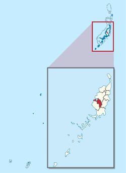 Location of Ngatpang in Palau | ||
| Country |
| |
| Capital | Oikuul | |
| Area | ||
| • Total | 47 km2 (18 sq mi) | |
| Population | ||
| • Total | 464 | |
| • Density | 9.9/km2 (26/sq mi) | |
| ISO 3166 code | PW-224 | |

Ngatpang is one of Palau's sixteen states. It comprises an area of around 47 square kilometers in the west of Palau's largest island, Babeldaob, facing onto Ngeremeduu Bay. The state capital is Oikuul. It has a population of 464, making it Palau's 5th largest state in population.
Ibobang is in Ngatpang.[1]
Education
The Ministry of Education operates public schools.
Ibobang Elementary School is in Ibobang. When it opened it relieved Ngatpang Elementary School.[2]
Palau High School in Koror is the country's only public high school, so children from this community go there.[3]
References
- ↑ Cook, Ben. Federated States of Micronesia and Palau. Other Places Publishing, 2010. ISBN 0982261934, 9780982261934. p. 207. " Only about 8% of Palauans practice Modekngei, most of whom reside in the same village, Ibobang. This small town of less than 100 in Ngatpang state[...]"
- ↑ "Ibobang Elementary School." Ministry of Education (Palau). Retrieved on February 22, 2018.
- ↑ "About." Palau High School. Retrieved on February 22, 2018.
External links
Coordinates: 7°28′N 134°32′E / 7.467°N 134.533°E
This article is issued from
Wikipedia.
The text is licensed under Creative Commons - Attribution - Sharealike.
Additional terms may apply for the media files.