Negley, Ohio
| Negley, Ohio | |
|---|---|
| Census-designated place | |
 Negley Post Office | |
 Location of Negley, Ohio | |
| Coordinates: 40°47′24″N 80°32′20″W / 40.79000°N 80.53889°WCoordinates: 40°47′24″N 80°32′20″W / 40.79000°N 80.53889°W | |
| Country | United States |
| State | Ohio |
| County | Columbiana |
| Township | Middleton |
| Area | |
| • Total | 0.9 sq mi (2.3 km2) |
| • Land | 0.9 sq mi (2.3 km2) |
| • Water | 0.0 sq mi (0.0 km2) |
| Elevation[1] | 1,115 ft (340 m) |
| Population (2010) | |
| • Total | 281 |
| • Density | 315/sq mi (121.7/km2) |
| Time zone | UTC-5 (Eastern (EST)) |
| • Summer (DST) | UTC-4 (EDT) |
| ZIP code | 44441 |
| Area code(s) | 234/330 |
| FIPS code | 39-53802 |
| GNIS Feature ID | 1065100 |
| School District | East Palestine City |
Negley is a census-designated place in northeastern Middleton Township, Columbiana County, Ohio, United States. The population was 281 at the 2010 census.[2]
Originally a mining community based from a nearby coal mine operated by the Powers Mining Company, Negley today is a primarily residential community clustered around Ohio State Route 154. A few small businesses generate traffic from customers traveling on the highway. A Youngstown and Southeastern Railroad shop is located in the town.[3]
A Negley post office has been in operation since 1883, now bearing the ZIP code of 44441.
Notable people
- Ammon Hennacy - Christian anarchist
- Derek Wolfe - NFL defensive end for the Denver Broncos
References
- ↑ "US Board on Geographic Names". United States Geological Survey. 2007-10-25. Retrieved 2008-01-31.
- ↑ "Geographic Identifiers: 2010 Demographic Profile Data (G001): Negley CDP, Ohio". U.S. Census Bureau, American Factfinder. Retrieved January 26, 2015.
- ↑ McCord, William B. (1905). History of Columbiana County, Ohio and Representative Citizens. Biographical Publishing Company. p. 127.
Municipalities and communities of Columbiana County, Ohio, United States | ||
|---|---|---|
| Cities | 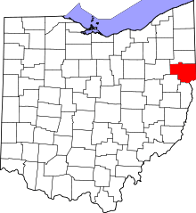 | |
| Villages | ||
| Townships | ||
| CDPs | ||
| Unincorporated communities |
| |
| Ghost town | ||
| Footnotes | ‡This populated place also has portions in an adjacent county or counties | |
This article is issued from
Wikipedia.
The text is licensed under Creative Commons - Attribution - Sharealike.
Additional terms may apply for the media files.