Kensington, Ohio
| Kensington, Ohio | |
|---|---|
| Unincorporated community | |
 Kensington Post Office | |
 Location of Kensington, Ohio | |
| Country | United States |
| State | Ohio |
| County | Columbiana |
| Township | Hanover |
| Time zone | UTC-5 (Eastern (EST)) |
| • Summer (DST) | UTC-4 (EDT) |
| ZIP code | 44427 |
| Area code(s) | 234/330 |
Kensington is an unincorporated community in southwestern Hanover Township, Columbiana County, Ohio, United States.[1] Although it is unincorporated, it has a post office, with the ZIP code of 44427.[2] It lies along U.S. Route 30 at its intersection with Ohio State Routes 9 and 644.
History
Kensington was originally called Mayville, and under the latter name was laid out in 1852 when the Cleveland and Pittsburgh Railroad was extended to that point.[3] A post office called Maysville was established in 1860, and the name was changed to Kensington in 1876.[4] Besides the post office, Kensington had a train station, hotel, and country store.[5]
References
- ↑ U.S. Geological Survey Geographic Names Information System: Kensington
- ↑ Zip Code Lookup
- ↑ Mack, Horace (1879). History of Columbiana County, Ohio: With Illustrations and Biographical Sketches of Some of Its Prominent Men and Pioneers. Unigraphic. p. 162.
- ↑ "Columbiana County". Jim Forte Postal History. Retrieved 10 January 2016.
- ↑ McCord, William B. (1905). History of Columbiana County, Ohio and Representative Citizens. Biographical Publishing Company. p. 282.
Municipalities and communities of Columbiana County, Ohio, United States | ||
|---|---|---|
| Cities | 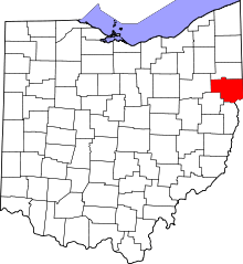 | |
| Villages | ||
| Townships | ||
| CDPs | ||
| Unincorporated communities |
| |
| Ghost town | ||
| Footnotes | ‡This populated place also has portions in an adjacent county or counties | |
Coordinates: 40°44′07″N 80°57′23″W / 40.73528°N 80.95639°W
This article is issued from
Wikipedia.
The text is licensed under Creative Commons - Attribution - Sharealike.
Additional terms may apply for the media files.