Negaunee, Michigan
| Negaunee, Michigan | |
|---|---|
| City | |
 Downtown Negaunee | |
| Nickname(s): Irontown | |
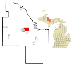 Location of Negaunee, Michigan | |
| Coordinates: 46°30′6″N 87°36′14″W / 46.50167°N 87.60389°W | |
| Country | United States |
| State | Michigan |
| County | Marquette |
| Government | |
| • Type | Council-Mayor |
| • Mayor | Don Gladwell |
| Area[1] | |
| • Total | 14.45 sq mi (37.43 km2) |
| • Land | 13.56 sq mi (35.12 km2) |
| • Water | 0.89 sq mi (2.31 km2) |
| Elevation | 1,371 ft (418 m) |
| Population (2010)[2] | |
| • Total | 4,568 |
| • Estimate (2016)[3] | 4,575 |
| • Density | 320/sq mi (120/km2) |
| Time zone | UTC-5 (Eastern (EST)) |
| • Summer (DST) | UTC-4 (EDT) |
| ZIP code | 49866 |
| Area code(s) | 906 |
| FIPS code | 26-56860[4] |
| GNIS feature ID | 0633261[5] |
Negaunee is a city in Marquette County in the U.S. state of Michigan. The population was 4,568 at the 2010 census. The city is located at the southwest corner of Negaunee Township in the Upper Peninsula. The city is home to the Michigan Iron Industry Museum and also a luge track. The name Negaunee comes from an Anishinabemowin (Ojibwa) word nigani, meaning "foremost, in advance, leading," which was determined to be the closest Ojibwa translation for "pioneer". Within the city limits is Teal Lake.
History
The city was built after the discovery of the Marquette Iron Range during the early 19th century. The Jackson Mine was established in 1845 to mine the ore for shipment to iron forges; the first such forge to operate in the Lake Superior basin was set up in Negaunee during this period. In 1858, the community was given a post office. In 1865, Negaunee was incorporated as a village and reincorporated as a city in 1873.[6] As mining operations expanded, many immigrants helped settle the area, bringing with them rich traditions that remain today. Due to extensive underground mining roughly half the city was abandoned in the early 20th century due to risk of cave-in. The city closed its trolley system in 1927. The Jackson Mine ceased all operations within the city limits in the 1940s.
Geography
Negaunee sits on the eastern shore of Teal Lake, all of which is considered within the city borders. According to the United States Census Bureau, the city has a total area of 14.45 square miles (37.43 km2), of which 13.56 square miles (35.12 km2) is land and 0.89 square miles (2.31 km2) is water.[1]
Attractions
The Michigan Iron Industry Museum is located near the Carp River on the outskirts of Negaunee. Negaunee is home to Pioneer Days, a festival held every year the week following July 4.
Negaunee is also the home of the only full-length natural-track luge course in the United States,[7] maintained by the Upper Peninsula Luge Club.[8] It is over 800 meters (0.50 mi) in length,[9] and the track features 29 curves along its 88 meters (289 ft) vertical drop.[10]
Transportation
Highways


Bus
- Indian Trails bus lines operates daily intercity bus service between Hancock and Milwaukee, Wisconsin, with a stop in Negaunee.[11]
Demographics
| Historical population | |||
|---|---|---|---|
| Census | Pop. | %± | |
| 1870 | 2,559 | — | |
| 1880 | 3,931 | 53.6% | |
| 1890 | 6,078 | 54.6% | |
| 1900 | 6,935 | 14.1% | |
| 1910 | 8,460 | 22.0% | |
| 1920 | 7,419 | −12.3% | |
| 1930 | 6,552 | −11.7% | |
| 1940 | 6,813 | 4.0% | |
| 1950 | 6,472 | −5.0% | |
| 1960 | 6,126 | −5.3% | |
| 1970 | 5,248 | −14.3% | |
| 1980 | 5,189 | −1.1% | |
| 1990 | 4,741 | −8.6% | |
| 2000 | 4,576 | −3.5% | |
| 2010 | 4,568 | −0.2% | |
| Est. 2016 | 4,575 | [3] | 0.2% |
| U.S. Decennial Census[12] | |||
2010 census
As of the census[2] of 2010, there were 4,568 people, 1,940 households, and 1,219 families residing in the city. The population density was 336.9 inhabitants per square mile (130.1/km2). There were 2,119 housing units at an average density of 156.3 per square mile (60.3/km2). The racial makeup of the city was 96.6% White, 0.1% African American, 1.1% Native American, 0.3% Asian, 0.2% from other races, and 1.7% from two or more races. Hispanic or Latino of any race were 1.1% of the population.
There were 1,940 households of which 30.6% had children under the age of 18 living with them, 47.1% were married couples living together, 10.9% had a female householder with no husband present, 4.8% had a male householder with no wife present, and 37.2% were non-families. 31.7% of all households were made up of individuals and 13.8% had someone living alone who was 65 years of age or older. The average household size was 2.30 and the average family size was 2.90.
The median age in the city was 39.7 years. 23.9% of residents were under the age of 18; 8% were between the ages of 18 and 24; 24.4% were from 25 to 44; 27.2% were from 45 to 64; and 16.7% were 65 years of age or older. The gender makeup of the city was 47.4% male and 52.6% female.
2000 census
As of the census[4] of 2000, there were 4,576 people, 1,946 households, and 1,218 families residing in the city. The population density was 332.1 per square mile (128.2/km²). There were 2,088 housing units at an average density of 151.5 per square mile (58.5/km²). The racial makeup of the city was 96.63% White, 0.28% African American, 1.29% Native American, 0.22% Asian, 0.13% from other races, and 1.44% from two or more races. Hispanic or Latino of any race were 0.44% of the population. 28.8% were of Finnish, 14.5% Italian, 14.0% English, 9.3% German, 8.9% Swedish and 5.8% French ancestry according to Census 2000. 95.7% spoke English, 1.7% Spanish and 1.5% Finnish as their first language.
There were 1,946 households out of which 27.4% had children under the age of 18 living with them, 49.4% were married couples living together, 9.0% had a female householder with no husband present, and 37.4% were non-families. 33.0% of all households were made up of individuals and 16.6% had someone living alone who was 65 years of age or older. The average household size was 2.30 and the average family size was 2.93.
In the city, the population was spread out with 22.3% under the age of 18, 9.1% from 18 to 24, 25.9% from 25 to 44, 23.8% from 45 to 64, and 18.8% who were 65 years of age or older. The median age was 40 years. For every 100 females, there were 92.0 males. For every 100 females age 18 and over, there were 89.7 males.
The median income for a household in the city was $33,117, and the median income for a family was $39,750. Males had a median income of $36,026 versus $22,380 for females. The per capita income for the city was $16,889. About 6.3% of families and 9.4% of the population were below the poverty line, including 11.7% of those under age 18 and 5.6% of those age 65 or over.
School system

The Negaunee school system ranks in the top 20% of schools for the State of Michigan.[13] In recent years several new businesses have also found their way to Negaunee, including Family Video, Subway, and Dollar General.
Negaunee Public Schools consists of three main buildings: Lakeview Elementary, which has K-4th grades; Negaunee Middle School, which has 5th through 8th grade; and Negaunee High School, which has 9th through 12th grade. Negaunee athletics have a large, healthy rivalry with the Marquette Redmen and Ishpeming Hematites.
Climate
This climatic region is typified by large seasonal temperature differences, with warm to hot (and often humid) summers and cold (sometimes severely cold) winters. According to the Köppen Climate Classification system, Negaunee has a humid continental climate, abbreviated "Dfb" on climate maps.[14]
Notable people
- Mark Ayotte (born 1964), National Basketball Association referee
- Edward Breitung (1831–1887), Michigan State House of Representatives member
- Bob Chase (1926–2016), sports commentator
- Dominic Jacobetti (1920–1994), Michigan State House of Representatives member
- Joan LeQuia (born 1937), All-American Girls Professional Baseball League player
- Steven Wiig (born 1972), film actor and musician
- Sarah York, became penpal of Manuel Noriega at age 10
References
- 1 2 "US Gazetteer files 2010". United States Census Bureau. Archived from the original on January 24, 2012. Retrieved November 25, 2012.
- 1 2 "American FactFinder". United States Census Bureau. Retrieved November 25, 2012.
- 1 2 "Population and Housing Unit Estimates". Retrieved June 9, 2017.
- 1 2 "American FactFinder". United States Census Bureau. Retrieved January 31, 2008.
- ↑ "US Board on Geographic Names". United States Geological Survey. October 25, 2007. Retrieved January 31, 2008.
- ↑ Romig, Walter (1986). Michigan Place Names: The History of the Founding and Naming of More than Five Thousand Past and Present Michigan Communities. Great Lakes Books. Detroit: Wayne State University Press. p. 390. ISBN 978-0-8143-1838-6. OCLC 756403524.
- ↑ Meyer, Zlati (February 23, 2014). "You Haven't Lived Here Until... You Slide Down the Naturbahn Luge Track in Negaunee". Detroit Free Press. Retrieved March 3, 2015.
- ↑ Vachon, Paul (2015). Moon Michigan's Upper Peninsula. Avalon Travel Publishing. p. 367. ISBN 978-1-61238-987-5.
- ↑ Bowers, Lisa (May 24, 2016). "World Cup Luge Event at Negaunee's Lucy Hill Canceled". The Mining Journal. Marquette, MI. Retrieved December 30, 2016.
- ↑ "The Luge Course". Upper Peninsula Luge Club. Retrieved December 30, 2016.
- ↑ "Hancock–Marquette–Green Bay–Milwaukee" (PDF). Indian Trails. January 12, 2012. Archived from the original (PDF) on February 22, 2014. Retrieved February 27, 2013.
- ↑ "Census of Population and Housing". Census.gov. Retrieved June 4, 2015.
- ↑ "Michigan Public School Rankings". psk12.com. Retrieved July 17, 2008.
- ↑ "Climate Summary for Negaunee, Michigan". WeatherBase.
External links
Municipalities and communities of Marquette County, Michigan, United States | ||
|---|---|---|
| Cities | 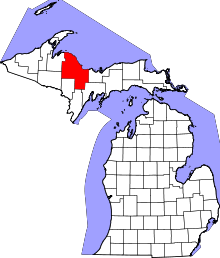 | |
| Charter townships | ||
| General law townships | ||
| CDPs | ||
| Other unincorporated communities | ||
| Indian reservation | ||
| Footnotes | ‡This populated place also has portions in an adjacent county or counties | |
Coordinates: 46°29′57″N 87°36′42″W / 46.49917°N 87.61167°W