Navarre, Florida
| Navarre, Florida | |
|---|---|
| Census Designated Place | |
| Community of Navarre, Florida | |
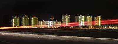 Navarre Beach skyline | |
| Nickname(s): Florida's Best Kept Secret, Florida's Playground, The South's Crossroads, Florida's Most Relaxing Place | |
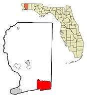 Location in Santa Rosa County and the U.S. state of Florida | |
| Country | United States |
| State | Florida |
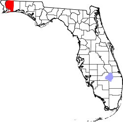
| County | Santa Rosa |
| First Explored | 1693 |
| Settled | 1850 |
| Founded | 1925 |
| Founded by | Guy Wyman |
| Named for | Province in Spain, Navarre |
| Government | |
| • Body | Santa Rosa County |
| Area | |
| • Census Designated Place | 84.83 sq mi (219.7 km2) |
| • Land | 32.21 sq mi (83.4 km2) |
| • Water | 51.68 sq mi (133.9 km2) |
| Elevation | 10 ft (3 m) |
| Lowest elevation | 0 ft (0 m) |
| Population (2014) | |
| • Census Designated Place | 42,200 |
| • Density | 471.88/sq mi (182.19/km2) |
| • Metro | 461,227 (Pensacola metropolitan area) |
| • Metro density | 219.12/sq mi (84.60/km2) |
| Demonym(s) | Navarreian, Navarrite |
| Time zone | UTC-6 (CST) |
| • Summer (DST) | UTC-5 (CDT) |
| ZIP code | 32566 |
| Area code(s) | 850 |
| Waterways |
Gulf of Mexico Santa Rosa Sound East Bay River Arachno Creek William's Creek Tom King Bayou [1] Gable Lake [2] |
| Website | floridasplayground.com/navarre-beach |
| Known from 1884-1895 as "Eagen" | |
| Historical population | |||
|---|---|---|---|
| Census | Pop. | %± | |
| 1970 | 1,500 | — | |
| 1990 | 8,673 | — | |
| 2000 | 19,255 | 122.0% | |
| 2010 | 31,378 | 63.0% | |
| Est. 2014 | 42,200 | 34.5% | |
Navarre[3] is a Census-designated place and unincorporated community in Santa Rosa County in the northwest Florida Panhandle. It is a bedroom community for mostly U.S. Military personnel, Federal Civil Servants, local population, retirees and defense contractors. Due to its proximity to Navarre Beach and its four miles of beach front on the Gulf of Mexico, not including the Navarre Beach Marine Park, as well as the Gulf Islands National Seashore, it has a small, but growing community of nature enthusiasts and tourists.[4]
Navarre is about 25 miles east of Pensacola and about 15 miles west of Fort Walton Beach. The community is roughly centered on the junction of U.S. Route 98 and State Road 87.[5] It is part of the Pensacola–Ferry Pass–Brent Metropolitan Statistical Area (more commonly referred to as the Pensacola Metro Area), and is the second largest community in the metropolitan area, according to a 2014 study. Navarre is part of the Fort Walton Beach-Navarre-Wright Urbanized Area. It is known for the natural environment, swimming, picnic spots, and county park which is located on the Gulf of Mexico.[4]
History
The Pez-Sigüenza Expedition of 1693
In 1693 Spanish explorers Carlos de Sigüenza y Góngora and Admiral Andrés de Pez y Malzárraga set sail from Veracruz. A skilled cartographer, scientist, mathematician and theologian, Sigüenza was responsible for scouting and mapping possible sites of Spanish colonization in Northwest Florida during the expedition. While traveling in the area of East Bay in April 1693 the Spanish discovered what is today called the East Bay River. In honor of Captain Jordan de Reina, an officer who had taken part in the Barroto-Romero voyage of 1686 as well as Sigüenza's in 1693, the Spanish dubbed the waters on which they traveled, "The River Jordan". On April 11, 1693, while sailing up East Bay River, sailors aboard the Spanish ships noticed a group of Native Americans observing from a camp near the shore. In order to greet the natives a landing party was sent out. By the time the Spanish reached the shore, however, the Native Americans were gone. As the Natives quickly abandoned camp the Spanish discovered half-cooked pieces of buffalo meat sitting over a fire, along with a fierce dog guarding the site. Due to the great number of oak trees in the area the campsite was named "El Robledal," meaning "The Oakgrove" in Spanish. After erecting a wooden cross and leaving gifts for the natives, the Spaniards continued their exploration upriver. Upon later return to El Robledal, the explorers noticed that their gifts had been taken. In return, the natives had also constructed a wooden cross and left a buffalo hide as a peace offering. The earliest-known map of Robledal dates from 1693, the same year as the Pez-Sigüenza Expedition. Three years later, in a 1698 map by Don Andrés de Arriola y Guzmán (the first governor of a settlement in the Pensacola area after the Tristán de Luna y Arellano colony was abandoned), Robledal is again noted.[6]
Town of Eagan
Approximately 41 years before Guy H. Wyman platted Navarre, a small settlement named Eagan arose in 1884. The settlement, composed of 40 families, was located off the Santa Rosa Sound and encompassed a portion of present-day Navarre. The settlement, which formerly existed as a post office location, was named after its first postmaster, John Eagan Esq., a famous Pensacola lawyer and politician. Following the post office's discontinuation on September 11, 1884, families continued to live in the area, and the town continued to appear on area maps even into the 1890s. While what became of the town and the people who lived there at that time is unknown, the discovery of the town's existence definitively established settlement of the Navarre area in South Santa Rosa County as being prior to the 20th century. The land upon which Eagan existed would, in fact, later become what is now known as Navarre.[7]
Guy Wyman and town development
The founder of Navarre was Guy Wyman, a colonel in the United States Army. During World War I, he met a French nurse named Noelle. At the time, immigration policies would not allow him to bring her to the United States as a fiancée or even as a wife, but he could bring her back as his legal child. Col. Wyman therefore adopted her, and brought her back to the Florida panhandle, where he purchased a large amount of land. Noelle named their holdings Navarre, after the province in Spain, near France.[5][8] Wyman platted the town in 1925,[5] but made no steps towards development. However, during the Great Depression, the Wymans could not pay the taxes on it, and were forced to begin selling it off. Part of that property is where the Navarre Park is today. While protecting and enhancing the natural environment of the area; several steps have been taken to develop luxury accommodations, water activities, boutique shopping, scenic trails, schools and nature/educational opportunities.[9][10]
Helicopter crash
On March 10, 2015, a UH-60 from Eglin Air Force Base crashed in the Santa Rosa Sound off the coast of the community of Navarre. All eleven on board were believed killed.[11] On November 18, 2016 Leadership Santa Rosa Class 29 unveiled the Navarre Black Hawk Memorial in Navarre Park. The memorial was built to honor the men who died in the Black Hawk crash and anyone who has paid the ultimate sacrifice in service to the United States.[12]
Protests
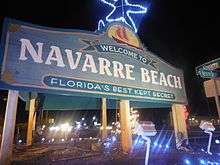
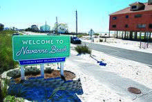
2017 and 2018 have seen a noticeable rise in civil activism in the Navarre area, with three notable protests occurring, all within the span of 12 months.
The first protests recorded in the community occurred on June 9, 2017,[13] after the county unilaterally changed the town's nickname and locally popular sign. The change was made without the consent of the citizens of the town[14][15][16] and have sparked additional calls for the incorporation of the community as a municipality.[13][14][15][16]
There are currently protests against the Holly-Navarre Water System.[17] The protests were over the water system's potential violations of the Florida Sunshine Law, which guarantees the rights for citizens and residents to access the meetings and public records of government agencies. The alleged violations occurred when the board of directors of the agency met for what they called a "secret" meeting. The Board president stated these meetings were closed due to their nature of discussing legal matters between members of the board and of several attorneys and lawyers.[17][18] The argument against these protests is that the water system is not government agency, but instead a utility contracted to serve the greater Navarre area. The situation, while still minorly ongoing, is coming to a close, as a new, more progressive water board has been elected by the citizens of Navarre.[18][19][20]
The third notable protests were part of the larger national school walkout to promote gun control.[21][22] While small, only consisting of a few students, it is considered notable in local political circles, as Navarre is in Florida's 1st congressional district, which is often polled as being the most conservative, and arguably the most pro-gun region in the state of Florida. There has been some speculation that this signals a larger change in the ideology of this region, as the younger generation begins to reach the voting age.[21]
Geography
Location
Navarre is located at 30°24′04″N 86°51′47″W / 30.401°N 86.863°WCoordinates: 30°24′04″N 86°51′47″W / 30.401°N 86.863°W. It is located within a portion of the Florida Panhandle observing the Central Time Zone.[23] Elevation is at an average of 10 feet.[24]
Navarre is located on roughly 12 miles (19.31 Kilometers) of shoreline along the Gulf of Mexico.[25] This figure however, does not include the shorelines on both sides of Santa Rosa Sound, and the shoreline Navarre has along East Bay, and the East Bay River.[26]
Topography
The community of Navarre is located on the Gulf Coastal Plain and is built on mostly sandy soil. Navarre is located on the Fairpoint Peninsula. It is bounded geographically in the north by the East Bay River and several creeks and on the south by the Santa Rosa Sound.[5]
Climate
Weather
| Climate data for Navarre, Florida, 1981–2010 normals | |||||||||||||
|---|---|---|---|---|---|---|---|---|---|---|---|---|---|
| Month | Jan | Feb | Mar | Apr | May | Jun | Jul | Aug | Sep | Oct | Nov | Dec | Year |
| Record high °F (°C) | 81 (27) |
82 (28) |
88 (31) |
96 (36) |
102 (39) |
102 (39) |
106 (41) |
104 (40) |
102 (39) |
95 (35) |
87 (31) |
81 (27) |
106 (41) |
| Average high °F (°C) | 60.5 (15.8) |
63.8 (17.7) |
69.6 (20.9) |
75.7 (24.3) |
83.2 (28.4) |
88.5 (31.4) |
90.0 (32.2) |
89.4 (31.9) |
86.5 (30.3) |
78.9 (26.1) |
70.3 (21.3) |
62.6 (17) |
76.6 (24.8) |
| Average low °F (°C) | 42.2 (5.7) |
45.5 (7.5) |
51.2 (10.7) |
57.6 (14.2) |
66.0 (18.9) |
72.5 (22.5) |
74.5 (23.6) |
74.2 (23.4) |
70.3 (21.3) |
60.3 (15.7) |
51.2 (10.7) |
44.4 (6.9) |
59.2 (15.1) |
| Record low °F (°C) | 5 (−15) |
7 (−14) |
22 (−6) |
33 (1) |
44 (7) |
55 (13) |
61 (16) |
60 (16) |
43 (6) |
32 (0) |
22 (−6) |
11 (−12) |
5 (−15) |
| Average precipitation inches (mm) | 4.64 (117.9) |
5.06 (128.5) |
5.81 (147.6) |
4.32 (109.7) |
4.17 (105.9) |
6.60 (167.6) |
7.40 (188) |
6.77 (172) |
5.98 (151.9) |
5.24 (133.1) |
4.73 (120.1) |
4.55 (115.6) |
65.27 (1,657.9) |
| Average precipitation days (≥ 0.01 in) | 8.9 | 8.6 | 8.1 | 6.5 | 6.7 | 11.1 | 14.0 | 13.6 | 8.8 | 6.1 | 7.2 | 9.0 | 108.6 |
| Source: NOAA (data listed is gathered in Pensacola, 1879–present)[27] | |||||||||||||
Hurricanes
As a low-elevation community near the Gulf of Mexico, Navarre is often threatened by hurricanes. Significant damage was incurred as a result of Hurricanes Erin, Opal, Ivan and Dennis. Many homes and businesses immediately along Santa Rosa Sound (generally south of U.S. Highway 98) suffered storm surge as a result of those storms. Recoveries have been rendered by the area with the population quickly flourishing. This area of Florida is consistently listed as one of the worst places for hurricanes.[28]
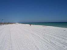
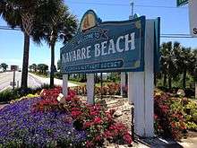
Navarre Beach
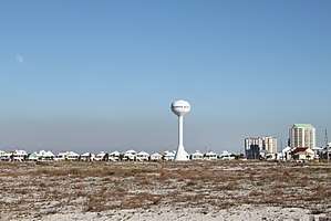
Navarre Beach is the beach neighborhood of Navarre. It is on Santa Rosa Island, a barrier island in the Gulf of Mexico.[29].
Immediately to its east is Navarre Beach Marine Park, a former Florida state park. Immediately to its west is a portion of the Gulf Islands National Seashore, and farther west is the city of Pensacola Beach.
On March 26, 2006 a "beach renourishment" project was begun, restoring sand lost due to the hurricanes of 2004 and 2005. This project eventually added approximately 200 feet (61 m) of sand and a 14-foot (4.3 m) high berm to the Gulf side of Santa Rosa Island for the entire length of Navarre Beach. The project was completed in December 2006. Another round of beach renourishment was completed in 2016.
Demographics
Navarre is a large community, estimated to have a population ranging somewhere between 41,545 and 42,300, as according to two different estimates completed in 2014. However, most county officials cite 42,200 as the population. [30][31] If the town of Navarre was to be incorporated it would be the largest city between Pensacola and Tallahassee (based on population).[31] This is a major increase from just 40 years ago, when the population was hovering around 1,500.[31][32] The below racial characteristics of the community are from 2017 estimates.[33]
- White 78.9%
- African-American 7.3%
- Hispanic 7.3%
- Multiracial 3.6%
- Asian 2.00%
- Native Hawaiian and other Pacific Islander 0.58%
- Native American and Alaska Native 0.32%
- Other 0.10%[33]
Attractions
Navarre is centered near the junction of U.S. Highway 98, the primary east-west route between Pensacola and the Fort Walton Beach area, and State Road 87. It is located near several large military facilities: Naval Air Station Pensacola to the west; Hurlburt Field and Eglin Air Force Base to the east; and Naval Air Station Whiting Field to the North.[34]
Tourism has increased in the Navarre area since 2010, being declared "Florida's Best Kept Secret" by the local hospitality business. Navarre has a park on the mainland next to Navarre Beach bridge and the Intracoastal Waterway that contains a Visitor Information Center; water splash pad, duck pond, butterfly house, playground, gazebos; pier and small beach area. Boating, Surfing, jet skiing, paddle boarding, fishing, bird watching, exploring scenic trails and walking/jogging are popular among the residents and visitors. Navarre's fourth hotel, a Springhill Suites, became the first beachfront hotel to operate since 2004 when it opened in 2017.[35][36]
In 2010 the Navarre Beach fishing pier was rebuilt after repeated damage from hurricanes. At 1,545-feet, it is currently the longest fishing pier on the Gulf of Mexico and in the state of Florida.[37]
The Panhandle Butterfly House on Navarre Parkway opened in 1997. Around 14,000 visitors stop by each year to see butterflies up close, learn about their life cycle, and find out how to attract butterflies to their own gardens. A highlight each year is the monarch migration; the orange and black butterflies are seen in the thousands as they travel to and from Mexico to breed.[38] Navarre Park provides a play area for children, basketball courts, picnic pavilions, and restroom facilities.[39] The park hosts several large community events each year.
Education
Education in Navarre is administrated by the Santa Rosa County District School system headquartered in Milton, Florida. The schools that serve the Navarre community are:[40]
- Navarre High School (Grades 9–12[41])
- Holley-Navarre Middle School (Grades 6–8)
- Holley-Navarre Intermediate School (Grades 3–5)
- Holley-Navarre Primary School (Grades K–2)
- Woodlawn Beach Middle School (Grades 6–8)
- West Navarre Primary School (Grades K–2)
- West Navarre Intermediate School (Grades 3–5)
Popular culture
Jaws 2
Many of the scenes in Jaws 2 were filmed off the coast of Navarre and Navarre Beach circa 1977.[42] The production "was a boost to the local economy because local boaters, extras and stand-ins or doubles were hired. Universal brought in actors, directors, producers and their wives, camera and crew people who needed housing, food and clothing for the movie. Services were needed for laundry, dry-cleaning and recreation." Navarre's Holiday Inn "Holidome" was used as the film's headquarters, with the ground floor converted into production offices, and some of the Gulf-front suites remodeled for David Brown and Roy Scheider. Universal rented 100 of the hotel's 200 rooms, spending $1 million. The Holiday Inn was destroyed in the 2004 Atlantic hurricane season.[43][36] A new Springhill Suites was built on the same site as the Holiday Inn and was completed during the summer of 2017.[36][35][44][45][46]
Notable People
Sports
Football
- Jordan Leggett, NFL Tight End for the New York Jets[47]
- Akeem Spence, NFL Defensive Tackle for the Detroit Lions[48]
- Frank Willis, former Defensive Back for the Air Force Falcons
- Jeff Van Camp, former Quarterback for the Florida Atlantic Owls[49]
Wrestling
- Michael "Crash" Lockwood, former WWE wrestler, died in 2003[50][51]
- Mick Foley, former WWE wrestler and color commentator [52]
Government
County
Entertainment
Literature
- Anne Rice, gothic fiction writer [52]
See also
References
- ↑ "Street View of Tom King Bayou in Navarre, Florida". www.instantstreetview.com. Retrieved 2018-03-27.
- ↑ "Street View of Gable Lake in Navarre, Florida". www.instantstreetview.com. Retrieved 2018-03-27.
- ↑ "GNIS Detail - Navarre". geonames.usgs.gov. Retrieved 2018-07-13.
- 1 2 "Dive into the Navarre Beach Marine Park - Navarre Beach | Florida's Panhandle". Navarre Beach | Florida's Panhandle. Retrieved 2018-03-21.
- 1 2 3 4 "Navarre Town Center Plan" (PDF). Santa Rosa County Board of Commissioners. Archived from the original (PDF) on October 30, 2007. Retrieved 2007-12-07.
- ↑ "Navarre's earliest recorded heritage began with Spanish explorers in 1693". www.navarrepress.com. Retrieved 2016-06-13.
- ↑ "When Navarre was Eagan". www.navarrepress.com. Retrieved 2015-12-01.
- ↑ "Discover Navarre Beach Florida". Archived from the original on April 10, 2006.
- ↑ "BOOMTOWN! - South Santa Rosa News". South Santa Rosa News. 2016-04-28. Retrieved 2018-03-21.
- ↑ jmckeon@nwfdailynews.com, Jennie McKeon | 315-4434 | @jenniemnwfdn |. "Navarre experiencing a major uptick in development projects". Northwest Florida Daily News. Retrieved 2018-03-21.
- ↑ "Reports: Cause of Black Hawk crash released". Pensacola News Journal. Retrieved 2016-01-27.
- ↑ "Navarre Black Hawk Memorial Unveiled".
- 1 2 "New Navarre Beach signs to stay - protest planned - South Santa Rosa News". South Santa Rosa News. 2017-06-05. Retrieved 2018-03-21.
- 1 2 McKEON, JENNIE. "Community speaks out after new signs are placed in Navarre". Northwest Florida Daily News. Retrieved 2018-03-21.
- 1 2 "Navarre residents will protest new signs at Navarre Beach entrance". Pensacola News Journal. Retrieved 2018-03-21.
- 1 2 "Navarre residents passionate about sign | Gulf Breeze News". Gulf Breeze. 2017-06-15. Retrieved 2018-03-21.
- 1 2 White, Romi (29 December 2017). "Protestors Picket Closed Holley-Navarre Water System Meeting". South Santa Rosa News (In Print). Navarre, Florida.
- 1 2 "Holley-Navarre Water System board attempts to remove director - South Santa Rosa News". South Santa Rosa News. 2017-11-22. Retrieved 2018-01-24.
- ↑ "Applications for unfilled Board of Directors seats for Holley Navarre Water System Inc. | Public Notice #2147 | Navarre Press". navarrepress.com. Retrieved 2018-03-21.
- ↑ "Water board takes on restructuring | Navarre Press". navarrepress.com. Retrieved 2018-03-21.
- 1 2 hosbourne@nwfdailynews.com, Heather Osbourne | 315-4440 | @heatheronwfdn |. "Local students to participate in national walkout". Northwest Florida Daily News. Retrieved 2018-03-21.
- ↑ Wood, Randy. "Local school holds 17-minute walkout honoring victims of South Florida shooting". WEAR. Retrieved 2018-03-21.
- ↑ Standard Time Zone Boundaries 49CFR71
- ↑ "USGS Geographic Names Information System". US Geological Survey. Retrieved 2010-02-02.
- ↑ "Navarre". www.visitflorida.com. Retrieved 2015-11-27.
- ↑ "tide predictions: East Bay, Pensacola Bay, Florida". tides.mobilegeographics.com. Retrieved 2018-07-11.
- ↑ "NOWData - NOAA Online Weather Data". National Oceanic and Atmospheric Administration. Retrieved 2012-08-21.
- ↑ "The Worst Places for Hurricanes". www.bestplaces.net. Retrieved 2015-11-27.
- ↑ "Navarre Beach Vacation | Where to Stay | Navarre Beach". Floridabeachestorivers.com. Retrieved 2012-12-18.
- ↑ "Power of the Precinct | Navarre Press". navarrepress.com. Retrieved 2018-03-21.
- 1 2 3 "Navarre Incorporation Fesibility Study" (PDF).
- ↑ News, DUSTY RICKETTS / Daily. "From nothing to Navarre". Northwest Florida Daily News. Retrieved 2018-01-30.
- 1 2 "Race and Ethnicity in Navarre, Florida (Unincorporated Place) - Statistical Atlas". statisticalatlas.com. Retrieved 2018-03-27.
- ↑ "Florida Military Bases | MilitaryBases.com - US Military Bases". militarybases.com. Retrieved 2017-10-19.
- 1 2 "SpringHill Suites Navarre Beach". Marriott International. Retrieved 2018-03-21.
- 1 2 3 jmckeon@nwfdailynews.com, Jennie McKeon | 315-4434 | @jenniemnwfdn |. "Navarre Beach hotel expected to open in late April (PHOTOS)". Northwest Florida Daily News. Retrieved 2018-03-21.
- ↑ "Welcome to Navarre Beach". www.santarosa.fl.gov. Retrieved 2015-11-27.
- ↑ "Panhandle Butterfly House | Navarre, FL". Panhandle Butterfly House. Retrieved 2018-03-11.
- ↑ "Santa Rosa County Florida Government". Santa Rosa County Florida Government. Retrieved 2018-03-11.
- ↑ "Santa Rosa County School District". www.santarosa.k12.fl.us. Retrieved 2017-10-19.
- ↑ "Home of the Navarre High School Raiders". www.santarosa.k12.fl.us. Retrieved 2015-11-27.
- ↑ Szwarc, Jeannot (1978-06-16), Jaws 2, retrieved 2016-02-23
- ↑ RICKETTS, DUSTY. "A Look Back: Signs of Ivan linger in Navarre". Northwest Florida Daily News. Retrieved 2018-03-21.
- ↑ GALVAN, ABRAHAM. "Springhill Suites Marriott on Navarre Beach celebrated its grand opening Saturday". Northwest Florida Daily News. Retrieved 2018-03-21.
- ↑ "Hotel Equities Opens SpringHill Suites by Marriott in Navarre Beach, Florida". Retrieved 2018-03-21.
- ↑ Saul, Christopher. "New beach hotel opening in Navarre". WEAR. Retrieved 2018-03-21.
- ↑ "New York Jets: Jordan Leggett". Retrieved 2018-03-21.
- ↑ "Akeem Spence". NFL.com. Retrieved 2018-03-21.
- ↑ "FAUSPORTS.COM Jeff Van Camp Bio :: Florida Atlantic University Official Athletic Site Florida Atlantic University Official Athletic Site - Football". Retrieved 2018-03-21.
- ↑ "Crash Holly Death - Wrestler Deaths". wrestlerdeaths.com. Retrieved 2018-03-21.
- ↑ "MICHAEL LOCKWOOD, aka CRASH HOLLY & MAD MIKEY, REST IN PEACE". www.wrestling-news.com. Retrieved 2018-03-21.
- 1 2 Vasquez, Savannah. "Celebs along the coast". Northwest Florida Daily News. Retrieved 2018-02-15.
- ↑ "Sheriff Bob Johnson | Santa Rosa County Sheriff's Office". santarosasheriff.org. Retrieved 2018-03-21.
- ↑ "Santa Rosa County Florida Government". Santa Rosa County Florida Government. Retrieved 2018-03-21.
External links
- Greatest Navarre Area Chamber of Commerce
- Holley-Navarre Historical Society
- Navarre Beach Area Official Visitor Information: Florida Beaches to Rivers
- Holley-Navarre Fire District